PRITCHARD LIFE

still picking out a paint color

Trip Report: Wyoming Road Trip

July 31, 2005 by matt Leave a Comment

When in the course of the daily grind, it becomes necessary for one Person to dissolve the Occupational bands which have connected them with a soulless corporation, and to assume among the powers of At-Will-Employment, the separate and equal Station to which the laws of Self-Preservation and of Mental Health entitle them, a decent Professional Courtesy requires that they should offer a minimum of two weeks notice and steadfast work ethic to the end. But not first, without taking a nine day vacation to the mountains of Wyoming.

Wyoming had been on our “must do” list for quite some time. However, quitting my job the day before we left wasn’t part of the original trip plan – nor the financial plan for that matter. But in the immortal words of Joel Goodsen, “Sometimes you just have to say ‘what the fuck’.”

We left San Francisco on Friday afternoon and promptly found ourselves stuck in Sacramento rush-hour traffic – lovely. Is it just me or does Sacramento just keep growing? It seems to stretch pretty much from Davis to Auburn now – solid town the entire way. Auburn brought a reprieve from the traffic and before long we were staring at the bright lights of Reno – or as our friend likes to call it “Las Vegas’ retarded little sister.”

After a quick dinner stop, we keep driving deep into the Nevada desert until we found a flat spot of dirt well off the Interstate that looked cozy enough for a short night’s sleep. Early to rise, we got back on the road and pushed all the way through Nevada and into Salt Lake City for an early lunch. Sad to see my favorite Peruvian restaurant had closed, we settled for tacos next door and got back on the road, making it to Daniel, Wyoming by mid-afternoon.

My good friend Doug is 100% Montanan, but considers himself a de-facto resident of Wyoming just the same. Growing up, his family spent quite a bit of time at their cabin near the Hoback River in Wyoming – about halfway between Pinedale and Jackson. After many years, Jody and I decided to take Doug and his parents up on their offer to use their cabin as a base camp for exploring the mountains of Wyoming – an area they’re happy to call home for five or six months of the year.

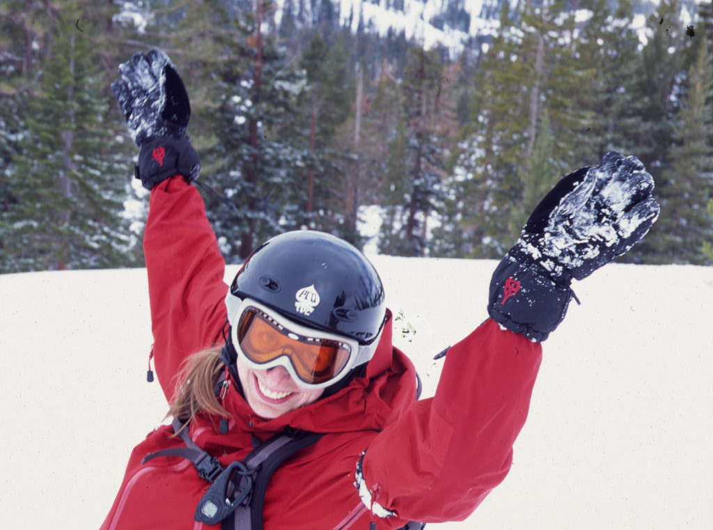
We met Doug at Daniel Junction and after some hugs and hellos, we were in his truck headed for Pinedale. After a quick stop by The Great Outdoor Store in Pinedale, we proceeded up to the Elk Heart Park area of the Wind River Mountains. We did a quick day hike, running into snow just a mile or two up the trail. The short hike felt great after nearly seventeen hours of driving. The hike was followed by a delicious steak dinner at the Half Moon Lake Lodge. We followed Doug back to the cabin and made plans for the next day.

Doug was only a couple of months into a new job and wasn’t quite ready to take a week-long vacation. He compromised by coming down from Billings on the two weekends we were there – giving us the week in between to explore the Wind Rivers and Tetons on our own. On Sunday, Doug gave us the dime tour of Teton Village and then on to Yellowstone – a park that hadn’t originally been on our itinerary. Jody and I were both very glad to have made the trip. We got a chance to see Yellowstone Falls, Grand Canyon of Yellowstone, Yellowstone Lake, Fishing Bridge, and more Bison than you can imagine – one of which caused a small traffic jam later in the day. The scenery was spectacular and we saw enough of the park to know we would have to return some day.

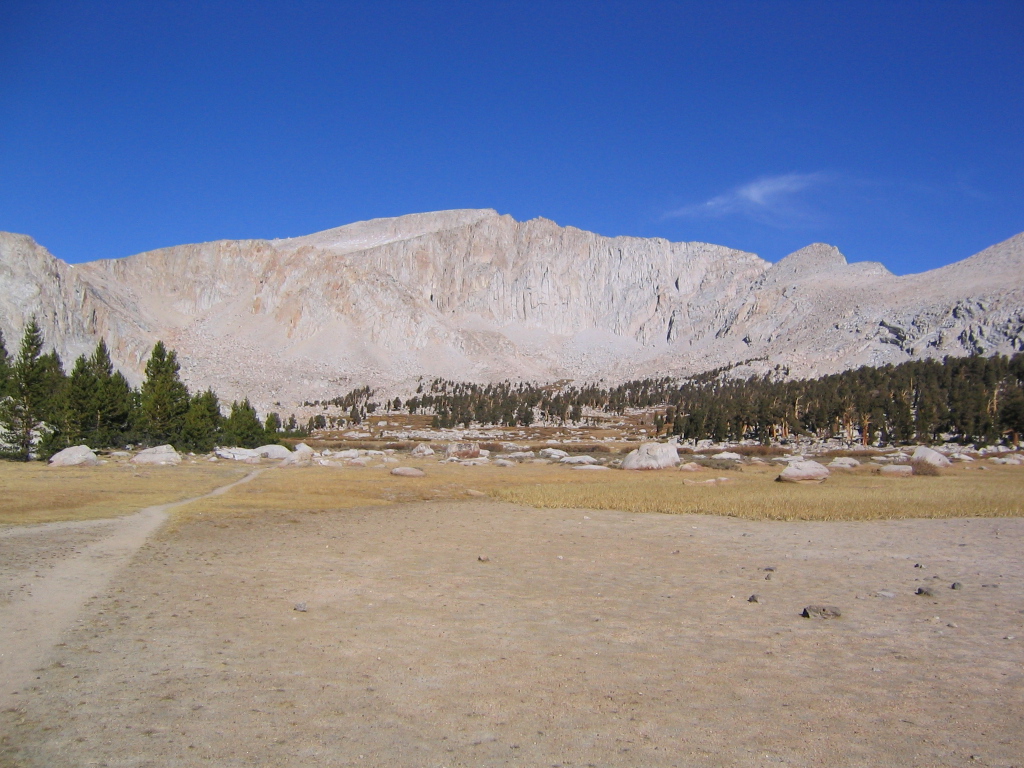
The drive back to the cabin that night was long and we got to bed pretty late, but that didn’t stop us from getting an early start on the next day. Our first overnighter was going to take us into the Wind River Mountains – a range of such scale and beauty it is a real surprise how easily they’re overlooked when compared to the more well know Teton Mountains. We stopped in Pinedale Monday morning to grab breakfast and consult the good people at the Pinedale ranger station. Our original plan to see the Big Sandy area was quickly kyboshed when we heard about the lingering snow in the area. Instead, the ranger suggested a trip into the Green River Lakes area, further north. The elevation was lower and the trail conditions were more stable.

The drive to the trailhead was a great chance for a nap – until we hit twenty-two straight miles of dirt road. The scenery was so incredible, that napping would have seemed like a total waste anyways. We started hiking the Highline Trail with no concrete plans on where we would camp, heading south along the Green River until we found a spot that would suit our tastes. We assumed this would probably be four or five miles at least. Captivated by the views and reluctant to put in much effort, the perfect site appeared just two miles down the trail, in a wooded area between the Green Lakes. The first spot we saw was taken by a large group of campers, so we hiked a short distance to another good looking site.

The mosquitoes were in full effect that night, but it didn’t stop us from staying out well past sunset to take pictures of the river and Flattop Mountain. We slept well that night and woke up to another beautiful day. During breakfast, I spotted a cow Moose with her calf a few hundred yards away on the other side of the river. Jody saw this same pair the day before and I was bummed to have missed it, so it was great to have a second chance. As the two of them walked up river towards us, Doug’s advice rang in my ears, “Don’t get anywhere near a Mama Moose and her calf – that’s just as dangerous as a bear and cub.” OK – super. The closer they got, the more I tried to convince myself that everything was cool. By the time she was directly across the river from us, Jody and I were moving up river fast, trying to put some distance between us. I never thought she would cross the river with a calf so young, but sure enough they jumped in, made their way across, and proceeded to walk right through the middle of our campsite. From a safe distance, we waited a good fifteen minutes before carefully making our way back to camp. No moose in sight – good. We finished breakfast, packed up for a day hike, and got back on the trail.

A hike up the Porcupine Creek Falls Trail afforded us some elevated views of the river valley where we were camped. The swollen creek also gave us an opportunity to practice our stream-crossing technique. Moving through ice-cold, knee-deep water takes some practice. On our return hike, we noticed the sky was closing up and decided to a make a hasty retreat back to the tent, not wanting to get caught in afternoon thunderstorms. Within 30 seconds of jumping into our tent, the sky let loose with a thunder and lightning storm like none we’ve experienced first hand. The rain poured down hard and we resigned ourselves to our favorite backcountry activity – taking a nap.

A different kind of thunder woke us with a start – the sound of thundering hooves pounding through our campsite. A couple of deep snorts announced the return of Mama Moose, who seemed upset we were still around. The lightning and rain kept on and I got to thinking that I’m perfectly comfortable negotiating one mortal threat at a time. But when two arrive at once, I’m a bit out of sorts. The best solution seemed obvious – keep sleeping until one threat goes away. A half hour later, the rain had stopped, and I emerged from the tent pleased to see no pissed off moose. Nonetheless, we took the hint and quickly moved camp back up the trail to the now empty site we had seen the day before. No sooner did we finish dinner than the lightning and rain returned full force and we decided yet again that the best offense is a good defense – we retired for the evening to the comforts of our tent – chalking up our second day in the Wind Rivers as an exciting one. It is occasions like these that give you pause and some perspective. It makes you realize just how insignificant some things are – like a job as a professional data monkey for a market research behemoth. Did I really care that I was going to be unemployed in two weeks? Not really – at least I hadn’t been trampled by a moose or struck by lighting. To quote another wise sage, Ice Cube, “I didn’t even have to use my A.K. – I gotta say it was a good day.” Indeed, Mr. Cube, indeed.

…Doug’s advice rang in my ears, Don’t get anywhere near a Mama Moose and her calf…

Wednesday morning came early after twelve to fourteen hours of sleep in the previous twenty four. We ate breakfast, broke camp, and made the short hike back to the trailhead, constantly turning around to catch one more glimpse of the serpentine river and the monolith of Flattop Mountain, standing sentinel over the area. After a huge lunch at the Wrangler Café in Pinedale, we made our way back to the cabin. Peter, Doug’s dad, had arrived earlier in the day and was a generous host, offering warm showers and a chance to relax before our next journey into the mountains. We had a great dinner of Elk backstraps, Spaghetti Bolognese, green salad and some tasty red wine. After dinner, Jody and I sorted out our gear and got ready for a pre-dawn start the next day.

On Thursday, Jody once again proved herself the most understanding wife on the planet as she woke with me at 3:30 AM for the ninety minute drive to Schwabacher’s Landing – the ideal spot for sunrise photos of the Grand Teton. I had read about the place a few months earlier and was determined to catch the good light while we were there. I felt like we were racing the sun as we drove through Jackson and proceeded north through Grand Teton National Park. We parked at the end of the Schwabacher’s Landing road and moved quickly up stream to a beaver pond that provides a perfect reflection of what many call the most photogenic mountains in the U.S.A. The twenty foot stretch of beach was already crowded with four of five photographers by the time we arrived, but people made room and we had made it in time for the light. We spent the next forty five minutes peeling off photo after photo of the Tetons as the light danced across the sky and the craggy peaks. The crew on hand that morning was a fun cross section of photographers. Amateurs and pros alike, we saw everything from large format view cameras, to Hasselblads, to Digital SLRs and a few folks (Jody included) with point and shoots. It was a fun way to start the morning and we were done before 7 AM.

Contemplating our next move for the day, we decided to take it easy (once again) and car camp for the next two nights at Jenny Lake. We justified this by acknowledging that the snow level was still too low to permit the full loop trips we had been considering. After checking into the Jenny Lake campground, we set out for a long dayhike around Jenny Lake and String Lake, taking a short side trip up to Inspiration Point, which is well worth the effort.

The next morning, we woke up without any definite plans for the day. Since Jody had laid out our schedule for the previous day, I took the lead and decided to head for Teton Village. I’ve always been hopeful that I’d have a chance to ski at Jackson Hole one day and this trip just cemented the idea. After a walking tour of the shops and restaurants around Teton Village, we coughed up nineteen dollars a piece for a ride to the top of the mountain in the Jackson Hole tram – an icon in the world of skiing and one that, sadly, will be retired at the end of the 2006 season. I positioned myself carefully in the tram car so that I would get a bird’s eye view of Corbet’s Couloir – one of the most infamous ski runs in North America. The view didn’t disappoint and I was once again amazed by the balls it must take to air ten to fifteen feet onto a 45+ degree pitch of snow with rock walls on either side. Unfortunately, the trail down to Corbet’s was closed, so we couldn’t get an up close look. But the other views from the top were quite incredible. We only did a short bit of hiking up top, but took advantage of the bird’s eye view and spent the entire time planning future backpacking trips that would take us deep into the Teton backcountry.

After lunch, we swung through a village ski shop that had a daily showing of Teton Gravity Research movies. We had the “theatre” to ourselves and enjoyed a screening of The Tribe. After the movie, we raced back to the park and met up with some old friends of Jody’s for dinner at Colter Bay. We enjoyed a nice campfire back at our site before retiring for the night – content that we had seen a slice of the Tetons, but aching to come back for more.

On Saturday morning, after a short drive back to the cabin, we met up with Doug and his family one more time and loaded all of our gear back into the car – an embarrassingly large pile of stuff we had toted along for the trip. After saying our goodbyes, we headed back down the dirt roads of Hoback Ranches one last time before turning south and starting our long drive home.

We pushed long and hard through the desert of Utah and Nevada before crashing late on Saturday night at what could only be described as the shittiest campsite on God’s green earth. Our little slice of hell was sandwiched in between Intestate 80 (less than 100 feet away) and a very active train track (less than 50 feet away). It was just close enough to Reno to get sketched out every time we heard something that sounded like footsteps nearby. I’m not sure how long I actually slept that night, but I was only lying down for about four and half hours before Jody and I noticed the break of dawn and got the hell out of there.

Our poorly rested bodies bounced back to life after a delicious breakfast at South Side Café – one of Jody’s old haunts from her Reno days. After a brief tour of her old neighborhood, we were back on the road – barreling down 395. It was Sunday, July 3rd and Jody’s whole family was convening at the cabin in Twain Harte for the holiday weekend. Our goal was to get there by Sunday afternoon so we could get in as much time with them as possible before heading home the next day.

We spent most of Sunday and Monday doing what the Salsig clan does at Twain Harte – chilling out on the huge deck, reading books and newspapers, and enjoying the occasional frosty beverage. By the time we left on Monday night, we were ready to get home and enjoy our comfy bed. We both had to be at work in the morning, but for once I didn’t dread the BART ride into Oakland – knowing I would only have to take that train nine more times before my gig was up. The trip to Wyoming had been a smashing success and we felt spoiled for the other mountains of the world. A return trip to Wyoming is inevitable and we look forward to spending more time in these incredible mountains – so full of life and beauty.

This post is part of the SierraSoul Archive. The trip took place in July, 2005 (or thereabouts).

Filed Under: sierrasoul Tagged With: adventure log, trip report

Trip Report: The Lost Coast

July 31, 2005 by matt Leave a Comment

Our return to the Lost Coast was four years in the making. Ever since our inaugural trip to the area in July of 2001, we’ve been trying to find the time to make our way back. We held onto great memories of empty beaches, curious wildlife, and breathtaking sunsets. During the first trip, we only explored a short section of the trail, opting for a low-key weekend at the beach. This time around, we aimed to see what other treasures this remote section of coastline held, as we hiked the 25-mile northern section of the Lost Coast Trail.

With a bit more planning and four more years of experience under our belts, this trip was off to a great start by the time we took our first steps down the trail. We had Thursday and Friday off of work and got a jump start on the drive by staying Wednesday night at Scott and Jena’s in Rohnert Park. On Thursday morning, we enjoyed a low-key drive north on 101 before heading west for the sleepy town of Shelter Cove. This is actually where we planned to end our hike. A few weeks earlier, we had scheduled a shuttle to drive us to the northern trailhead where we would start our hike.

Roxanne, our chauffeur, was right on time and talked our ears off all the way to the trailhead – about 45 minutes to the north. She handed us a tide table, told us to be careful and bid us farewell as we adjusted our packs and got ready for a mellow first day of hiking. The sky was clear and a gentle breeze invited us toward the beach. Our destination was only three miles away – the Punta Gorda Lighthouse. When we visited in 2001, this area was our home for two nights and we wanted a chance to reminisce. Also, the Punta Gorda Lighthouse offers some pretty great photo opportunities under the right conditions (unfortunately, the incredible light we saw on our first trip didn’t make a repeat performance this time). While Jody napped, I got myself re-acquainted with the area, photographing some very cooperative seals and sea lions.

We planned our hiking to be heavy on the second and third days, allowing for ample drive time on our first and last days. These long hikes had to be timed just right to cooperate with the tides. The northern section of the Lost Coast Trail has three “intertidal” sections – areas that are literally under water during high tide. We passed the first of these spots (Windy Point) on our first day. The other two intertidal sections are considerably longer at 3 to 4 miles a stretch and we planned to deal with one each on our second and third days. After leaving the lighthouse on Friday morning, the trail meandered along the bluffs to a point above Sea Lion Gulch – the beginning of our intertidal zone. Realizing we’d arrived well before high tide, we dropped our packs and sunned ourselves for an hour or two before heading down to the beach where the trail continued.

Better than half of the Lost Coast Trail isn’t actually a trail at all. It is more of a suggested route, tracing a path down long stretches of rocky and sandy beaches. The feeling is incredible as you hike a stone’s throw from the pounding breakers, listening to the distinctive barks of the sea lions, smelling the fresh sea air. The downside is the tempo of your travel. Rocky, sandy beaches make for slow hiking, but it’s really hard to complain considering the setting. We eased into a slow and steady pace and after several hours and a few tricky stream crossings, we arrived at Kinsey Creek – our second campsite.

For a second night we were spoiled with a righteous site on the bluffs overlooking the beach – close to stream water and knee-deep in gorgeous wildflowers. About an hour before sunset, the clear skies yielded to ominous, dark-grey clouds that rolled in from the south like a band of misfits. Despite a drop in temperature and some stiff winds, the storm had more bark than bite and we never saw a drop of rain that second night.

Jody isn’t known for her acute sense of balance, and stream crossings are usually an opportunity for both worry and high comedy.

We enjoyed a lazy morning on Saturday, taking our time to break camp so we could hit the intertidal section well after high tide. Early in the day, we came across another swift stream crossing. This one was precariously bridged by a narrow, wet log that sat a good four or five feet above the water. I made my way across and turned around to keep an eye on Jody, hoping she would motor across it without psyching herself out. Jody isn’t known for her acute sense of balance, and stream crossings are usually an opportunity for both worry and high comedy. After surveying multiple options, she approached the log and began an ill-advised side shuffle walk across the slick surface. After four or five steps, she wobbled a bit and instinctively crouched down. As if in slow motion, she lowered herself, tipped to one side and gravity took over. She toppled off the log and landed square on her backpack in the stream. Scrambling to her feet, she got back to dry land, swallowed her pride, and straddled the log as she shuffled herself to the other side (the hiking equivalent of the underhand free throw). Despite her little dip into the drink, she was mostly dry, thanks to her pack, which took the brunt of the hit.

Even with the best of intentions, we hit the intertidal section pretty early in the outgoing tide cycle. This wasn’t a problem for the most part – we just had to hike a little higher on the beach to avoid getting wet. But every once in a while, we’d come to a point where the rocks jutted too far into the water and staying dry involved watching, waiting, and then running like hell (see pictures below). This added a bit more excitement to the hike.

The trail eventually headed back to the bluffs above the beach and opened up to the aptly named Big Flat. The narrow trail grew into an arrow-straight, grassy road marked by three distinctive tire tracks. It wasn’t long before we realized this wasn’t a road, so much as it was a landing strip for small planes. Several private cabins dot the Lost Coast Trail and the means for reaching them are extremely limited. This was the coolest solution we had seen yet and we envied the people that had their own fly-in cabin on the most remote section of coastline in California.

After another deep stream crossing at Big Flat Creek, we stumbled across another surprise – a pair of surfers at Miller Flat. I had read that the area attracted hearty surfers willing to hike nearly 8 miles from Shelter Cove, but we hadn’t expected to see anyone out there. I wished we had seen them hiking in with full packs and surfboards strapped to their backs. Gitchell Creek and our final campsite arrived before long and we set up our tent on a patch of beach surrounded by some really good “sitting logs”. Another amazing sunset got me thinking about how spoiled we had become over the past three days – empty trails, beautiful campsites, abundant wildlife, clear skies, and more wildflowers than we had ever seen – at times, literally paving the trail in ribbons of yellow and orange.

A bit of rain moved in overnight and lingered in the morning. By the time we started hiking, the skies had cleared and four miles of black, sandy beach lie ahead of us – leading the way to Shelter Cove. Stream crossings had become second nature as we splashed through knee deep water without giving it a second thought. The parking lot at Black Sands beach was a welcome sight for tired bones. We dropped our packs by the car, celebrated with a long, smelly hug and settled in for a long drive home – content that we had seen the Lost Coast Trail in all of her splendor and glory.

Click here for a printable guide to hiking the Lost Coast Trail

Google Maps Link (trailhead)

This post is part of the SierraSoul Archive. The trip took place in July, 2005 (or thereabouts).

Filed Under: sierrasoul Tagged With: adventure log, trip report

Kirkwood Winter 2005

April 30, 2005 by matt Leave a Comment

Winter arrived with a bang this year, hitting the Sierra with mid-October snowstorms and the earliest opening day on record. Storm after storm pounded the range of light and offered up more deep powder days than either of us can remember. Early January snowstorms dumped 20+ feet of snow in less than two weeks. Speaking to a co-worker in Chicago, she remarked that she heard about our snowstorms in California and was surprised to hear about the “20 inches” of snow we had received. 20 inches? Silly mid-Westerner, inches are for chumps.

Kirkwood, our home mountain, topped out just over 800 inches this year. Yes, 800! That’s the most in North America for 2004/2005. The extended season afforded us more days on the mountain, despite our busy schedules. There were two firsts this season. Lindsay and Wayne tried their hand at snowboarding and I think they’re hooked. As for Jody, she finally muscled up and took some runs off of Chair 10 – realizing the splendor and bounty of the Sisters Chutes and Eagle Bowl.

I’m sorry to report that our tired bones rested themselves more often at Motel 6 than at our favorite snow-camping spot on Carson Pass. We only had one snow-camping night this year, but I for one, hope this will change next season. The season was capped off with a chill day at the Wood watching the Big Air comp – pictures below.

Here’s hoping we have another 800+ in 2005/2006.

his post is part of the SierraSoul Archive.

Filed Under: sierrasoul Tagged With: adventure log

Trip Report: Mount Langley, 2004

October 31, 2004 by matt 1 Comment

Although the storm had been forecast, scores of climbers and backpackers had misjudged how severe it would be. Longtime rangers said it had the character—and duration—of a January blizzard, not an October surprise. By week’s end, the search for some 30 hikers and climbers stranded up and down the Sierra Nevada made CNN.

Special Report: Six Nights on the Dark Tower, Daniel Duane, National Geographic Adventure, Feb 2005 (Issue 47)

Twenty percent chance of precipitation. That was the prediction from the NOAA website before we departed for one of our more memorable trips to the High Sierra. It was late October and our plan was to squeeze in one last dry land trip before the snow started to fall and our focus shifted to snow sports. Little did we know that two weeks later we would be pointing our tips downhill at Kirkwood to kick off our earliest ski season on record.

Our plan was simple…and stupid. One weekend, round-trip summit bid on Mt. Langley. Never mind that the trailhead was a nine hour drive from San Francisco and the hike itself was 21 miles round trip – topping out at 14,026 feet. Simple facts such as these are no match for ignorance and exuberance. A big storm was predicted to hit the Sierra at some point, but the specifics of where and when were a bit cloudy, and that was good enough for us.

On the same weekend, one year prior, Jody and I stood atop White Mountain – California’s third highest peak and the first Fourteener for both of us. We hoped luck would be on our side again as we made another late season trip. This time around we were joined by our friend, the irrepressible Ben Sabraw – a man that is one half court jester, one half Six Million Dollar Man, and just dumb enough to think this plan made sense.

None of us could take Friday off, so the best we could do was a 4PM departure from San Francisco. The roads were clear as we made our way east – out of the Bay Area, through the Central Valley, into Yosemite and over Tioga Pass. By the time we gassed up in Bishop, the supercomputers at the National Weather Service predicted a storm could blow through as soon as Saturday night. Never a group to exercise caution in the face of scientific reason, and buoyed by the fact that Ben’s barometer was holding steady, we pushed on and arrived at the trailhead around 1AM Saturday morning. Our initial plan to hike through the night to Cottonwood Lakes was put to rest by tired eyes and freezing temperatures. We threw our sleeping bags down near the car and called it a night.

Up for an early start the next morning, we hit the trail for the relatively level, 6-mile hike to the Cottonwood Lakes basin. We made pretty good time and found a great campsite near Cottonwood Lake #3. Jody had decided to lay low and play the role of Basecamp Bunny while Ben and I made our way for the summit. Our original plan called for a chill day on Saturday and an alpine start Sunday morning. But the weather was holding steady and it was only 11AM, so we decided to make a dash for the top. We opted for the Old Army Pass route – a long slog over a rocky pass, leading to an equally unglamorous slog up scree slopes to the mountain’s summit. Langley isn’t exactly Sierra climbing at its aesthetic best, but it’s still an interesting hike up a big damn mountain.

Less than a mile from camp, just as we started making our way up Old Army Pass, we got sucker-punched by unexpected snow on the route. Neither of us had planned for snow. Postings on the summitpost message board indicated the trail was clear and dry as recently as the prior weekend. The snow looked fresh and couldn’t have been more than a few days old. We didn’t have ice-axes or crampons and our choice in footwear was better suited for a long, dry hike than a snowy one. We tried to ignore it for a few hundred feet, but as it got deeper we realized the obvious – this mountain would just have to wait. The hike up didn’t concern us so much as coming down – especially if we ran into problems and had to make the descent in the dark after the snow had firmed up.Never a group to exercise caution in the face of scientific reason…we pushed on…

Jody was a bit surprised when she saw us return to camp only an hour after we had left, but she was glad to see we had turned around rather than taking a chance. The sky was clear and the barometer was still holding steady, so we decided to enjoy an afternoon in the mountains and hike out the next morning. Jody and I spent the better part of the afternoon shooting an assignment for my photography class, while Ben took a nap by the lake. As soon as the sun fell behind the ridgeline, the mercury took a nose dive and we hurried to get some dinner cooked so we could get to bed as soon as possible.

We crashed on the early side – Jody and I in our tiny hoop tent and Ben nearby in his bivy sack. All across the Sierra, from Mt. Whitney to El Capitan, climbers and hikers were settling in for the night, unaware that the mother of all snowstorms was about to hit us like a ton of bricks. We woke briefly around 3AM to the faint sound of snow hitting our tent fly. By the time we woke up at first light, we knew that hanging around wasn’t an option – 11,000 feet, six miles deep isn’t a good place to be during a Sierra snowstorm. Thick clouds overhead blocked out the sun. A steady wind gave the modest snowfall a bit more gravitas. A few inches had fallen overnight. A quick survey of the trail offered some relief, as it was still somewhat visible under the blanket of white.

We broke camp fast and started moving with some purpose. We lost the trail while crossing the Cottonwood Lakes basin, but had ourselves straightened out before we ran into trouble. Once the route ducked into the trees, the sparse canopy offered some shelter from the snow, but the trail was slick and we had to watch our step. We were so rushed to get moving that morning, we hadn’t taken the time to eat. After an hour of hiking, we decided to take a break and recharge with some snacks. While we munched away, a solo hiker stopped by and asked if he could join us for the hike out. Like us, it was his first time in the area, and we all figured it was best to team up. We soon realized this was the same guy we saw float tube fishing at Cottonwood Lake #5 the previous day. Hauling that kind of gear into the backcountry at this elevation requires a pretty salty fisherman – we were impressed. Before long, we ran into two more hikers making their escape. The six of us leapfrogged each other all the way back to the trailhead.

It was a relief to see the snow wasn’t sticking to the asphalt. The long road down to Big Pine isn’t one you want to negotiate with snow or ice on the road. Staring back at the Sierra Crest from the safety of the Owens Valley was a humbling sight. The High Sierra was socked in and taking a beating. We felt lucky to have made it out of there without much trouble. While gassing up, we heard the news that Tioga Pass had been closed – blocking off our most direct route home. It’s always a game of chance around October/November – trying to schedule one more trip to the Eastern Sierra before Tioga closes. What are the chances that it’s going to happen over the course of a weekend trip? With the route through Yosemite closed, our next fastest option was an end run around the High Sierra – over Walker Pass and through BAKERSFIELD, BABY, BAKERSFIELD! A few more hours in the car is hardly worth mentioning when compared to the complete hell that several groups of hikers and climbers were up against.

Just outside of Bakersfield, Jody picked up a worried message from her mom, who had been had been hearing news about several search and rescue operations being launched throughout the Sierra. The storm was even more serious than we thought. Most of these searches ended happily over the next several days with parties making it out under their own power or with some assistance from SAR teams. Two Japanese climbers, however, met a more tragic end on the unforgiving vertical of El Capitan in Yosemite Valley. The rescue efforts in Yosemite prompted a Special Report in National Geographic Adventure (Feb, 2005) and made the cover of Rock & Ice magazine.

The whole experience, while exciting, was a stark reminder of how important it is to heed the warning signs around you and to respond without hesitation. We all walked away that weekend relieved to be safe, and with a renewed respect for the awesome power of Mother Nature.

You may be wondering, “Why so many photos of Matt below?” Well, I was working on an assignment for a photo class that weekend involving self portraits. Yes, I am trying to look cool. Yes, I am trying way too hard.

This post is part of the SierraSoul Archive. The trip took place in October, 2004 (or thereabouts).

Filed Under: sierrasoul Tagged With: adventure log, trip report

Trip Report: Round Lake, Carson Pass North

September 30, 2004 by matt Leave a Comment

It seems a bit mischievous – driving past your office on a weekday morning with a car full of backpacking gear and no intention of slowing down. That’s how I felt as we sped across the Bay Bridge in full view of my building in downtown Oakland, knowing that my co-workers would be showing up soon to put in a full 8 hours on this beautiful summertime Friday. Jody and I were bound for the Sierra – in search of some much needed R+R.

We spend a lot of time around Carson Pass during the winter – skiing at Kirkwood and snow camping near Red Lake. The area is so beautiful and accessible, it just begs for exploration. A couple of years ago we did a weekend backpacking trip to nearby Margaret Lake, which we really enjoyed. It’s hard to go wrong with blue water, granite, pines, and aspens. This time we were heading to Round Lake on the suggestion of a friend. Originally, we wanted to hike south from Carson Pass and explore the Winnemucca, Round Top, Emigrant Lake area, but our 3 day time limit and soft physical condition dictated a more mellow trip.

Round Lake can be reached from the north via the Big Meadow trailhead and from the south via Carson Pass. Since we would be staying put for two nights, we opted for the slightly longer hike in from Carson Pass. After stopping by Kirkwood to pick up our 04/05 season passes, we parked at the Carson Pass lot and hit the trail. The route to Round Lake follows the Pacific Crest Trail for a few of miles before branching off onto the Tahoe Rim Trail for the final two miles. The trail itself climbs high above Highway 88, meandering through groves of aspens and pines and dense pockets of fennel. The trail crests a small pass with great views to the north of Lake Tahoe and to the south of Round Top and the Sisters and Elephant’s Back. The grade was mellow, but our breathing was not. Apparently sitting on one’s ass for the better portion of a season doesn’t do much for your level of aerobic fitness. We stopped for a breather and made note of the thunderheads stacking up in the distance.

Fearing afternoon thunderstorms, we tried to keep a brisk pace, but our legs and lungs just refused to toe the company line. We made it to Round Lake before too long and were pleased to find a large campsite not far from the lake. We pitched camp and settled into our favorite backcountry activity: sleeping. By the time we woke up, the sun had called it quits and we had to cook dinner by headlamp. A noticeable lack of mosquitoes made for a pleasant evening and we called it a night on the early side.

Fearing afternoon thunderstorms, we tried to keep a brisk pace, but our legs and lungs just refused to toe the company line.

Staying both nights at Round Lake gave us time on Saturday to explore a bit and hunt down some of the other lakes in the area. Two were close by, but Meiss Lake grabbed our attention because there was no trail leading the way. Located in between the PCT and the TRT, the lake is not far, but not visible from either trail. We also heard it was great for swimming, so we packed a bag and beat a path in that general direction. Jody and I didn’t exactly agree on the route through the thicket of tall grass and shrubs and I’ll admit now that Jody had us moving in the right direction. We eventually found the lake and scoped out a seat along it’s grassy shore. The lake is very shallow and would have been great for a swim if it hadn’t been for the wind. A large, lush meadow spills out of the lake to the south. We spent some time reading and watching a nymph dragonfly fight a losing battle against the strong wind.

On our way back to camp, we encountered a large group of scouts making their way to Round Lake. We seem to attract Boy Scouts on our trips and despite their charms (i.e. high entertainment value, unintentional comedy off the charts), we usually try to keep a safe distance. We made a hasty retreat back to camp and the youngsters pulled up short on the other side of the lake.

Despite the natural beauty of Round Lake, the place takes a beating from overuse. We spent a good portion of our Saturday evening and Sunday morning cleaning up our campsite and several others. The amount of trash we found really surprised me. I understand the occasional scrap that falls out of your pack or blows away in the wind when you’re not looking, but I don’t understand the mind of someone that would leave an entire bag of garbage sitting in a fire pit or stash empty liquor bottles in between a few rocks. What gives? If you can pack it in, you can pack it out. My 4 year old niece knows how to pick up after herself, what excuse do these people have? Together, Jody and I packed out about 10 lbs of trash. There would have been more if our packs were bigger.

We made fast work of the hike out on Sunday. The air was cold and the sky was overcast. It felt like autumn had arrived. The wind was blowing and the aspens were making that cool sound that aspens make. I wished I could be back there in a few weeks when the leaves turn yellow and carpet the hillside. We must have cut an hour from our time on the way out. Bub’s Sports Bar at Kirkwood was calling our names and we inhaled some quesadillas and burgers before heading back the Bay. Overall, it was a lovely weekend. We look forward to exploring more of the Carson Pass area in the coming years.

This post is part of the SierraSoul Archive. The trip took place in September, 2004 (or thereabouts).

Filed Under: sierrasoul Tagged With: adventure log, trip report

Trip Report: Lassen Volcanic National Park

September 30, 2004 by matt Leave a Comment

The weekend was born out of necessity. We were jonesing for some time outside and it needed to happen soon. The autumn is good for this kind of trip. The mercury is falling, kids are back in school, and areas that host hordes in the summer are thinning out before winter. You can pretty much pick a spot on the map and plan a trip in little to no time. We zeroed in on Mt Lassen without much thought. It’s been on our list for the past few years, it is easy to get to, and neither of us had been to the area since we were knee-high to a grasshopper.

We hit the road well before dawn on Saturday morning, with Jody assuming captain duties. I flew second-seat and slumbered through the bulk of the drive – not waking until we veered off I-5 near Red Bluff. We pulled through the park gates around 8:30 and dumped our gear at a nice spot in the walk-in campground. Before long, we were back in the car, heading towards the Mt. Lassen trailhead – a few miles down the road. Mt. Lassen is the southernmost of the major Cascade peaks. Having last erupted in 1915, it is considered to be the largest plug-dome volcano in the world. The main cone of the volcano rises two thousand feet above the surrounding area, topping out at 10,453 ft. Before the 1980 eruption of Mt. St Helens, Lassen was the most important volcanic research area in the U.S. To this day, it serves an important role foretelling the recovery cycle of St. Helens and other recently erupted volcanoes.

Hiking to the summit of Mt. Lassen is a pretty straightforward deal – a well worn trail winds 2.5 miles and 2,000 vertical feet to the summit. Switchbacks lead the way up the rocky, barren slopes that characterize so many of the Cascade peaks. We took our time and enjoyed a blue-bird day in the mountains. We had plenty of company, including a large group of high-schoolers from Eureka, who offered a fair amount of entertainment. A wee bit of scrambling at the top put us on the summit inside of two hours.

To the north, we could see Mt Shasta in all its glory, more than 3,500 ft. higher than us. In every direction small cinder cones told a clear story about the rumblings underneath the earth’s crust. On the northeast side of the mountain, we could see the devastated area caused by the massive mudslides that accompanied the mountain’s most recent eruption. To the south was a bird’s eye view of Brokeoff Mountain, another gem of the park – it might not be as geologically interesting, but the hiking and climbing opportunities abound. A quick descent put us in camp in the early afternoon and gave us the rest of the day to relax and catch up on some reading and sleeping.

For people that spend most of their outside time backpacking, the occasional car camping trip can be a real treat. Why? Let’s start with comfy camp chairs, coolers of beer, massive food lockers, real mashed potatoes, and tri-trip grilled on the hibachi. With full stomachs and tired eyes, we settled down for the night.

We woke early Sunday morning to take advantage of the good light near Bumpass Hell. There are two hikes you are pretty much required to do when you visit Lassen – the first of which is the hike to the summit. The other is the hike to Bumpass Hell. This area most vividly describes the history and the character of the park. Bubbling (literally) with geothermal activity, the pools, vents, and mudpots around Bumpass Hell burp, gurgle and spew a noxious funk of hydrogen sulfide and steam. Crisscrossed with boardwalks and guardrails, there is a very Venusian quality to the place, giving it the feel of Jabba the Hut’s personal day spa. By starting early, we were treated to beautiful light and absolutely no crowds. For the 30 or 40 minutes we spent there, we didn’t see another person. It afforded us some great photos, which can be seen below.

We returned to camp after our hike and decided to call it a weekend. We had other hikes on our list, but we needed to save something for next time – also, we were feeling lazy. We hit the road around noon and spent the car ride home talking about trips for ’05. It’s shaping up to be a very good year.

This post is part of the SierraSoul Archive. The trip took place in September, 2004 (or thereabouts).

Filed Under: sierrasoul Tagged With: adventure log, trip report

Trip Report: Mount Shasta, 14,162′

July 31, 2004 by matt Leave a Comment

The third time is the charm, right? That’s how the saying goes. As if, by fate’s design, we are all destined to taste bitter failure twice before we can truly appreciate success the next time ’round. Maybe the moon was in the seventh house and Jupiter was aligned with Mars and all of the cosmic forces of the universe willed us to succeed. Or perhaps Mt. Shasta needed us to prove our worth and determination on those previous attempts before it would acquiese and grant us safe passage to her craggy summit. Or maybe that is all a load of crap. Maybe this time we were just a bit stronger and bit smarter than we had been in the past.

The afternoon before we made the summit push from Helen Lake, the climbing ranger came around to discuss route conditions with us. He asked if we had been up on Mt. Shasta before and we explained that we had both made two attempts but failed to summit. His reaction surprised me at first, although it shouldn’t have. He said, “Good, at least you’re smart enough to turn around when it starts to look bad.” And maybe that was it. The trip certainly had its fair share of weird weather, interesting characters, bumps, bruises, and general odditites. But at no point did it ever look bad. That much can’t be said for my first two attempts, one of which ended in a trip to the ER and another that was capped off by a 12 hour sandblasting at the hands of a nasty windstorm.

Our Mt. Shasta trip had already been delayed once by a brute of a headcold that punched Ben in the nose and took his lunch money two days before our original departure date. We rescheduled for mid-July and crossed our fingers that Avalanche Gulch would hold enough snow to keep conditions on the route just this side of a scree-bound death march. It had been 5 years since my last attempt and a couple of years since Ben’s. We had never climbed together before this trip. In fact, we had never spent much time outside together. Come to think of it, the majority of our time together had been spent in a beer-fueled daze watching OSU football games or attending Mother Hips concerts. Having met through mutual friends, we knew of each others’ love for the outdoors and spent the brief moments between Derek Anderson interceptions spraying about our various outdoor feats – his far more impressive than mine.

We rolled out of San Francisco at 5:30 on Friday afternoon, and by 7:30 we had made it all the way to Berkeley – nearly 15 miles away. The frenetic pace was almost more than our tender hearts could handle. At one point, we saw the needle on the speedometer edge past the 30 mph mark. Such is the life of bona fide weekend warriors. We made it to Vacaville before stopping for dinner and fueled up on top notch energy food – Jack in the Box Ultimate Cheeseburgers, oil soaked fries, and massive sodas. We certainly were setting ourselves up for success in every conceivable way.

I Digress

Sixty-four ounces of Dr. Pepper has a way of making its presence known in one’s bladder, and just shy of Dunsmuir I decided I could wait no longer. Somewhere between the I-5 Pollard Flat exit and the parking lot of the Exxon, we must have passed through a portal into the Twilight Zone. As we pulled into the parking lot of this gas station/restaurant/general roadside oddity, we surveyed the cast of character loitering outside. They looked like they were on a field trip from the Siskiyou School of Bathtub Chemistry – all sleeveless shirts and mesh-back caps and faded tats.

I’m not easily spooked, but I was in no mood to linger at this place. I walked inside the front door and picked up a very creepy vibe. The place was empty – dark inside except for a couple of random lights and the blue cast of a TV shining from one corner. I looked around for the bathroom but didn’t see anything obvious. This is an odd analogy to be sure, but the most fitting one that I can find. Think back to the movie “Goonies” – at the beginning when the kids first go looking for the entrance to the cave and wind up inside of the Fratelli’s hide-out/restaurant – that is the kind of vibe this place had. It looked like they’d hired Ted Nugent to do the interior decorating. As I made my way to the far end of the room, a voice behind me bellowed, “Can I help you?” I told the grissled gentleman that I was looking for the bathroom. He muttered something about being closed but that I could use the bathroom in the corner by the TV. I made my way over to the bathroom and pushed the door halfway open. I could hear the faucet running. Thinking I had barged in on someone, I quickly closed the door and offered an apology. Then I realized there was nobody inside and pushed the door open further this time. A survey of the single-seater bathroom revealed a full-size, clawfoot bathtub sitting in one corner with a female mannequin propped up inside. When I wandered over to the toilet, the mannequin was staring right at me. Somebody had a pretty twisted sense of humor. I finished up my business as quickly as I could and made a bee-line back to the car.

A Moonlight Hike

After some aimless cruising around the fringes of Mt. Shasta City, we found the Everett Memorial Highway and arrived at the Bunny Flat trailhead at 12:30AM. We decided to start hiking so we could rest at Horse Camp, rather than trying to sleep through late night arrivals in the parking lot. We made it to Horse Camp in no time, but we were still dog tired from a full day of work and 7 hours of driving. The formalities of a tent seemed too complicated and we opted for a night under the stars. The 4AM rain showers made us temporarily regret that decision, but we slumbered on through and before long the sun was rising.

We took our time ambling up the scree and soft snow between Horse Camp and Helen Lake, stopping for photos and Clif bars frequently. During our hike, we passed several dejected parties that were on the return leg of a failed summit attempt. Apparently the sprinkles we felt down at 8,000 feet were a bit more imposing between 10,000 and 12,000 feet. Most people put on a smile and wished us luck on our attempt that night, but one middle-aged, alpine superstud took his 30 seconds to inform us that nobody was going to catch a break this weekend. I appreciate it when fellow climbers, hikers, etc. have some useful information to pass along regarding route conditions, weather patterns, Yeti sightings, etc. But spraying bad energy all over someone’s hopes just because your attempt came up short is pretty weak. We nodded, dropped a couple of mental F-bombs on the guy, and kept on slogging.

For the uninitiated, Helen Lake is not a lake at all. It’s a large, sloping snowfield that has a pleasant habit of developing 3-foot suncups by mid-July. Most people opt to set up camp on the windward side of the rocky bench that surrounds the southern end of the “lake”. The stakes we had for the Megamid were no good in dirt, and by setting up camp on the snowfield itself, we had a 100-foot head start on everyone else the next morning. Our afternoon was spent ingesting massive amounts of calories and boiling snow for water. We took a couple of naps and generally laid low for the rest of the day. We knew Sunday was going to be big and we didn’t want to waste any energy.

Guy – A Cautionary Tale

Early that evening, this random guy (henceforth known as “Guy”) hauled himself up to our campsite and dropped his pack right next to Ben. Guy was sweaty and haggard looking; dressed in lightweight hiking boots and a glorified track suit. He had a thick accent and went on about the hike being much harder than he expected. Guy asked us where we got our water and we explained that we had been melting snow all afternoon. When he asked us how to melt snow, a few points became clear: a) Guy was pretty weird, b) Guy was in way over his head, c) Guy was in real danger of hurting himself if he kept going the next day.

Ben started grilling Guy on his gear and how much food and water he had with him. He was reluctant to answer most questions and occupied himself by stretching out his back. Then he stood up and asked Ben if he could, “…do me a favor.” Reluctant, Ben asked what he needed. Guy hesitated and then said, “I need you to kick me in the back.” I nearly spit the Gatorade I was drinking through my nose, but Ben didn’t miss a beat – “NO, absolutely not. I will not kick you in the back!” After some further explanation and awkward hand gesturing, we came to understand that he meant punch, not kick, and was looking for an impromptu back massage – slightly less weird, but not by much. Looking to get Guy on his way sooner than later, Ben obliged and punched him in the back a few times before sitting down and pretty much ignoring him until he left.

A Bid for the Top

Sunset brought with it the surreal colors that only appear in the high mountains. We spent some time taking photos and retired for the evening soon after the sky fell dark. That night’s sleep was restful, but short. It wasn’t long before the alarm went off and we were up and dressed for game day. We left the tent just after 2AM and made our way toward the main snowfield leading to the Red Banks. Without any moonlight, we were left to find our way using headlamps and the faint outlines of the major rock formations that contrasted against the snow. We were the first pair on the route that morning and everytime we turned around there were more and more headlamps winding their way toward us. On more than one occasion, I hoped they weren’t all following us, because neither Ben nor I were 100% confident about our route selection. Our progress was slow on this most difficult section of the climb, but we made it to the Red Banks before dawn and found an end-run route to the far right of the Red Banks, taking us toward Thumb Rock. We encounted steep scree that slid with every step and further slowed our progress, but we eventually made it above the Red Banks and were treated to great views of the east side of the mountain.

Once you’ve made it past the Red Banks, the climb is very straightforward. There is still 1,500+ feet of vertical to go and the summit is not yet visible, but a well worn path leads the way. Endless switchbacks took us to the base of the aptly named Misery Hill. We rested up and grabbed a bite to eat before we resumed the slogging. Misery Hill is a false summit that tops out near 13,800 feet – it’s an annoying but necessary final step before you are treated to views of the summit. Ben was moving faster than I was at this point, but he waited for me at the base of the summit plateau, where we encountered the first snow since the Red Banks.

From the summit plateau, the summit block looked a bit intimidating. It’s only 300 feet tall, but it’s craggy and steep and doesn’t appear to hold any simple lines. As we got closer an obvious route around the left side of the block appeared. We made one final push up a set of switchbacks and scrambled to the top – 14,126 feet – the sixth highest mountain in California and the second highest mountain in the Cascade range. We took a minute to sign the summit register and snap some summit photos. As far as we can tell, we were the first pair on the summit that day – sometime around 8:15 am.

Inside the Storm

The weather had been slowly deteriorating all morning, and from the summit we got a better view of what was going on. Clouds were bearing down from the west and splitting as they approached the mountain. The wind was picking up and we had one massive cloud slowly spinning around us. It felt like we were onboard the mothership and I soon realized we were in the middle of a massive lenticular formation. It was a very strange feeling and not one that we cared to sit around and contemplate. On our way down from the summit block we passed four or five parties that had been clipping our heels the whole way. With smiles on our faces, we encouraged them along. We beat a hasty retreat down the mountain and made use of the large snowfields to do some glissading.

The weather continued to deteriorate, and we encountered some rain and some hail, which made us very glad we left camp when we did that morning. We passed all varieties of climber on our descent – young and old, fit and fat, a group of four that had enough equipment to put up a new line on Cerro Torre, and even Guy, who was suffering like a champ. We took a few minutes at Helen Lake to break down camp and fill our packs. Ben was itching to get down, so he made quick work of the snowfield down to 50/50 and on to Horse Camp. I moved as fast as I could, which wasn’t fast at all. During the hike out, I gained an appreciation for just how long the route actually is – 7,000 feet of vertical and about 7 miles each way. It might be considered a walk-up by some, but that’s nothing to sniff at.

I met Ben at the car around 2PM. We were both pretty beat, but the smiles were wide and spirits were high. More hugs, more high-fives, more photos. We drove down to Mt Shasta City and grabbed a bite to eat. The drive back was mercifully faster than our drive up and we made it home to San Francisco before dark. This had been the quintessential weekend warrior trip, and it was a success no matter how you look at it.

Google Maps Link (trailhead)

This post is part of the SierraSoul Archive. The trip took place in July, 2004 (or thereabouts).

Filed Under: sierrasoul Tagged With: adventure log, trip report

Trip Report: Trekking in Patagonia, Part 3

November 30, 2003 by matt 1 Comment

Back to Natales

As our bus pulled into Puerto Natales, we made the easy decision to spend a couple of bucks on a nicer hotel. Nothing against Hospedaje Laury, but when you’ve only had one shower in eight days, a private bathroom is a nice touch. We found Aqua Terra Lodge. It might not be the most authentic place in Puerto Natales, but we can both attest to the fact that it is one of the most comfortable. We only had one evening in town, so we had our work cut out for us. After acquiring bus tickets to El Calafate for the next morning, we dropped our laundry off at Servilaundry, got some cash, did our grocery shopping, and looked for a place to eat dinner.

After wandering around aimlessly for a half hour, we finally settled on a tiny restaurant on a side street – Mom and Pop kinda place. We were the only people in there and the husband and wife that ran the place didn’t speak a lick of English. No problem, Jody ordered the spaghetti, I ordered the steak, and we also asked for an appetizer that we thought was going to be some type of sausage. Five minutes later, we see a plate full of odd-looking shellfish arrive at our table. Neither Jody nor I are big fans of seafood, especially shellfish, especially very weird looking shellfish. Ummm, we can do this. Afraid that we would deeply offend this nice couple if we didn’t eat our food, we both choked down one of the little suckers, trying our best to repress our gag reflexes. This just wasn’t going to happen. I’m ashamed to admit that it was my idea, but it seemed genius at the time. “Hey Jody, spoon a bunch of these things into that bag they gave us at the drugstore.” Jody stared at me liked I was high, but eventually when the coast was clear, she shoveled half of the plate of what we had concluded were “clams” into the bag, and stuffed it in her pocket. We suffered through the rest of dinner, anxious to know whether they were on to us. We couldn’t get out of there soon enough – Jody with a bag full of juicy shellfish sitting in her warm jacket. We left as soon as we could and decided that from now on, the litmus test for any bad meal is whether it is just “bad” or “clams in the pocket bad”.

Argentina, Ho

Reveling in our cultural ignorance, we settled down for the night and rested well in our comfy bed at Aqua Terra. Early to rise, we jumped on the bus for El Calafate and made our way to a new town, and a new country for that matter. The trip was uneventful, save for Jody misplacing her Chilean tourist visa. El Calafate was a bit unexpected. It’s a relatively small town in the middle of nowhere. With easy access to Parque Nacional Los Glaciares, it has become some type of nouveau-swank mountain town. There is a bit of Bodie, CA mixed with a bit of Whistler/Aspen/insert mountain resort town here. We had a tough time finding a place to stay, but eventually we stumbled onto Hospedaje Sir Thomas. Only a couple of blocks from the main drag in town, Sir Thomas is a very clean and comfortable hospedaje that is run by a charming, young couple.

…from now on, the litmus test for any bad meal is whether it is just bad or clams in the pocket bad.

Over the next two days, we did enough eating and shopping to last an entire trip. I like to call our time in El Calafate the “Gastronomical Safari.” We ate at three fantastic restaurants for dinner and each night we felt like the bar had been raised a little bit higher. On our first night we tried Mi Viejo. This is a classic steakhouse, featuring excellent beef and lamb, along with seafood and pasta dishes. They also have a decent selection of Argentine wines and a good dessert menu. The following night, we upped the ante and ate down the street at Casimiro. A bit more refined than Mi Viejo, Casimiro is another excellent steakhouse with a very impressive wine list and impeccable service. The starters we had would have made an ample meal, and the grilled vegetables were excellent as well. The only bad thing we can say about Casimiro was that our Chocolate Soufflé was a bit overdone. But if you’re at the end of the earth and you’ve just enjoyed one of the best meals of your life, and you even consider complaining about the preparation of your chocolate soufflé, you deserve a good ass-kicking. After Casimiro, we really thought it would be tough to find a better meal in a town of this size. But low and behold, on our way back through El Calafate to Puerto Natales, we enjoyed probably the best meal that either of us can remember. We stopped in at Sancho. Again, beef is the specialty in this area and we didn’t want to offend. The steak I ate was a no-B.S. 2.5″ thick, butterflied down the center, stuffed with bacon, and covered with a gruyere cheese sauce. It was cooked to perfection. Jody ordered the Filet Mignon with peppercorn sauce and they brought out a plate with 2 filets. It really did border on the obscene. The starters, the wine, the dessert – it was all unbelievable. All three of these dinners were about the same price and included wine, steaks, sides, and dessert and each of them barely went over $50 US, including a very generous tip.

While in El Calafate, we signed up for a one-day bus tour out to the Perito Moreno glacier, in the southern portion of PN Los Glaciares. The Perito Moreno glacier is thought to be the only advancing glacier in the world – 30 km long by 4 km wide and 60-80 meters tall at its face on Lago Argentino. When a snowflake falls on this glacier, it takes 300 years before it is churned out on the other side. It is truly a magnificent sight. The tour included every single view of the glacier that you can imagine. We also decided to pay the extra few bucks to take a boat ride past the face of the glacier. I don’t know that the boat ride really gets you a much better view, but cruising past a 240 foot wall of ice, and watching chunks calve off into Lago Argentino while sipping on bad Scotch poured over glacial ice, is a pleasantly surreal experience.

BFE, Argentina

The next day we headed to El Chalten. We were both ready to get back onto the trail and El Chalten is the launching point for treks into the Fitz Roy area of PN Los Glaciares. The ride to this dusty outpost is quite an experience. It’s dirt roads the whole way – dusty, bumpy, dirt roads. I swear our driver was on a mission to set some sort of record as he launched over berms and fishtailed the bus around corners. Five hours later we pulled into El Chalten. We couldn’t decide if this was a very small town or a very large trailhead. We had an informative and stern talking to by a friendly ranger named Alejandro at the entrance to town. He advised us about the layout of the park and the need to stay on trail and pack out every bit of waste. It was a good talk – something I wish they did here at US National Parks. After our talk, the bus dropped us off at the far northern end of town – near the trailheads to Cerro Torre and Fitz Roy. We were surprised to see that only one other couple hit the trail right away. Everyone else checked into a hotel or hostel.

Our first destination in the park was the D’Agostini campsite, near the base of Cerro Torre. Torre is one of the most famous mountains in the world, especially within mountaineering circles. Infamous may be a better way to describe this daunting giant. Imagine a granite spire with routes as difficult as El Capitan, dropped in the middle of one of the harshest climates on earth. It wasn’t climbed until 1970, and only then amid divisive controversy over the means used to do so. The hike to D’Agostini was pleasant. The climbing was front-loaded and the weather was nice. At our first stop along the way, we ran into two guys doing a little day hiking to break up their bike tour. One of them had ridden his bike from Santiago (about 1200 miles away) – quite a distance, no? Actually, compared to his partner, this guy was a lightweight. The Japanese man he was riding with had started his trip in Alaska! He had been riding for 2 straight years! Holy shit, indeed! We were humbled. After chatting for a bit, we got moving, and watched as the clouds closed in over Cerro Torre and our soon-to-be camp. We spent almost 24 hours camped below Cerro Torre and never got a glimpse of its famous profile – it was shrouded in thick clouds the entire time. We weren’t surprised. Climbers ambitious enough to attempt Torre show up with months of provisions, ready to wait out the storms; hoping for just a few days of stable weather.

Five hours later we pulled into El Chalten. We couldn’t decide if this was a very small town or a very large trailhead.

The next day we kept moving on to Campamento Poincenot. Before entering the park, we had planned to hike back to El Chalten before moving over to Poincenot. Most of our guidebooks and maps indicated that the trail linking D’Agostini to Poincenot was closed. During our orientation by Ranger Alejandro, he assured us that the trail (officially called Sendero Laguna Madre e Hija) was open – and had been open for 7 years. This was great news but once again called into question the accuracy of our guidebooks. Along the trail we ran into a group that spoke English and were advised for the second time to do the hike up to Laguna de los Tres from Poincenot. We continued along the steep trail and crested at a lush area near beautiful meadows and countless butterflies. Before long, we were hiking along the southern edge of Lagunas Madre and Hija. These picturesque lakes really begged for some exploration. But the winds made us feel like we were hiking in the jet stream, so we continued on to Poincenot.

Campamento Poincenot lies at the foot of another giant – the namesake of this sector of the park: Cerro Fitz Roy. Fitz Roy is the tallest mountain in the park, topping out at 3405 meters. Like Cerro Torre, Fitz Roy is a distinguished mountain with a summit that is among the most coveted in the world by serious mountaineers. Originally named Chalten (Telhueche for “smoking mountain”), it was renamed Fitz Roy by Charles Darwin. Darwin is thought to be among the first Europeans to ever see the mountain and Fitz Roy was the captain of Darwin’s ship – the Beagle. Fitz Roy was first climbed in 1952 by a French expedition led by Lionell Terray, of Annapurna fame. Terray had this to say about Fitz Roy and its surrounding peaks – “When in the peace and warmth of my home I let my spirit wander, recalling so many images and adventures, the peaks of Patagonia seem to my mind so unreal, so fabulously slender, that they seem to belong to some crazy dream.”

Continued in Part 4

This post is part of the SierraSoul Archive. The trip took place in November, 2003 (or thereabouts).

Filed Under: sierrasoul Tagged With: adventure log, trip report

  • « Previous Page
  • 1
  • …
  • 7
  • 8
  • 9
  • 10
  • Next Page »

Even More Stuff

  • SF Recommendations
  • SierraSoul Archive
  • Lands End Aerospace
  • Yummy Lovin'
  • PritchardPeck Lighting

Social

  • Matt on Instagram
  • Jody on Instagram
  • PritchardPeck on Instagram
  • Cali on Instagram

History

  • December 2024
  • November 2024
  • December 2023
  • December 2022
  • December 2021
  • June 2020
  • December 2019
  • December 2018
  • December 2016
  • July 2016
  • April 2016
  • December 2015
  • August 2015
  • January 2015
  • November 2014
  • August 2014
  • January 2014
  • December 2013
  • January 2013
  • November 2012
  • October 2012
  • August 2012
  • April 2012
  • March 2012
  • February 2012
  • December 2011
  • November 2011
  • October 2011
  • April 2011
  • March 2011
  • December 2010
  • November 2010
  • August 2010
  • July 2010
  • June 2010
  • April 2010
  • January 2010
  • November 2009
  • October 2009
  • September 2009
  • August 2009
  • June 2009
  • May 2009
  • April 2009
  • March 2009
  • February 2009
  • January 2009
  • December 2008
  • November 2008
  • October 2008
  • September 2008
  • October 2007
  • September 2007
  • August 2007
  • May 2007
  • March 2007
  • December 2006
  • October 2006
  • September 2006
  • June 2006
  • May 2006
  • April 2006
  • December 2005
  • September 2005
  • July 2005
  • May 2005
  • April 2005
  • October 2004
  • September 2004
  • July 2004
  • May 2004
  • November 2003
  • October 2003
  • September 2003
  • August 2003
  • July 2003
  • May 2003
  • March 2003
  • July 2001
  • April 2001

Copyright © 2025 · WordPress · Log in