PRITCHARD LIFE

still picking out a paint color

Trip Report: Mount Langley, 2006

October 31, 2006 by matt Leave a Comment

Eric is a reluctant mountaineer.

His childhood in Oregon’s Willamette Valley offered ample opportunity for time outside: picking blackberries, fishing for trout, chucking dirt clods and the like. His family took regular trips to Tokatee Lake, and Cousin Jeff was a willing partner for adventures of every kind. The latter days of his adolescence found him applying his natural gifts as an athlete—blazing nine-patterns down the gridiron and tossing up three-pointers for the South Albany Rebels. Although new priorities emerged during college (namely girls, beer and football), it was his migration south, to the paved-over landscape of San Francisco, that completed his degeneration into a bona fide city dweller. Corporate job. Convenient bus routes. Twenty-three restaurants in a two-block radius. The transformation suits him fine. His wife is very understanding. A Northwest native herself, Jen spends her Saturdays bouncing from yoga class to surf break, casually asserting herself over her urban trappings. Eric, meanwhile, is content (nay, positively delighted) to spend his day on the couch, tracking twelve different college football games on three screens.

This is why I found it so surprising that he was one of the first to sign on as I organized a group climb in the High Sierra. It helped that OSU had a bye that weekend, and I’m sure Jen offered more than a little encouragement. Mount Langley is not the most majestic summit in the Sierra. Nor is it a technically challenging climb. Sitting just four miles south of Mt. Whitney, it is usually overlooked by the casual explorer. The twenty-two mile round-trip hike to the summit requires a bit of commitment or a friend like me who is willing to gloss over the details.

Jody and I were repeat visitors to Langley, the memory of our 2004 escapade still fresh in our minds. Neither Jen nor Eric had spent any time in the High Sierra. Climbing a fourteener is certainly one way to get your feet wet. We made a three-day weekend of it. An all-night drive on Friday was quickly followed by a six-mile hike into the Cottonwood Lakes Basin. After setting up camp, most of Saturday was spent napping, eating and checking out the line over Old Army Pass. The Cottonwood Lakes Basin is a stunning slice of the Sierra Nevada. I harbored a wish that spending the weekend in such a great locale would get Eric & Jen stoked for future trips. Were it not for the slag heap that is Mount Langley, I’d have more confidence in this outcome.

We woke early on Sunday and cooked a hot breakfast before leaving camp. The most challenging part of the climb came early as we made our way up and over Old Army Pass. Once we reached the pass, our goal was more visible. We took it slow, stopping every few minutes to catch our breath and “consider the view.” Despite tired legs and heavy breathing, we kept moving, one foot in front of the other. Eric looked haggard like the rest of us, but never once complained. Steady progress made up for a bit of misdirection that found us scrambling through some Class 2 sections of rock. Past the worst of it, Eric took more interest in the route-finding and studied the map every time we stopped. Our wobbly legs pushed us to the top around noon, and we enjoyed the views from the 14,026 foot summit. I pointed out the craggy summit of Mount Whitney, just four miles to the north, hoping Eric & Jen would show some interest in another trip next year. Of course, aligning the Mount Whitney lottery system with the OSU football schedule is easier said than done.

The hike down was uneventful until Eric twisted his knee with just a half mile to go. He took a pair of trekking poles and walked gingerly back to camp. That night we celebrated our success with freeze-dried lasagna, box wine, and dark chocolate. As the sunlight faded from the summit of Mount Langley, so did the burning in our lungs and the soreness of our legs. My friend Eric was in good spirits as we toasted our success. I’m proud of him, and I hope our trip offered a taste of his past, a bit of adventure for the skinny kid from Albany.

This post is part of the SierraSoul Archive. The trip took place in October, 2006 (or thereabouts).

Filed Under: sierrasoul Tagged With: adventure log, trip report

Trip Report: Mount Dana

October 31, 2006 by matt Leave a Comment

Standing sentinel over the Tioga Pass area, Mount Dana casts an impressive profile for all who pass through the eastern reaches of Yosemite National Park. The route to her lofty summit is a no-bullshit affair; the trail climbs well over three-thousand vertical feet in just four miles. It is a must-do for any Yosemite regular, offering unrivaled views and a good physical challenge.

We had this hike on our list for a number of years before it reached the top of the batting order in August of 2006. An early morning start from San Francisco found us blazing through the Yosemite high country in the wee hours of the morning. Apparently, we were blazing a bit too fast, as I got pulled over for going 10 MPH over the limit around Tuolumne Meadows. I’m convinced the Yosemite Bear Project sticker on our back window saved my butt, and the ranger let me go with a stern warning. We grabbed a campsite in Lee Vining Canyon and spent Saturday doing a couple of warm-up hikes. A hike to the top of Lembert Dome offered unspoiled views of Tuolumne Meadows and our goal for the following day, Mount Dana. On our way back to camp we solicited a bit of route-finding advice from a seasoned ranger at the Tioga Pass station. He pointed out a few landmarks on the upper reaches of the peak and wished us well.

We woke early on Sunday and broke camp while it was dark. The air was still bitter cold when we hit the trail. We made our way through Dana Meadow and began the long, slow climb up countless switchbacks. The hike reminded me of the slog up the lower reaches of Mount Shasta: one rocky switchback after another, terribly slow progress, and a goal that seemed no closer with every step. We took ample breaks and were amazed by at least two specimens who jogged past us en route to the summit. The last portion of the hike is a Class 2 scramble with an indiscriminate number of routes up the rocky slope. We got a bit off course and found some exciting views along the exposed northwest ridge of the mountain. We got ourselves back on course and reached the summit by mid-morning. At 13,057 feet, Mount Dana is the second tallest mountain in Yosemite National Park, but views from the summit were second to none. The entirety of the Mono Basin lay at our feet and the spiny backbone of the Yosemite High Country drifted south toward the giants of the High Sierra.

We took our time up top, signing the summit log, eating snacks and taking photos. We weren’t looking forward to the hike down, but before long we started the reverse slog back to the car. As we approached Dana Meadow, we passed a number of groups who looked ill-prepared for such a hike. One woman exclaimed, “Well, it must stop going up at some point. I really wish they put in more switchbacks.” No problem, Honey, it levels off just ahead, right around 13,000 feet. We got back to the car and knew there was only one way to finish the day. Ice cream sandwiches from the Tuolumne store brought smiles to our faces and closure to another beautiful Yosemite weekend.

This post is part of the SierraSoul Archive. The trip took place in October, 2006 (or thereabouts).
Filed Under: sierrasoul Tagged With: adventure log, trip report

Trip Report: Zion & Bryce Canyon National Parks

September 30, 2005 by jody Leave a Comment

I received some sideways glances after telling my city coworkers we planned to spend our hard earned vacation days road tripping to Utah. “Really?” “Really.” Exploring the dry playas of Death Valley, navigating the rushing waters of the Zion Virgin River Narrows, and hiking under the towering spires of Bryce Canyon make affairs of the cube seem downright comical.

The adventure began with a race through Yosemite to a favorite spot nestled between the Sierra’s eastern base and Mono Lake. Tioga Toomey’s, a rare combination of fine dining and gas station, offered us yet another outstanding alfresco meal. After dinner we navigated the now very familiar back roads to Crooked Meadow and settled into our first night on the road. Full tummies, starry skies, and the silence of Mono Basin – it was starting to feel like a vacation.

Manzanar

On our south-bound tour of Hwy 395, we paid a visit to Manzanar, a WWII Japanese internment camp and National Historic Site in Owens Valley. Although not much is left of the camp itself, two structures solemnly stand against a dramatic Eastern Sierra backdrop. A new museum was recently built within the original high school gymnasium and we were blown away by its quality. My nerves tingled while experiencing the eerily familiar rhetoric that “justified” the trampling of American civil rights in the name of wartime national security. A lonely white monument now stands in the cemetery and is dedicated to the Japanese Americans who died on these grounds. Manzanar isn’t necessarily a vacation “upper” but definitely worth the visit to absorb a sobering piece of American history.

Death Valley

Back in the trusty Subaru, we continued down Hwy 395, and within two hours had the highest and lowest points within the lower 48 states in view. Mt. Whitney towers a proud 14,495 ft. and Bad Water, Death Valley sinks -282 ft. with less than 150 miles between them.

Not surprisingly, camping in Death Valley around early September is a warm affair. Overnight lows in the mid 80s did little to temper the 100+ daytime temperatures. Fortunately, I developed my appreciation for dry, desert climates while living in Reno for a year and familiarized myself with the phrase “Well, at least it’s a dry heat”. Frankly, that doesn’t mean shit when the hot, gusty Bad Water winds make you question the choice of vacationing inside a convection oven. Even though the heat was intense, the aptly-named Furnace Creek campground offered excellent shade beneath Mesquite trees and a surprisingly comfortable duff bed. The desert further embraced us that night with a shocking number of stars and the serenade of howling coyotes just a few hundred feet from our tent. The evening was intense and magical.

The next morning we rose in the dark to capture the sun’s first rays fall on Zabriskie Point, but we were not alone. There must be something about the American Southwest that Europeans adore, because that morning we were surrounded by a gamut of Euro tourists. We were even joined by a French motorcycle gang complete with Harleys, leather, and fringe. The noticeable absence of English reminded us once again National Parks are not just us, but for the world to enjoy. After we all held hands and joined in rounds of “I’d like to teach the world to sing,” we recycled our Coke cans and zoomed onto another national err… treasure – Pahrump, Nevada.

Oddly, the international tourist scene did not follow us into the Nevada gem known as Pahrump. With many of its citizens looking like extras from Deliverance, we determined a five minute stop was longer than safely recommended and rocketed eastward. In no time, we left the billboards peddling brothels and plastic surgery behind and glimpsed the red outlines of Utah’s famous landmarks.

Zion – The Virgin River Narrows

I was completely unprepared for the grandeur of Zion National Park and no other backpacking trip has stirred my adrenaline like our hike through the Virgin River Narrows. There are two methods of hiking this area. The first option is to day hike up the river from the Temple of Sinawava into the opening between the narrow canyon walls. The second option requires taking a shuttle to the headwaters outside the park and hiking down the river and out the day hiker’s entrance. This 16-mile trail is mostly under water and between narrow 1000+ ft. vertical walls that are at times a mere 15ft. apart. Hikers accept the hazards of traveling with full packs, on a surface they can’t see, and the lurking danger of flash floods along a route with no exit. It just doesn’t seem like a safe place to go for a walk, but that’s exactly what people travel from all over the world to do and we had just arrived.

It was a crisp September morning, and the fine folks from the Zion Adventure Company had just dropped us off at Chamberlain’s Ranch – the trailhead for hiking the Virgin River Narrows from the top down. The head waters seemed gentle enough – only a few inches deep and couple feet wide. It was hard to imagine the “minimum four mandatory swims” we had heard about due to the unusually wet year. We knew we were going to get wet and the terrain would be rough, but both Matt and I decided against renting canyoneering shoes. I wore my hiking boots, Matt chose his trail runners. Both of us had carefully wrapped all of the items in our packs in tightly bound trash compactor bags and left the “expensive” cameras back in the car.

As we traveled downstream, the sandstone walls grew above us until only a narrow slice of azure sky could be seen nearly 80 stories above. The head waters also grew. As tributaries joined in, the creek swelled to a small river with a surprisingly swift and cold current. Matt and I developed a zigzag technique of crossing the river in search for areas offering steadier footing. Plant a trekking pole, follow with a foot, repeat. Full packs and rowdy terrain made for slow but steady progress.

Experiencing a slot canyon from the inside is a thrill. Over time, the water creates honeycomb pockets in the sandstone and the formations left behind are fascinating. Smooth vertical walls twisted above us and glowed with warm reflected light we had only seen on covers of adventure magazines. It felt like we were in the belly of some living creature, as if we had been swallowed and were slowly hiking our way out through the numbing waters to its mouth.

As we got the hang of navigating the “trail”, nature threw us some curve balls including thigh-high water and log jams, complete with cascading white water. Navigating solutions to each of these challenges was mentally and physically demanding. By the time we reached camp, our knees and ankles were screaming for a break and we felt sorry for the few folks that decided to take on the full length of the Narrows as a “day hike”. Campsite No. 8 proved to be king among kings in the world of backcountry homesteads; it included an actual cavern for our tent. And, since the Narrows let in so little moon light, we enjoyed the blackest night we could remember in the backcountry that evening.

Day two in the water brought some new excitement to my mental scrapbook of backpacking. Faced with a deep, serpentine segment, Matt and I tried to circumnavigate the obstacle by climbing over a large boulder. We met an unfortunate dead end and Matt backed out and prepared for our first swim. My detour was interrupted when I slipped and suddenly felt the rush of cold water spilling over my head. Since my waist belt had not been fastened, my pack floated to the surface and I was stuck underneath with arms looped through the straps. I panicked when I couldn’t touch the bottom and was being pushed forward into the large boulder. With a few fluid moves, I kicked both feet towards the boulder to halt my forward movement and shoved my trekking pole down. “Thank God!” – It reached the bottom and I could hold myself still long enough to slide out from under my pack with my free hand. I maneuvered my way to the sandbar with Matt and took some nervous deep breaths.

Already soaking wet, we placed our packs in front of us and swam the serpent. It was deep and the current was kinder than my earlier submersion. It felt like riding a gentle animal. Our packs were surprisingly buoyant and in just a few minutes we were on solid land again with water-laden gear. Our items were dry, but the nylon acted like a bucket. We were forced to carry a portion of the river with us each time we needed to swim. Fortunately, these other swims got easier with time and no other sections induced the same level of fear I had experienced earlier.

Spotting the first group of day-hikers whom had started at the bottom was an encouraging moment. Our finish line was finally approaching. The air became warmer and our hearts lighter knowing we could focus more on the amazing features of the canyon and less on our personal safety. “Wall Street” was an especially amazing section where the river banks completely disappeared and the water spanned between the towering walls like pavement between skyscrapers. All too soon the sunlight swallowed the darkness and we passed barefoot tourists playing at the Temple’s mouth. We had finally completed this unusual hike and were ready for some solid land, flip flops, and a few well deserved beers.

Zion – The West Rim Trail

After spending only one night recovering from our slot canyon adventure in the Virgin River Narrows, we were ready to tackle the plateaus. We rose early for Round Two of our backpacking tour of Zion National Park and hopped into another Zion Adventure Company shuttle to the trailhead.

We began our hike on top of the sweeping Kolob Terrace at Lava Point and enjoyed the freedom of walking on a dry path bordered by pines and aspens. As we approached the edge of the terrace we were treated to some fantastic views of the Great West Canyon, rivaled only by the views of Zion Canyon from our campsite. The surrounding plateaus resembled isolated islands from our perch. They were separated from one another by canyon walls of red-orange rock streaked with layers of geological history. When the sun set that evening, these walls created a brilliant display of color against a cool sky. The bird’s eye view seemed worlds away from the black Narrows night spent in the cave, yet the camp sites were less than six miles from one another.

The next morning, our trail took a nose dive and plummeted nearly 3000 ft. to the bottom of Zion Canyon. Our knees and ankles were still wobbly from the Narrows, but the vistas served as excellent distractions. In particular, the first glimpse of Angel’s Landing stopped us in our tracks.

Before we even left San Francisco, Matt had been singing the praises of the hike up Angel’s Landing – a short detour from our current route. From above, this monolith resembled a paper-thin tropical fish ready to swim into the center of Zion Canyon. By hiking along the spine of the narrow rock slab, hikers can reach the top and capture a once in a lifetime view of the valley floor. Matt was aware of my issue with heights and knew coaxing me into this side trip was going to take some work. He started with an irresistible grin and explained even though the sheer walls rise 1700 ft. above the valley floor, there would be safety cables. Images of Half Dome anyone? We dropped our packs, put both hands on the chain cables, and walked against the vertical sandstone face. I only lasted a few hundred feet. Grin or no grin, my adrenaline quota had been maxed on this particular trip and I was a shaking mess. Matt pushed on and I checked out his photos later. Amazing, yes, but some places are just more fun to enjoy from the comfort of a sofa.

Bryce Canyon

Having backpacked the highs and lows of Zion, we were ready to explore another national park on our tour of Utah. We headed northeast and skidded into Bryce Canyon ready for some low-key car camping.

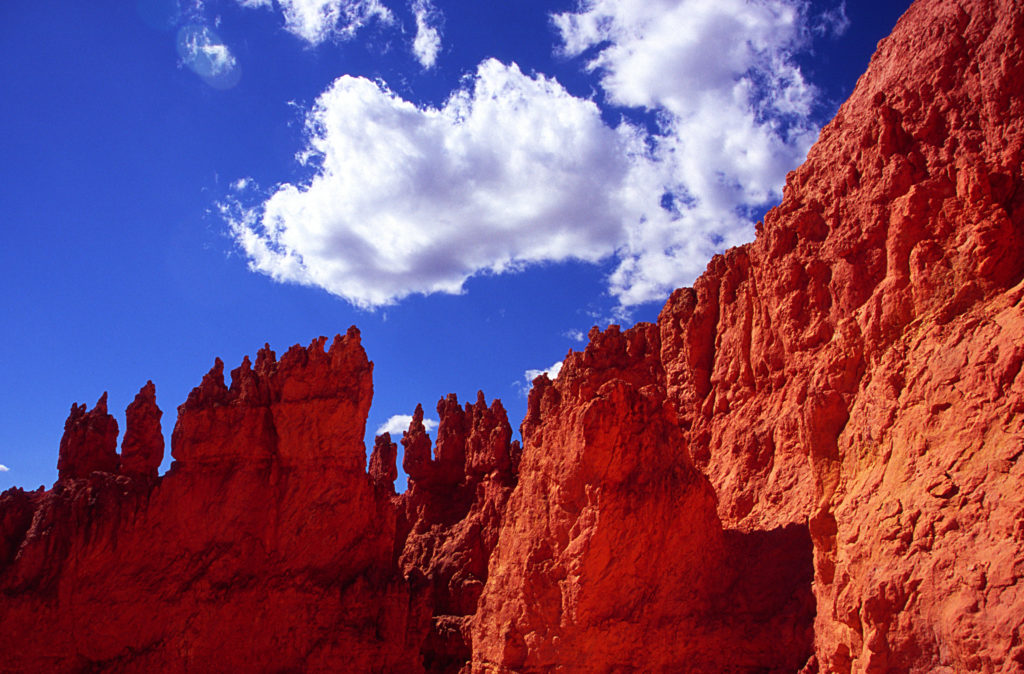
Ebenezer Bryce, an early Mormon settler for whom the park is named, described the amphitheater behind his ranch as, “A hell of a place to lose a cow”. Stand at one of the many overlooks and it’s easy to understand the “bad day at work” this scenario could create for a rancher in a place like Bryce Canyon. Collections of sherbet toned spires called “Hoodoos” give rise to redwood scaled stone forests below. The towers took over 10 million years to develop and seem close to toppling over at any moment. We decided to get a closer look and hiked down to the base to discover much of the canyon in orange filtered light.

Although colorful during the day, we discovered the real magic of Bryce begins at night. The air quality in this park is among the best in the world due to Bryce’s elevation and distance from developed land, and this set the stage for some world-class star gazing. We took advantage of an offer we received from a park ranger to look through a large telescope at the canyon’s edge after dark. A full moon had risen and we studied the topography for one area not currently on our backpacking wish list. Later that night, we grabbed our cameras and headed into the canyon for some moon-lit night photography.

Staying warm during Matt’s long exposures was tough since I just wanted to sit still and enjoy our last night of vacation doing nothing. Instead, I wandered the trails to stay warm and felt the presence of something alive around me even though we were the only two people around at 2am. Earlier in the day I had read Paiute tales describing the hoodoos as the Legend People turned to stone by the Great Coyote. I imagined the towers taking on supernatural expressions under the moon light before my imagination got the best of me and I hurried back to Matt. We sat quietly together and waited for the last click indicating the shutter had closed on his final exposure. City life was just around the corner and we wanted to drink in every minute of silence we could before returning home.

Headed Home

While ten days may seem like a long time on the road, we barely scratched the surface uncovering Utah’s wild side. With any luck we’ll be packing up the Suby again soon and headed east for places like Arches, Canyon Lands, and the countless other parks that couldn’t be stuffed into our first tour. Until then, our photos will have to suffice as a reminder of what waits for us when we return.

This post is part of the SierraSoul Archive. The trip took place in September, 2005 (or thereabouts).

Filed Under: sierrasoul Tagged With: adventure log, trip report

Trip Report: The Lost Coast

July 31, 2005 by matt Leave a Comment

Our return to the Lost Coast was four years in the making. Ever since our inaugural trip to the area in July of 2001, we’ve been trying to find the time to make our way back. We held onto great memories of empty beaches, curious wildlife, and breathtaking sunsets. During the first trip, we only explored a short section of the trail, opting for a low-key weekend at the beach. This time around, we aimed to see what other treasures this remote section of coastline held, as we hiked the 25-mile northern section of the Lost Coast Trail.

With a bit more planning and four more years of experience under our belts, this trip was off to a great start by the time we took our first steps down the trail. We had Thursday and Friday off of work and got a jump start on the drive by staying Wednesday night at Scott and Jena’s in Rohnert Park. On Thursday morning, we enjoyed a low-key drive north on 101 before heading west for the sleepy town of Shelter Cove. This is actually where we planned to end our hike. A few weeks earlier, we had scheduled a shuttle to drive us to the northern trailhead where we would start our hike.

Roxanne, our chauffeur, was right on time and talked our ears off all the way to the trailhead – about 45 minutes to the north. She handed us a tide table, told us to be careful and bid us farewell as we adjusted our packs and got ready for a mellow first day of hiking. The sky was clear and a gentle breeze invited us toward the beach. Our destination was only three miles away – the Punta Gorda Lighthouse. When we visited in 2001, this area was our home for two nights and we wanted a chance to reminisce. Also, the Punta Gorda Lighthouse offers some pretty great photo opportunities under the right conditions (unfortunately, the incredible light we saw on our first trip didn’t make a repeat performance this time). While Jody napped, I got myself re-acquainted with the area, photographing some very cooperative seals and sea lions.

We planned our hiking to be heavy on the second and third days, allowing for ample drive time on our first and last days. These long hikes had to be timed just right to cooperate with the tides. The northern section of the Lost Coast Trail has three “intertidal” sections – areas that are literally under water during high tide. We passed the first of these spots (Windy Point) on our first day. The other two intertidal sections are considerably longer at 3 to 4 miles a stretch and we planned to deal with one each on our second and third days. After leaving the lighthouse on Friday morning, the trail meandered along the bluffs to a point above Sea Lion Gulch – the beginning of our intertidal zone. Realizing we’d arrived well before high tide, we dropped our packs and sunned ourselves for an hour or two before heading down to the beach where the trail continued.

Better than half of the Lost Coast Trail isn’t actually a trail at all. It is more of a suggested route, tracing a path down long stretches of rocky and sandy beaches. The feeling is incredible as you hike a stone’s throw from the pounding breakers, listening to the distinctive barks of the sea lions, smelling the fresh sea air. The downside is the tempo of your travel. Rocky, sandy beaches make for slow hiking, but it’s really hard to complain considering the setting. We eased into a slow and steady pace and after several hours and a few tricky stream crossings, we arrived at Kinsey Creek – our second campsite.

For a second night we were spoiled with a righteous site on the bluffs overlooking the beach – close to stream water and knee-deep in gorgeous wildflowers. About an hour before sunset, the clear skies yielded to ominous, dark-grey clouds that rolled in from the south like a band of misfits. Despite a drop in temperature and some stiff winds, the storm had more bark than bite and we never saw a drop of rain that second night.

Jody isn’t known for her acute sense of balance, and stream crossings are usually an opportunity for both worry and high comedy.

We enjoyed a lazy morning on Saturday, taking our time to break camp so we could hit the intertidal section well after high tide. Early in the day, we came across another swift stream crossing. This one was precariously bridged by a narrow, wet log that sat a good four or five feet above the water. I made my way across and turned around to keep an eye on Jody, hoping she would motor across it without psyching herself out. Jody isn’t known for her acute sense of balance, and stream crossings are usually an opportunity for both worry and high comedy. After surveying multiple options, she approached the log and began an ill-advised side shuffle walk across the slick surface. After four or five steps, she wobbled a bit and instinctively crouched down. As if in slow motion, she lowered herself, tipped to one side and gravity took over. She toppled off the log and landed square on her backpack in the stream. Scrambling to her feet, she got back to dry land, swallowed her pride, and straddled the log as she shuffled herself to the other side (the hiking equivalent of the underhand free throw). Despite her little dip into the drink, she was mostly dry, thanks to her pack, which took the brunt of the hit.

Even with the best of intentions, we hit the intertidal section pretty early in the outgoing tide cycle. This wasn’t a problem for the most part – we just had to hike a little higher on the beach to avoid getting wet. But every once in a while, we’d come to a point where the rocks jutted too far into the water and staying dry involved watching, waiting, and then running like hell (see pictures below). This added a bit more excitement to the hike.

The trail eventually headed back to the bluffs above the beach and opened up to the aptly named Big Flat. The narrow trail grew into an arrow-straight, grassy road marked by three distinctive tire tracks. It wasn’t long before we realized this wasn’t a road, so much as it was a landing strip for small planes. Several private cabins dot the Lost Coast Trail and the means for reaching them are extremely limited. This was the coolest solution we had seen yet and we envied the people that had their own fly-in cabin on the most remote section of coastline in California.

After another deep stream crossing at Big Flat Creek, we stumbled across another surprise – a pair of surfers at Miller Flat. I had read that the area attracted hearty surfers willing to hike nearly 8 miles from Shelter Cove, but we hadn’t expected to see anyone out there. I wished we had seen them hiking in with full packs and surfboards strapped to their backs. Gitchell Creek and our final campsite arrived before long and we set up our tent on a patch of beach surrounded by some really good “sitting logs”. Another amazing sunset got me thinking about how spoiled we had become over the past three days – empty trails, beautiful campsites, abundant wildlife, clear skies, and more wildflowers than we had ever seen – at times, literally paving the trail in ribbons of yellow and orange.

A bit of rain moved in overnight and lingered in the morning. By the time we started hiking, the skies had cleared and four miles of black, sandy beach lie ahead of us – leading the way to Shelter Cove. Stream crossings had become second nature as we splashed through knee deep water without giving it a second thought. The parking lot at Black Sands beach was a welcome sight for tired bones. We dropped our packs by the car, celebrated with a long, smelly hug and settled in for a long drive home – content that we had seen the Lost Coast Trail in all of her splendor and glory.

Click here for a printable guide to hiking the Lost Coast Trail

Google Maps Link (trailhead)

This post is part of the SierraSoul Archive. The trip took place in July, 2005 (or thereabouts).

Filed Under: sierrasoul Tagged With: adventure log, trip report

Kirkwood Winter 2005

April 30, 2005 by matt Leave a Comment

Winter arrived with a bang this year, hitting the Sierra with mid-October snowstorms and the earliest opening day on record. Storm after storm pounded the range of light and offered up more deep powder days than either of us can remember. Early January snowstorms dumped 20+ feet of snow in less than two weeks. Speaking to a co-worker in Chicago, she remarked that she heard about our snowstorms in California and was surprised to hear about the “20 inches” of snow we had received. 20 inches? Silly mid-Westerner, inches are for chumps.

Kirkwood, our home mountain, topped out just over 800 inches this year. Yes, 800! That’s the most in North America for 2004/2005. The extended season afforded us more days on the mountain, despite our busy schedules. There were two firsts this season. Lindsay and Wayne tried their hand at snowboarding and I think they’re hooked. As for Jody, she finally muscled up and took some runs off of Chair 10 – realizing the splendor and bounty of the Sisters Chutes and Eagle Bowl.

I’m sorry to report that our tired bones rested themselves more often at Motel 6 than at our favorite snow-camping spot on Carson Pass. We only had one snow-camping night this year, but I for one, hope this will change next season. The season was capped off with a chill day at the Wood watching the Big Air comp – pictures below.

Here’s hoping we have another 800+ in 2005/2006.

his post is part of the SierraSoul Archive.

Filed Under: sierrasoul Tagged With: adventure log

Trip Report: Mount Langley, 2004

October 31, 2004 by matt Leave a Comment

Although the storm had been forecast, scores of climbers and backpackers had misjudged how severe it would be. Longtime rangers said it had the character—and duration—of a January blizzard, not an October surprise. By week’s end, the search for some 30 hikers and climbers stranded up and down the Sierra Nevada made CNN.

Special Report: Six Nights on the Dark Tower, Daniel Duane, National Geographic Adventure, Feb 2005 (Issue 47)

Twenty percent chance of precipitation. That was the prediction from the NOAA website before we departed for one of our more memorable trips to the High Sierra. It was late October and our plan was to squeeze in one last dry land trip before the snow started to fall and our focus shifted to snow sports. Little did we know that two weeks later we would be pointing our tips downhill at Kirkwood to kick off our earliest ski season on record.

Our plan was simple…and stupid. One weekend, round-trip summit bid on Mt. Langley. Never mind that the trailhead was a nine hour drive from San Francisco and the hike itself was 21 miles round trip – topping out at 14,026 feet. Simple facts such as these are no match for ignorance and exuberance. A big storm was predicted to hit the Sierra at some point, but the specifics of where and when were a bit cloudy, and that was good enough for us.

On the same weekend, one year prior, Jody and I stood atop White Mountain – California’s third highest peak and the first Fourteener for both of us. We hoped luck would be on our side again as we made another late season trip. This time around we were joined by our friend, the irrepressible Ben Sabraw – a man that is one half court jester, one half Six Million Dollar Man, and just dumb enough to think this plan made sense.

None of us could take Friday off, so the best we could do was a 4PM departure from San Francisco. The roads were clear as we made our way east – out of the Bay Area, through the Central Valley, into Yosemite and over Tioga Pass. By the time we gassed up in Bishop, the supercomputers at the National Weather Service predicted a storm could blow through as soon as Saturday night. Never a group to exercise caution in the face of scientific reason, and buoyed by the fact that Ben’s barometer was holding steady, we pushed on and arrived at the trailhead around 1AM Saturday morning. Our initial plan to hike through the night to Cottonwood Lakes was put to rest by tired eyes and freezing temperatures. We threw our sleeping bags down near the car and called it a night.

Up for an early start the next morning, we hit the trail for the relatively level, 6-mile hike to the Cottonwood Lakes basin. We made pretty good time and found a great campsite near Cottonwood Lake #3. Jody had decided to lay low and play the role of Basecamp Bunny while Ben and I made our way for the summit. Our original plan called for a chill day on Saturday and an alpine start Sunday morning. But the weather was holding steady and it was only 11AM, so we decided to make a dash for the top. We opted for the Old Army Pass route – a long slog over a rocky pass, leading to an equally unglamorous slog up scree slopes to the mountain’s summit. Langley isn’t exactly Sierra climbing at its aesthetic best, but it’s still an interesting hike up a big damn mountain.

Less than a mile from camp, just as we started making our way up Old Army Pass, we got sucker-punched by unexpected snow on the route. Neither of us had planned for snow. Postings on the summitpost message board indicated the trail was clear and dry as recently as the prior weekend. The snow looked fresh and couldn’t have been more than a few days old. We didn’t have ice-axes or crampons and our choice in footwear was better suited for a long, dry hike than a snowy one. We tried to ignore it for a few hundred feet, but as it got deeper we realized the obvious – this mountain would just have to wait. The hike up didn’t concern us so much as coming down – especially if we ran into problems and had to make the descent in the dark after the snow had firmed up.Never a group to exercise caution in the face of scientific reason…we pushed on…

Jody was a bit surprised when she saw us return to camp only an hour after we had left, but she was glad to see we had turned around rather than taking a chance. The sky was clear and the barometer was still holding steady, so we decided to enjoy an afternoon in the mountains and hike out the next morning. Jody and I spent the better part of the afternoon shooting an assignment for my photography class, while Ben took a nap by the lake. As soon as the sun fell behind the ridgeline, the mercury took a nose dive and we hurried to get some dinner cooked so we could get to bed as soon as possible.

We crashed on the early side – Jody and I in our tiny hoop tent and Ben nearby in his bivy sack. All across the Sierra, from Mt. Whitney to El Capitan, climbers and hikers were settling in for the night, unaware that the mother of all snowstorms was about to hit us like a ton of bricks. We woke briefly around 3AM to the faint sound of snow hitting our tent fly. By the time we woke up at first light, we knew that hanging around wasn’t an option – 11,000 feet, six miles deep isn’t a good place to be during a Sierra snowstorm. Thick clouds overhead blocked out the sun. A steady wind gave the modest snowfall a bit more gravitas. A few inches had fallen overnight. A quick survey of the trail offered some relief, as it was still somewhat visible under the blanket of white.

We broke camp fast and started moving with some purpose. We lost the trail while crossing the Cottonwood Lakes basin, but had ourselves straightened out before we ran into trouble. Once the route ducked into the trees, the sparse canopy offered some shelter from the snow, but the trail was slick and we had to watch our step. We were so rushed to get moving that morning, we hadn’t taken the time to eat. After an hour of hiking, we decided to take a break and recharge with some snacks. While we munched away, a solo hiker stopped by and asked if he could join us for the hike out. Like us, it was his first time in the area, and we all figured it was best to team up. We soon realized this was the same guy we saw float tube fishing at Cottonwood Lake #5 the previous day. Hauling that kind of gear into the backcountry at this elevation requires a pretty salty fisherman – we were impressed. Before long, we ran into two more hikers making their escape. The six of us leapfrogged each other all the way back to the trailhead.

It was a relief to see the snow wasn’t sticking to the asphalt. The long road down to Big Pine isn’t one you want to negotiate with snow or ice on the road. Staring back at the Sierra Crest from the safety of the Owens Valley was a humbling sight. The High Sierra was socked in and taking a beating. We felt lucky to have made it out of there without much trouble. While gassing up, we heard the news that Tioga Pass had been closed – blocking off our most direct route home. It’s always a game of chance around October/November – trying to schedule one more trip to the Eastern Sierra before Tioga closes. What are the chances that it’s going to happen over the course of a weekend trip? With the route through Yosemite closed, our next fastest option was an end run around the High Sierra – over Walker Pass and through BAKERSFIELD, BABY, BAKERSFIELD! A few more hours in the car is hardly worth mentioning when compared to the complete hell that several groups of hikers and climbers were up against.

Just outside of Bakersfield, Jody picked up a worried message from her mom, who had been had been hearing news about several search and rescue operations being launched throughout the Sierra. The storm was even more serious than we thought. Most of these searches ended happily over the next several days with parties making it out under their own power or with some assistance from SAR teams. Two Japanese climbers, however, met a more tragic end on the unforgiving vertical of El Capitan in Yosemite Valley. The rescue efforts in Yosemite prompted a Special Report in National Geographic Adventure (Feb, 2005) and made the cover of Rock & Ice magazine.

The whole experience, while exciting, was a stark reminder of how important it is to heed the warning signs around you and to respond without hesitation. We all walked away that weekend relieved to be safe, and with a renewed respect for the awesome power of Mother Nature.

You may be wondering, “Why so many photos of Matt below?” Well, I was working on an assignment for a photo class that weekend involving self portraits. Yes, I am trying to look cool. Yes, I am trying way too hard.

This post is part of the SierraSoul Archive. The trip took place in October, 2004 (or thereabouts).

Filed Under: sierrasoul Tagged With: adventure log, trip report

Trip Report: Mount Shasta, 14,162′

July 31, 2004 by matt Leave a Comment

The third time is the charm, right? That’s how the saying goes. As if, by fate’s design, we are all destined to taste bitter failure twice before we can truly appreciate success the next time ’round. Maybe the moon was in the seventh house and Jupiter was aligned with Mars and all of the cosmic forces of the universe willed us to succeed. Or perhaps Mt. Shasta needed us to prove our worth and determination on those previous attempts before it would acquiese and grant us safe passage to her craggy summit. Or maybe that is all a load of crap. Maybe this time we were just a bit stronger and bit smarter than we had been in the past.

The afternoon before we made the summit push from Helen Lake, the climbing ranger came around to discuss route conditions with us. He asked if we had been up on Mt. Shasta before and we explained that we had both made two attempts but failed to summit. His reaction surprised me at first, although it shouldn’t have. He said, “Good, at least you’re smart enough to turn around when it starts to look bad.” And maybe that was it. The trip certainly had its fair share of weird weather, interesting characters, bumps, bruises, and general odditites. But at no point did it ever look bad. That much can’t be said for my first two attempts, one of which ended in a trip to the ER and another that was capped off by a 12 hour sandblasting at the hands of a nasty windstorm.

Our Mt. Shasta trip had already been delayed once by a brute of a headcold that punched Ben in the nose and took his lunch money two days before our original departure date. We rescheduled for mid-July and crossed our fingers that Avalanche Gulch would hold enough snow to keep conditions on the route just this side of a scree-bound death march. It had been 5 years since my last attempt and a couple of years since Ben’s. We had never climbed together before this trip. In fact, we had never spent much time outside together. Come to think of it, the majority of our time together had been spent in a beer-fueled daze watching OSU football games or attending Mother Hips concerts. Having met through mutual friends, we knew of each others’ love for the outdoors and spent the brief moments between Derek Anderson interceptions spraying about our various outdoor feats – his far more impressive than mine.

We rolled out of San Francisco at 5:30 on Friday afternoon, and by 7:30 we had made it all the way to Berkeley – nearly 15 miles away. The frenetic pace was almost more than our tender hearts could handle. At one point, we saw the needle on the speedometer edge past the 30 mph mark. Such is the life of bona fide weekend warriors. We made it to Vacaville before stopping for dinner and fueled up on top notch energy food – Jack in the Box Ultimate Cheeseburgers, oil soaked fries, and massive sodas. We certainly were setting ourselves up for success in every conceivable way.

I Digress

Sixty-four ounces of Dr. Pepper has a way of making its presence known in one’s bladder, and just shy of Dunsmuir I decided I could wait no longer. Somewhere between the I-5 Pollard Flat exit and the parking lot of the Exxon, we must have passed through a portal into the Twilight Zone. As we pulled into the parking lot of this gas station/restaurant/general roadside oddity, we surveyed the cast of character loitering outside. They looked like they were on a field trip from the Siskiyou School of Bathtub Chemistry – all sleeveless shirts and mesh-back caps and faded tats.

I’m not easily spooked, but I was in no mood to linger at this place. I walked inside the front door and picked up a very creepy vibe. The place was empty – dark inside except for a couple of random lights and the blue cast of a TV shining from one corner. I looked around for the bathroom but didn’t see anything obvious. This is an odd analogy to be sure, but the most fitting one that I can find. Think back to the movie “Goonies” – at the beginning when the kids first go looking for the entrance to the cave and wind up inside of the Fratelli’s hide-out/restaurant – that is the kind of vibe this place had. It looked like they’d hired Ted Nugent to do the interior decorating. As I made my way to the far end of the room, a voice behind me bellowed, “Can I help you?” I told the grissled gentleman that I was looking for the bathroom. He muttered something about being closed but that I could use the bathroom in the corner by the TV. I made my way over to the bathroom and pushed the door halfway open. I could hear the faucet running. Thinking I had barged in on someone, I quickly closed the door and offered an apology. Then I realized there was nobody inside and pushed the door open further this time. A survey of the single-seater bathroom revealed a full-size, clawfoot bathtub sitting in one corner with a female mannequin propped up inside. When I wandered over to the toilet, the mannequin was staring right at me. Somebody had a pretty twisted sense of humor. I finished up my business as quickly as I could and made a bee-line back to the car.

A Moonlight Hike

After some aimless cruising around the fringes of Mt. Shasta City, we found the Everett Memorial Highway and arrived at the Bunny Flat trailhead at 12:30AM. We decided to start hiking so we could rest at Horse Camp, rather than trying to sleep through late night arrivals in the parking lot. We made it to Horse Camp in no time, but we were still dog tired from a full day of work and 7 hours of driving. The formalities of a tent seemed too complicated and we opted for a night under the stars. The 4AM rain showers made us temporarily regret that decision, but we slumbered on through and before long the sun was rising.

We took our time ambling up the scree and soft snow between Horse Camp and Helen Lake, stopping for photos and Clif bars frequently. During our hike, we passed several dejected parties that were on the return leg of a failed summit attempt. Apparently the sprinkles we felt down at 8,000 feet were a bit more imposing between 10,000 and 12,000 feet. Most people put on a smile and wished us luck on our attempt that night, but one middle-aged, alpine superstud took his 30 seconds to inform us that nobody was going to catch a break this weekend. I appreciate it when fellow climbers, hikers, etc. have some useful information to pass along regarding route conditions, weather patterns, Yeti sightings, etc. But spraying bad energy all over someone’s hopes just because your attempt came up short is pretty weak. We nodded, dropped a couple of mental F-bombs on the guy, and kept on slogging.

For the uninitiated, Helen Lake is not a lake at all. It’s a large, sloping snowfield that has a pleasant habit of developing 3-foot suncups by mid-July. Most people opt to set up camp on the windward side of the rocky bench that surrounds the southern end of the “lake”. The stakes we had for the Megamid were no good in dirt, and by setting up camp on the snowfield itself, we had a 100-foot head start on everyone else the next morning. Our afternoon was spent ingesting massive amounts of calories and boiling snow for water. We took a couple of naps and generally laid low for the rest of the day. We knew Sunday was going to be big and we didn’t want to waste any energy.

Guy – A Cautionary Tale

Early that evening, this random guy (henceforth known as “Guy”) hauled himself up to our campsite and dropped his pack right next to Ben. Guy was sweaty and haggard looking; dressed in lightweight hiking boots and a glorified track suit. He had a thick accent and went on about the hike being much harder than he expected. Guy asked us where we got our water and we explained that we had been melting snow all afternoon. When he asked us how to melt snow, a few points became clear: a) Guy was pretty weird, b) Guy was in way over his head, c) Guy was in real danger of hurting himself if he kept going the next day.

Ben started grilling Guy on his gear and how much food and water he had with him. He was reluctant to answer most questions and occupied himself by stretching out his back. Then he stood up and asked Ben if he could, “…do me a favor.” Reluctant, Ben asked what he needed. Guy hesitated and then said, “I need you to kick me in the back.” I nearly spit the Gatorade I was drinking through my nose, but Ben didn’t miss a beat – “NO, absolutely not. I will not kick you in the back!” After some further explanation and awkward hand gesturing, we came to understand that he meant punch, not kick, and was looking for an impromptu back massage – slightly less weird, but not by much. Looking to get Guy on his way sooner than later, Ben obliged and punched him in the back a few times before sitting down and pretty much ignoring him until he left.

A Bid for the Top

Sunset brought with it the surreal colors that only appear in the high mountains. We spent some time taking photos and retired for the evening soon after the sky fell dark. That night’s sleep was restful, but short. It wasn’t long before the alarm went off and we were up and dressed for game day. We left the tent just after 2AM and made our way toward the main snowfield leading to the Red Banks. Without any moonlight, we were left to find our way using headlamps and the faint outlines of the major rock formations that contrasted against the snow. We were the first pair on the route that morning and everytime we turned around there were more and more headlamps winding their way toward us. On more than one occasion, I hoped they weren’t all following us, because neither Ben nor I were 100% confident about our route selection. Our progress was slow on this most difficult section of the climb, but we made it to the Red Banks before dawn and found an end-run route to the far right of the Red Banks, taking us toward Thumb Rock. We encounted steep scree that slid with every step and further slowed our progress, but we eventually made it above the Red Banks and were treated to great views of the east side of the mountain.

Once you’ve made it past the Red Banks, the climb is very straightforward. There is still 1,500+ feet of vertical to go and the summit is not yet visible, but a well worn path leads the way. Endless switchbacks took us to the base of the aptly named Misery Hill. We rested up and grabbed a bite to eat before we resumed the slogging. Misery Hill is a false summit that tops out near 13,800 feet – it’s an annoying but necessary final step before you are treated to views of the summit. Ben was moving faster than I was at this point, but he waited for me at the base of the summit plateau, where we encountered the first snow since the Red Banks.

From the summit plateau, the summit block looked a bit intimidating. It’s only 300 feet tall, but it’s craggy and steep and doesn’t appear to hold any simple lines. As we got closer an obvious route around the left side of the block appeared. We made one final push up a set of switchbacks and scrambled to the top – 14,126 feet – the sixth highest mountain in California and the second highest mountain in the Cascade range. We took a minute to sign the summit register and snap some summit photos. As far as we can tell, we were the first pair on the summit that day – sometime around 8:15 am.

Inside the Storm

The weather had been slowly deteriorating all morning, and from the summit we got a better view of what was going on. Clouds were bearing down from the west and splitting as they approached the mountain. The wind was picking up and we had one massive cloud slowly spinning around us. It felt like we were onboard the mothership and I soon realized we were in the middle of a massive lenticular formation. It was a very strange feeling and not one that we cared to sit around and contemplate. On our way down from the summit block we passed four or five parties that had been clipping our heels the whole way. With smiles on our faces, we encouraged them along. We beat a hasty retreat down the mountain and made use of the large snowfields to do some glissading.

The weather continued to deteriorate, and we encountered some rain and some hail, which made us very glad we left camp when we did that morning. We passed all varieties of climber on our descent – young and old, fit and fat, a group of four that had enough equipment to put up a new line on Cerro Torre, and even Guy, who was suffering like a champ. We took a few minutes at Helen Lake to break down camp and fill our packs. Ben was itching to get down, so he made quick work of the snowfield down to 50/50 and on to Horse Camp. I moved as fast as I could, which wasn’t fast at all. During the hike out, I gained an appreciation for just how long the route actually is – 7,000 feet of vertical and about 7 miles each way. It might be considered a walk-up by some, but that’s nothing to sniff at.

I met Ben at the car around 2PM. We were both pretty beat, but the smiles were wide and spirits were high. More hugs, more high-fives, more photos. We drove down to Mt Shasta City and grabbed a bite to eat. The drive back was mercifully faster than our drive up and we made it home to San Francisco before dark. This had been the quintessential weekend warrior trip, and it was a success no matter how you look at it.

Google Maps Link (trailhead)

This post is part of the SierraSoul Archive. The trip took place in July, 2004 (or thereabouts).

Filed Under: sierrasoul Tagged With: adventure log, trip report

Trip Report: Trinity Alps, Caribou Lakes

August 31, 2003 by matt Leave a Comment

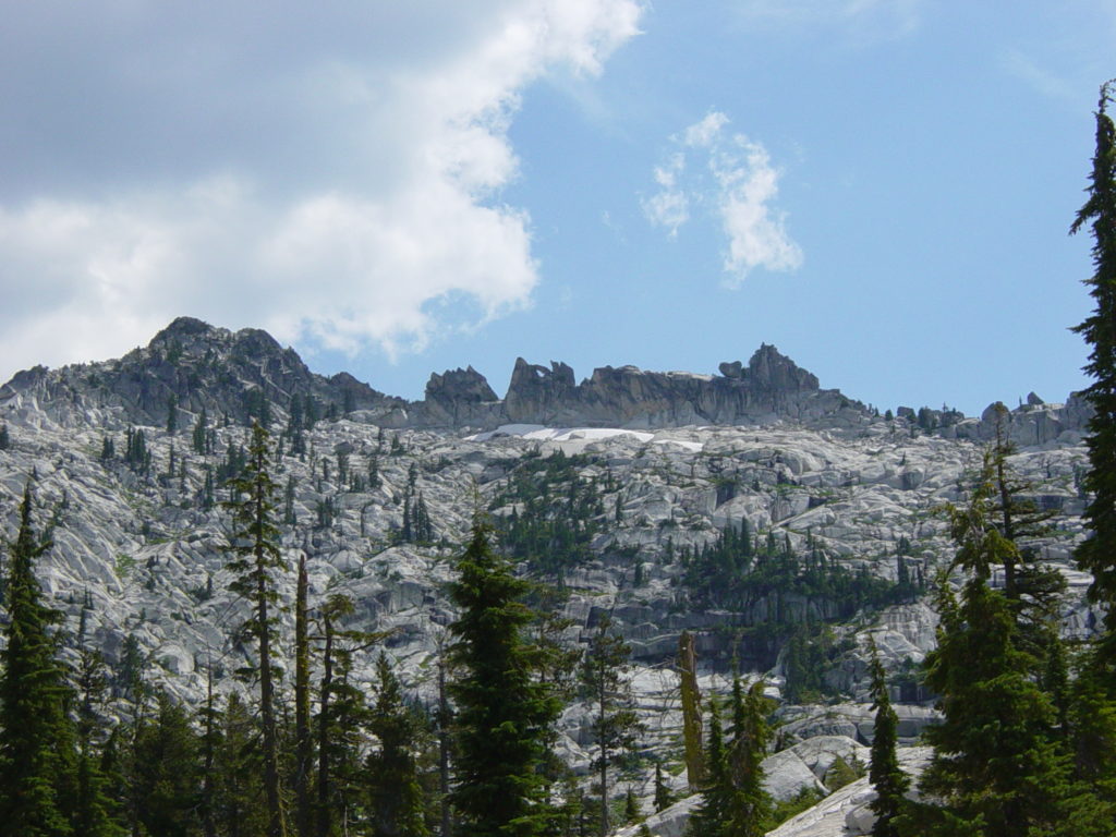
Labor Day weekend. The symbolic end of summer. The last three day weekend to get outside and enjoy the summertime sun. For us, it was an opportunity to explore new terrain and tune up in preparation for our Patagonia trip. The Trinity Alps was our destination and we were excited to see something new. Located in between Interstate 5 and Highway 101, northwest of Redding, the Trinity Alps Wilderness is a rugged, beautiful, and less crowded alternative to the Sierra. Our plan was a 3 day, 2 night romp through the Caribou Basin area.

Looking to avoid holiday traffic and trailhead crowds, we opted for an alpine start to our weekend, leaving San Francisco at 2 AM on Saturday morning. With minimal traffic, we reached Redding in a little over 3 hours. After filling up on $2/gal ARCO gas (love it), we headed west on 299 and made it through Weaverville just as the sun was rising. Another 40 miles north on Highway 4, put us at the Coffee Creek ranger station where we picked up a Wilderness Permit. The trailhead is only about 20 miles from the ranger station on Coffee Creek road, but 15 of those 20 miles are unpaved and a bit rowdy in a little Subaru.

There were a lot of cars at the trailhead and we encountered several groups along the trail to Caribou Lake. The route to Caribou Lake has two versions – the shorter, steeper Old Caribou Trail, or the longer, flatter New Caribou Trail. After driving all night we opted for the New Caribou Trail, which still had plenty of climbing to keep it interesting. The trail was long and a bit rugged in spots, but after 5 hours of hiking we saw the dark, blue waters of Caribou Lake below us. Of the three lakes in the area (Caribou, Lower Caribou, and Snowslide), Snowslide Lake is the first one you reach. Tired and thirsty, we dropped our packs at the first site we came to and decided it would be just fine for the evening. After pumping some water and setting up camp, we actually realized that we had scored a great site. It was large, shady, near the water (but not too close), and had a great big granite slab that we could use to cook and spread out our gear.

The rest of the day was spent taking naps, taking pictures, and tending to blistered feet. A delicious chicken fajita dinner and excellent lakeside views made the decision to stay put a simple one. Originally, we had entertained the idea of hiking over Caribou Mountain and off-trail to Little Caribou Lake. But we were quite happy right where we were and neither of us fancied the idea of doing a hard hike the next day. Instead we got some rest and spent Sunday exploring the area. We hiked up to Caribou Lake and spent the day swimming and relaxing in the sun. The area around Caribou Lake proper is beautiful, with small waterfalls and “gardens” and incredible views of Sawtooth Ridge.

Another relaxing night gave way to an early morning departure back to the trailhead. Our goal to put the worst of the climbing behind us before the sun beat down paid off, and we made good time back to the car. We reached the car a little bit before noon and headed back towards Redding. About two or three miles down the dirt road from the trailhead, the left rear tire on the Subaru decided to go flat. We still had about 10-12 miles of dirt road and 80+ miles to Redding. After swapping out the tire for a donut-sized spare, we gingerly eased down the road and made it to Redding at 4:30. It was 107 degrees. Finding a place to buy tires in Redding at 4:30 on Labor Day can be quite a challenge. Les Scwabb was closed. Costco was closed. The good people at Kragen’s offered us a bit of advice – Wal*Mart. Now, I basically hate Wal*Mart and everything that they stand for, but I was pretty damn excited to see the greasy faces at the Express Lube and Tire center that day. The abhorrent business and labor practices of Wal*Mart came through in a pinch. While the tires were being installed, we found a Red Robin and asked the hostess to seat us as far from everyone else as possible, lest we offend them with our surly odor. After 2 hours (about an hour longer than you ever want to spend in Redding on an August afternoon), we had full stomachs and a pair of the finest Goodyears that Sam Walton had in stock. A friend later told me, “Anytime you get to hike 20 miles, sleep outside, and deal with Redding locals all in one weekend, I think adventure goes without saying.” I would have to agree.

This post is part of the SierraSoul Archive. The trip took place in August, 2003 (or thereabouts).

Filed Under: sierrasoul Tagged With: adventure log, trip report

Other Websites

  • PritchardPeck Lighting
  • SierraSoul Archive
  • Yummy Lovin'
  • Lands End Aerospace

Social

  • Matt on Instagram
  • Jody on Instagram
  • PritchardPeck on Instagram
  • Cali on Instagram

History

  • December 2022
  • December 2021
  • June 2020
  • December 2019
  • December 2018
  • December 2016
  • July 2016
  • April 2016
  • December 2015
  • August 2015
  • January 2015
  • November 2014
  • August 2014
  • January 2014
  • December 2013
  • January 2013
  • November 2012
  • October 2012
  • August 2012
  • April 2012
  • March 2012
  • February 2012
  • December 2011
  • November 2011
  • October 2011
  • April 2011
  • March 2011
  • December 2010
  • November 2010
  • August 2010
  • July 2010
  • June 2010
  • April 2010
  • January 2010
  • November 2009
  • October 2009
  • September 2009
  • August 2009
  • June 2009
  • May 2009
  • April 2009
  • March 2009
  • February 2009
  • January 2009
  • December 2008
  • November 2008
  • October 2008
  • September 2008
  • October 2006
  • September 2005
  • July 2005
  • April 2005
  • October 2004
  • July 2004
  • August 2003
  • March 2003

Copyright © 2023 · WordPress · Log in