PRITCHARD LIFE

still picking out a paint color

Kirkwood Winter 2005

April 30, 2005 by matt Leave a Comment

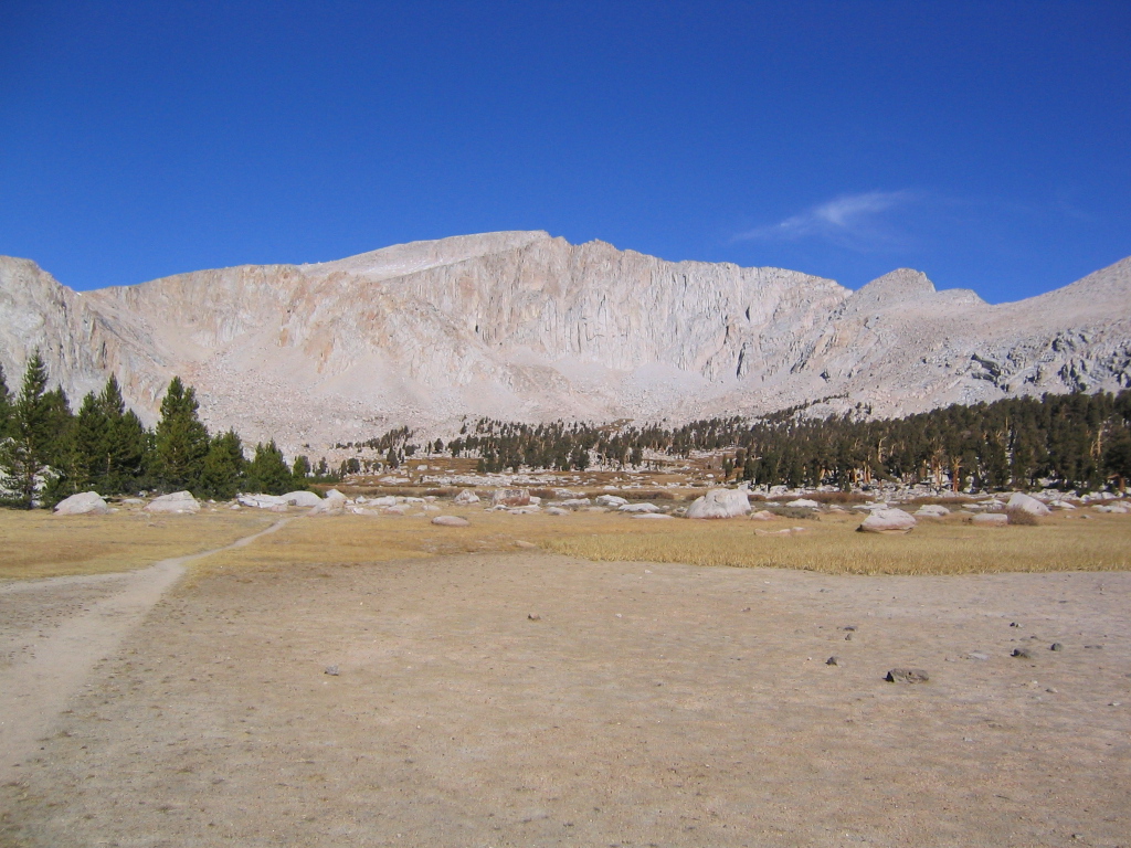
Winter arrived with a bang this year, hitting the Sierra with mid-October snowstorms and the earliest opening day on record. Storm after storm pounded the range of light and offered up more deep powder days than either of us can remember. Early January snowstorms dumped 20+ feet of snow in less than two weeks. Speaking to a co-worker in Chicago, she remarked that she heard about our snowstorms in California and was surprised to hear about the “20 inches” of snow we had received. 20 inches? Silly mid-Westerner, inches are for chumps.

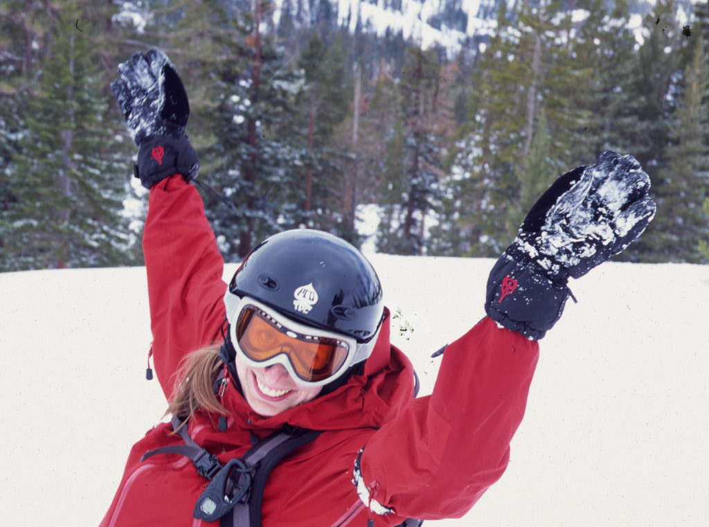
Kirkwood, our home mountain, topped out just over 800 inches this year. Yes, 800! That’s the most in North America for 2004/2005. The extended season afforded us more days on the mountain, despite our busy schedules. There were two firsts this season. Lindsay and Wayne tried their hand at snowboarding and I think they’re hooked. As for Jody, she finally muscled up and took some runs off of Chair 10 – realizing the splendor and bounty of the Sisters Chutes and Eagle Bowl.

I’m sorry to report that our tired bones rested themselves more often at Motel 6 than at our favorite snow-camping spot on Carson Pass. We only had one snow-camping night this year, but I for one, hope this will change next season. The season was capped off with a chill day at the Wood watching the Big Air comp – pictures below.

Here’s hoping we have another 800+ in 2005/2006.

his post is part of the SierraSoul Archive.

Filed Under: sierrasoul Tagged With: adventure log

Trip Report: Mount Langley, 2004

October 31, 2004 by matt 1 Comment

Although the storm had been forecast, scores of climbers and backpackers had misjudged how severe it would be. Longtime rangers said it had the character—and duration—of a January blizzard, not an October surprise. By week’s end, the search for some 30 hikers and climbers stranded up and down the Sierra Nevada made CNN.

Special Report: Six Nights on the Dark Tower, Daniel Duane, National Geographic Adventure, Feb 2005 (Issue 47)

Twenty percent chance of precipitation. That was the prediction from the NOAA website before we departed for one of our more memorable trips to the High Sierra. It was late October and our plan was to squeeze in one last dry land trip before the snow started to fall and our focus shifted to snow sports. Little did we know that two weeks later we would be pointing our tips downhill at Kirkwood to kick off our earliest ski season on record.

Our plan was simple…and stupid. One weekend, round-trip summit bid on Mt. Langley. Never mind that the trailhead was a nine hour drive from San Francisco and the hike itself was 21 miles round trip – topping out at 14,026 feet. Simple facts such as these are no match for ignorance and exuberance. A big storm was predicted to hit the Sierra at some point, but the specifics of where and when were a bit cloudy, and that was good enough for us.

On the same weekend, one year prior, Jody and I stood atop White Mountain – California’s third highest peak and the first Fourteener for both of us. We hoped luck would be on our side again as we made another late season trip. This time around we were joined by our friend, the irrepressible Ben Sabraw – a man that is one half court jester, one half Six Million Dollar Man, and just dumb enough to think this plan made sense.

None of us could take Friday off, so the best we could do was a 4PM departure from San Francisco. The roads were clear as we made our way east – out of the Bay Area, through the Central Valley, into Yosemite and over Tioga Pass. By the time we gassed up in Bishop, the supercomputers at the National Weather Service predicted a storm could blow through as soon as Saturday night. Never a group to exercise caution in the face of scientific reason, and buoyed by the fact that Ben’s barometer was holding steady, we pushed on and arrived at the trailhead around 1AM Saturday morning. Our initial plan to hike through the night to Cottonwood Lakes was put to rest by tired eyes and freezing temperatures. We threw our sleeping bags down near the car and called it a night.

Up for an early start the next morning, we hit the trail for the relatively level, 6-mile hike to the Cottonwood Lakes basin. We made pretty good time and found a great campsite near Cottonwood Lake #3. Jody had decided to lay low and play the role of Basecamp Bunny while Ben and I made our way for the summit. Our original plan called for a chill day on Saturday and an alpine start Sunday morning. But the weather was holding steady and it was only 11AM, so we decided to make a dash for the top. We opted for the Old Army Pass route – a long slog over a rocky pass, leading to an equally unglamorous slog up scree slopes to the mountain’s summit. Langley isn’t exactly Sierra climbing at its aesthetic best, but it’s still an interesting hike up a big damn mountain.

Less than a mile from camp, just as we started making our way up Old Army Pass, we got sucker-punched by unexpected snow on the route. Neither of us had planned for snow. Postings on the summitpost message board indicated the trail was clear and dry as recently as the prior weekend. The snow looked fresh and couldn’t have been more than a few days old. We didn’t have ice-axes or crampons and our choice in footwear was better suited for a long, dry hike than a snowy one. We tried to ignore it for a few hundred feet, but as it got deeper we realized the obvious – this mountain would just have to wait. The hike up didn’t concern us so much as coming down – especially if we ran into problems and had to make the descent in the dark after the snow had firmed up.Never a group to exercise caution in the face of scientific reason…we pushed on…

Jody was a bit surprised when she saw us return to camp only an hour after we had left, but she was glad to see we had turned around rather than taking a chance. The sky was clear and the barometer was still holding steady, so we decided to enjoy an afternoon in the mountains and hike out the next morning. Jody and I spent the better part of the afternoon shooting an assignment for my photography class, while Ben took a nap by the lake. As soon as the sun fell behind the ridgeline, the mercury took a nose dive and we hurried to get some dinner cooked so we could get to bed as soon as possible.

We crashed on the early side – Jody and I in our tiny hoop tent and Ben nearby in his bivy sack. All across the Sierra, from Mt. Whitney to El Capitan, climbers and hikers were settling in for the night, unaware that the mother of all snowstorms was about to hit us like a ton of bricks. We woke briefly around 3AM to the faint sound of snow hitting our tent fly. By the time we woke up at first light, we knew that hanging around wasn’t an option – 11,000 feet, six miles deep isn’t a good place to be during a Sierra snowstorm. Thick clouds overhead blocked out the sun. A steady wind gave the modest snowfall a bit more gravitas. A few inches had fallen overnight. A quick survey of the trail offered some relief, as it was still somewhat visible under the blanket of white.

We broke camp fast and started moving with some purpose. We lost the trail while crossing the Cottonwood Lakes basin, but had ourselves straightened out before we ran into trouble. Once the route ducked into the trees, the sparse canopy offered some shelter from the snow, but the trail was slick and we had to watch our step. We were so rushed to get moving that morning, we hadn’t taken the time to eat. After an hour of hiking, we decided to take a break and recharge with some snacks. While we munched away, a solo hiker stopped by and asked if he could join us for the hike out. Like us, it was his first time in the area, and we all figured it was best to team up. We soon realized this was the same guy we saw float tube fishing at Cottonwood Lake #5 the previous day. Hauling that kind of gear into the backcountry at this elevation requires a pretty salty fisherman – we were impressed. Before long, we ran into two more hikers making their escape. The six of us leapfrogged each other all the way back to the trailhead.

It was a relief to see the snow wasn’t sticking to the asphalt. The long road down to Big Pine isn’t one you want to negotiate with snow or ice on the road. Staring back at the Sierra Crest from the safety of the Owens Valley was a humbling sight. The High Sierra was socked in and taking a beating. We felt lucky to have made it out of there without much trouble. While gassing up, we heard the news that Tioga Pass had been closed – blocking off our most direct route home. It’s always a game of chance around October/November – trying to schedule one more trip to the Eastern Sierra before Tioga closes. What are the chances that it’s going to happen over the course of a weekend trip? With the route through Yosemite closed, our next fastest option was an end run around the High Sierra – over Walker Pass and through BAKERSFIELD, BABY, BAKERSFIELD! A few more hours in the car is hardly worth mentioning when compared to the complete hell that several groups of hikers and climbers were up against.

Just outside of Bakersfield, Jody picked up a worried message from her mom, who had been had been hearing news about several search and rescue operations being launched throughout the Sierra. The storm was even more serious than we thought. Most of these searches ended happily over the next several days with parties making it out under their own power or with some assistance from SAR teams. Two Japanese climbers, however, met a more tragic end on the unforgiving vertical of El Capitan in Yosemite Valley. The rescue efforts in Yosemite prompted a Special Report in National Geographic Adventure (Feb, 2005) and made the cover of Rock & Ice magazine.

The whole experience, while exciting, was a stark reminder of how important it is to heed the warning signs around you and to respond without hesitation. We all walked away that weekend relieved to be safe, and with a renewed respect for the awesome power of Mother Nature.

You may be wondering, “Why so many photos of Matt below?” Well, I was working on an assignment for a photo class that weekend involving self portraits. Yes, I am trying to look cool. Yes, I am trying way too hard.

This post is part of the SierraSoul Archive. The trip took place in October, 2004 (or thereabouts).

Filed Under: sierrasoul Tagged With: adventure log, trip report

Trip Report: Round Lake, Carson Pass North

September 30, 2004 by matt Leave a Comment

It seems a bit mischievous – driving past your office on a weekday morning with a car full of backpacking gear and no intention of slowing down. That’s how I felt as we sped across the Bay Bridge in full view of my building in downtown Oakland, knowing that my co-workers would be showing up soon to put in a full 8 hours on this beautiful summertime Friday. Jody and I were bound for the Sierra – in search of some much needed R+R.

We spend a lot of time around Carson Pass during the winter – skiing at Kirkwood and snow camping near Red Lake. The area is so beautiful and accessible, it just begs for exploration. A couple of years ago we did a weekend backpacking trip to nearby Margaret Lake, which we really enjoyed. It’s hard to go wrong with blue water, granite, pines, and aspens. This time we were heading to Round Lake on the suggestion of a friend. Originally, we wanted to hike south from Carson Pass and explore the Winnemucca, Round Top, Emigrant Lake area, but our 3 day time limit and soft physical condition dictated a more mellow trip.

Round Lake can be reached from the north via the Big Meadow trailhead and from the south via Carson Pass. Since we would be staying put for two nights, we opted for the slightly longer hike in from Carson Pass. After stopping by Kirkwood to pick up our 04/05 season passes, we parked at the Carson Pass lot and hit the trail. The route to Round Lake follows the Pacific Crest Trail for a few of miles before branching off onto the Tahoe Rim Trail for the final two miles. The trail itself climbs high above Highway 88, meandering through groves of aspens and pines and dense pockets of fennel. The trail crests a small pass with great views to the north of Lake Tahoe and to the south of Round Top and the Sisters and Elephant’s Back. The grade was mellow, but our breathing was not. Apparently sitting on one’s ass for the better portion of a season doesn’t do much for your level of aerobic fitness. We stopped for a breather and made note of the thunderheads stacking up in the distance.

Fearing afternoon thunderstorms, we tried to keep a brisk pace, but our legs and lungs just refused to toe the company line. We made it to Round Lake before too long and were pleased to find a large campsite not far from the lake. We pitched camp and settled into our favorite backcountry activity: sleeping. By the time we woke up, the sun had called it quits and we had to cook dinner by headlamp. A noticeable lack of mosquitoes made for a pleasant evening and we called it a night on the early side.

Fearing afternoon thunderstorms, we tried to keep a brisk pace, but our legs and lungs just refused to toe the company line.

Staying both nights at Round Lake gave us time on Saturday to explore a bit and hunt down some of the other lakes in the area. Two were close by, but Meiss Lake grabbed our attention because there was no trail leading the way. Located in between the PCT and the TRT, the lake is not far, but not visible from either trail. We also heard it was great for swimming, so we packed a bag and beat a path in that general direction. Jody and I didn’t exactly agree on the route through the thicket of tall grass and shrubs and I’ll admit now that Jody had us moving in the right direction. We eventually found the lake and scoped out a seat along it’s grassy shore. The lake is very shallow and would have been great for a swim if it hadn’t been for the wind. A large, lush meadow spills out of the lake to the south. We spent some time reading and watching a nymph dragonfly fight a losing battle against the strong wind.

On our way back to camp, we encountered a large group of scouts making their way to Round Lake. We seem to attract Boy Scouts on our trips and despite their charms (i.e. high entertainment value, unintentional comedy off the charts), we usually try to keep a safe distance. We made a hasty retreat back to camp and the youngsters pulled up short on the other side of the lake.

Despite the natural beauty of Round Lake, the place takes a beating from overuse. We spent a good portion of our Saturday evening and Sunday morning cleaning up our campsite and several others. The amount of trash we found really surprised me. I understand the occasional scrap that falls out of your pack or blows away in the wind when you’re not looking, but I don’t understand the mind of someone that would leave an entire bag of garbage sitting in a fire pit or stash empty liquor bottles in between a few rocks. What gives? If you can pack it in, you can pack it out. My 4 year old niece knows how to pick up after herself, what excuse do these people have? Together, Jody and I packed out about 10 lbs of trash. There would have been more if our packs were bigger.

We made fast work of the hike out on Sunday. The air was cold and the sky was overcast. It felt like autumn had arrived. The wind was blowing and the aspens were making that cool sound that aspens make. I wished I could be back there in a few weeks when the leaves turn yellow and carpet the hillside. We must have cut an hour from our time on the way out. Bub’s Sports Bar at Kirkwood was calling our names and we inhaled some quesadillas and burgers before heading back the Bay. Overall, it was a lovely weekend. We look forward to exploring more of the Carson Pass area in the coming years.

This post is part of the SierraSoul Archive. The trip took place in September, 2004 (or thereabouts).

Filed Under: sierrasoul Tagged With: adventure log, trip report

Trip Report: Lassen Volcanic National Park

September 30, 2004 by matt Leave a Comment

The weekend was born out of necessity. We were jonesing for some time outside and it needed to happen soon. The autumn is good for this kind of trip. The mercury is falling, kids are back in school, and areas that host hordes in the summer are thinning out before winter. You can pretty much pick a spot on the map and plan a trip in little to no time. We zeroed in on Mt Lassen without much thought. It’s been on our list for the past few years, it is easy to get to, and neither of us had been to the area since we were knee-high to a grasshopper.

We hit the road well before dawn on Saturday morning, with Jody assuming captain duties. I flew second-seat and slumbered through the bulk of the drive – not waking until we veered off I-5 near Red Bluff. We pulled through the park gates around 8:30 and dumped our gear at a nice spot in the walk-in campground. Before long, we were back in the car, heading towards the Mt. Lassen trailhead – a few miles down the road. Mt. Lassen is the southernmost of the major Cascade peaks. Having last erupted in 1915, it is considered to be the largest plug-dome volcano in the world. The main cone of the volcano rises two thousand feet above the surrounding area, topping out at 10,453 ft. Before the 1980 eruption of Mt. St Helens, Lassen was the most important volcanic research area in the U.S. To this day, it serves an important role foretelling the recovery cycle of St. Helens and other recently erupted volcanoes.

Hiking to the summit of Mt. Lassen is a pretty straightforward deal – a well worn trail winds 2.5 miles and 2,000 vertical feet to the summit. Switchbacks lead the way up the rocky, barren slopes that characterize so many of the Cascade peaks. We took our time and enjoyed a blue-bird day in the mountains. We had plenty of company, including a large group of high-schoolers from Eureka, who offered a fair amount of entertainment. A wee bit of scrambling at the top put us on the summit inside of two hours.

To the north, we could see Mt Shasta in all its glory, more than 3,500 ft. higher than us. In every direction small cinder cones told a clear story about the rumblings underneath the earth’s crust. On the northeast side of the mountain, we could see the devastated area caused by the massive mudslides that accompanied the mountain’s most recent eruption. To the south was a bird’s eye view of Brokeoff Mountain, another gem of the park – it might not be as geologically interesting, but the hiking and climbing opportunities abound. A quick descent put us in camp in the early afternoon and gave us the rest of the day to relax and catch up on some reading and sleeping.

For people that spend most of their outside time backpacking, the occasional car camping trip can be a real treat. Why? Let’s start with comfy camp chairs, coolers of beer, massive food lockers, real mashed potatoes, and tri-trip grilled on the hibachi. With full stomachs and tired eyes, we settled down for the night.

We woke early Sunday morning to take advantage of the good light near Bumpass Hell. There are two hikes you are pretty much required to do when you visit Lassen – the first of which is the hike to the summit. The other is the hike to Bumpass Hell. This area most vividly describes the history and the character of the park. Bubbling (literally) with geothermal activity, the pools, vents, and mudpots around Bumpass Hell burp, gurgle and spew a noxious funk of hydrogen sulfide and steam. Crisscrossed with boardwalks and guardrails, there is a very Venusian quality to the place, giving it the feel of Jabba the Hut’s personal day spa. By starting early, we were treated to beautiful light and absolutely no crowds. For the 30 or 40 minutes we spent there, we didn’t see another person. It afforded us some great photos, which can be seen below.

We returned to camp after our hike and decided to call it a weekend. We had other hikes on our list, but we needed to save something for next time – also, we were feeling lazy. We hit the road around noon and spent the car ride home talking about trips for ’05. It’s shaping up to be a very good year.

This post is part of the SierraSoul Archive. The trip took place in September, 2004 (or thereabouts).

Filed Under: sierrasoul Tagged With: adventure log, trip report

Trip Report: Mount Shasta, 14,162′

July 31, 2004 by matt Leave a Comment

The third time is the charm, right? That’s how the saying goes. As if, by fate’s design, we are all destined to taste bitter failure twice before we can truly appreciate success the next time ’round. Maybe the moon was in the seventh house and Jupiter was aligned with Mars and all of the cosmic forces of the universe willed us to succeed. Or perhaps Mt. Shasta needed us to prove our worth and determination on those previous attempts before it would acquiese and grant us safe passage to her craggy summit. Or maybe that is all a load of crap. Maybe this time we were just a bit stronger and bit smarter than we had been in the past.

The afternoon before we made the summit push from Helen Lake, the climbing ranger came around to discuss route conditions with us. He asked if we had been up on Mt. Shasta before and we explained that we had both made two attempts but failed to summit. His reaction surprised me at first, although it shouldn’t have. He said, “Good, at least you’re smart enough to turn around when it starts to look bad.” And maybe that was it. The trip certainly had its fair share of weird weather, interesting characters, bumps, bruises, and general odditites. But at no point did it ever look bad. That much can’t be said for my first two attempts, one of which ended in a trip to the ER and another that was capped off by a 12 hour sandblasting at the hands of a nasty windstorm.

Our Mt. Shasta trip had already been delayed once by a brute of a headcold that punched Ben in the nose and took his lunch money two days before our original departure date. We rescheduled for mid-July and crossed our fingers that Avalanche Gulch would hold enough snow to keep conditions on the route just this side of a scree-bound death march. It had been 5 years since my last attempt and a couple of years since Ben’s. We had never climbed together before this trip. In fact, we had never spent much time outside together. Come to think of it, the majority of our time together had been spent in a beer-fueled daze watching OSU football games or attending Mother Hips concerts. Having met through mutual friends, we knew of each others’ love for the outdoors and spent the brief moments between Derek Anderson interceptions spraying about our various outdoor feats – his far more impressive than mine.

We rolled out of San Francisco at 5:30 on Friday afternoon, and by 7:30 we had made it all the way to Berkeley – nearly 15 miles away. The frenetic pace was almost more than our tender hearts could handle. At one point, we saw the needle on the speedometer edge past the 30 mph mark. Such is the life of bona fide weekend warriors. We made it to Vacaville before stopping for dinner and fueled up on top notch energy food – Jack in the Box Ultimate Cheeseburgers, oil soaked fries, and massive sodas. We certainly were setting ourselves up for success in every conceivable way.

I Digress

Sixty-four ounces of Dr. Pepper has a way of making its presence known in one’s bladder, and just shy of Dunsmuir I decided I could wait no longer. Somewhere between the I-5 Pollard Flat exit and the parking lot of the Exxon, we must have passed through a portal into the Twilight Zone. As we pulled into the parking lot of this gas station/restaurant/general roadside oddity, we surveyed the cast of character loitering outside. They looked like they were on a field trip from the Siskiyou School of Bathtub Chemistry – all sleeveless shirts and mesh-back caps and faded tats.

I’m not easily spooked, but I was in no mood to linger at this place. I walked inside the front door and picked up a very creepy vibe. The place was empty – dark inside except for a couple of random lights and the blue cast of a TV shining from one corner. I looked around for the bathroom but didn’t see anything obvious. This is an odd analogy to be sure, but the most fitting one that I can find. Think back to the movie “Goonies” – at the beginning when the kids first go looking for the entrance to the cave and wind up inside of the Fratelli’s hide-out/restaurant – that is the kind of vibe this place had. It looked like they’d hired Ted Nugent to do the interior decorating. As I made my way to the far end of the room, a voice behind me bellowed, “Can I help you?” I told the grissled gentleman that I was looking for the bathroom. He muttered something about being closed but that I could use the bathroom in the corner by the TV. I made my way over to the bathroom and pushed the door halfway open. I could hear the faucet running. Thinking I had barged in on someone, I quickly closed the door and offered an apology. Then I realized there was nobody inside and pushed the door open further this time. A survey of the single-seater bathroom revealed a full-size, clawfoot bathtub sitting in one corner with a female mannequin propped up inside. When I wandered over to the toilet, the mannequin was staring right at me. Somebody had a pretty twisted sense of humor. I finished up my business as quickly as I could and made a bee-line back to the car.

A Moonlight Hike

After some aimless cruising around the fringes of Mt. Shasta City, we found the Everett Memorial Highway and arrived at the Bunny Flat trailhead at 12:30AM. We decided to start hiking so we could rest at Horse Camp, rather than trying to sleep through late night arrivals in the parking lot. We made it to Horse Camp in no time, but we were still dog tired from a full day of work and 7 hours of driving. The formalities of a tent seemed too complicated and we opted for a night under the stars. The 4AM rain showers made us temporarily regret that decision, but we slumbered on through and before long the sun was rising.

We took our time ambling up the scree and soft snow between Horse Camp and Helen Lake, stopping for photos and Clif bars frequently. During our hike, we passed several dejected parties that were on the return leg of a failed summit attempt. Apparently the sprinkles we felt down at 8,000 feet were a bit more imposing between 10,000 and 12,000 feet. Most people put on a smile and wished us luck on our attempt that night, but one middle-aged, alpine superstud took his 30 seconds to inform us that nobody was going to catch a break this weekend. I appreciate it when fellow climbers, hikers, etc. have some useful information to pass along regarding route conditions, weather patterns, Yeti sightings, etc. But spraying bad energy all over someone’s hopes just because your attempt came up short is pretty weak. We nodded, dropped a couple of mental F-bombs on the guy, and kept on slogging.

For the uninitiated, Helen Lake is not a lake at all. It’s a large, sloping snowfield that has a pleasant habit of developing 3-foot suncups by mid-July. Most people opt to set up camp on the windward side of the rocky bench that surrounds the southern end of the “lake”. The stakes we had for the Megamid were no good in dirt, and by setting up camp on the snowfield itself, we had a 100-foot head start on everyone else the next morning. Our afternoon was spent ingesting massive amounts of calories and boiling snow for water. We took a couple of naps and generally laid low for the rest of the day. We knew Sunday was going to be big and we didn’t want to waste any energy.

Guy – A Cautionary Tale

Early that evening, this random guy (henceforth known as “Guy”) hauled himself up to our campsite and dropped his pack right next to Ben. Guy was sweaty and haggard looking; dressed in lightweight hiking boots and a glorified track suit. He had a thick accent and went on about the hike being much harder than he expected. Guy asked us where we got our water and we explained that we had been melting snow all afternoon. When he asked us how to melt snow, a few points became clear: a) Guy was pretty weird, b) Guy was in way over his head, c) Guy was in real danger of hurting himself if he kept going the next day.

Ben started grilling Guy on his gear and how much food and water he had with him. He was reluctant to answer most questions and occupied himself by stretching out his back. Then he stood up and asked Ben if he could, “…do me a favor.” Reluctant, Ben asked what he needed. Guy hesitated and then said, “I need you to kick me in the back.” I nearly spit the Gatorade I was drinking through my nose, but Ben didn’t miss a beat – “NO, absolutely not. I will not kick you in the back!” After some further explanation and awkward hand gesturing, we came to understand that he meant punch, not kick, and was looking for an impromptu back massage – slightly less weird, but not by much. Looking to get Guy on his way sooner than later, Ben obliged and punched him in the back a few times before sitting down and pretty much ignoring him until he left.

A Bid for the Top

Sunset brought with it the surreal colors that only appear in the high mountains. We spent some time taking photos and retired for the evening soon after the sky fell dark. That night’s sleep was restful, but short. It wasn’t long before the alarm went off and we were up and dressed for game day. We left the tent just after 2AM and made our way toward the main snowfield leading to the Red Banks. Without any moonlight, we were left to find our way using headlamps and the faint outlines of the major rock formations that contrasted against the snow. We were the first pair on the route that morning and everytime we turned around there were more and more headlamps winding their way toward us. On more than one occasion, I hoped they weren’t all following us, because neither Ben nor I were 100% confident about our route selection. Our progress was slow on this most difficult section of the climb, but we made it to the Red Banks before dawn and found an end-run route to the far right of the Red Banks, taking us toward Thumb Rock. We encounted steep scree that slid with every step and further slowed our progress, but we eventually made it above the Red Banks and were treated to great views of the east side of the mountain.

Once you’ve made it past the Red Banks, the climb is very straightforward. There is still 1,500+ feet of vertical to go and the summit is not yet visible, but a well worn path leads the way. Endless switchbacks took us to the base of the aptly named Misery Hill. We rested up and grabbed a bite to eat before we resumed the slogging. Misery Hill is a false summit that tops out near 13,800 feet – it’s an annoying but necessary final step before you are treated to views of the summit. Ben was moving faster than I was at this point, but he waited for me at the base of the summit plateau, where we encountered the first snow since the Red Banks.

From the summit plateau, the summit block looked a bit intimidating. It’s only 300 feet tall, but it’s craggy and steep and doesn’t appear to hold any simple lines. As we got closer an obvious route around the left side of the block appeared. We made one final push up a set of switchbacks and scrambled to the top – 14,126 feet – the sixth highest mountain in California and the second highest mountain in the Cascade range. We took a minute to sign the summit register and snap some summit photos. As far as we can tell, we were the first pair on the summit that day – sometime around 8:15 am.

Inside the Storm

The weather had been slowly deteriorating all morning, and from the summit we got a better view of what was going on. Clouds were bearing down from the west and splitting as they approached the mountain. The wind was picking up and we had one massive cloud slowly spinning around us. It felt like we were onboard the mothership and I soon realized we were in the middle of a massive lenticular formation. It was a very strange feeling and not one that we cared to sit around and contemplate. On our way down from the summit block we passed four or five parties that had been clipping our heels the whole way. With smiles on our faces, we encouraged them along. We beat a hasty retreat down the mountain and made use of the large snowfields to do some glissading.

The weather continued to deteriorate, and we encountered some rain and some hail, which made us very glad we left camp when we did that morning. We passed all varieties of climber on our descent – young and old, fit and fat, a group of four that had enough equipment to put up a new line on Cerro Torre, and even Guy, who was suffering like a champ. We took a few minutes at Helen Lake to break down camp and fill our packs. Ben was itching to get down, so he made quick work of the snowfield down to 50/50 and on to Horse Camp. I moved as fast as I could, which wasn’t fast at all. During the hike out, I gained an appreciation for just how long the route actually is – 7,000 feet of vertical and about 7 miles each way. It might be considered a walk-up by some, but that’s nothing to sniff at.

I met Ben at the car around 2PM. We were both pretty beat, but the smiles were wide and spirits were high. More hugs, more high-fives, more photos. We drove down to Mt Shasta City and grabbed a bite to eat. The drive back was mercifully faster than our drive up and we made it home to San Francisco before dark. This had been the quintessential weekend warrior trip, and it was a success no matter how you look at it.

Google Maps Link (trailhead)

This post is part of the SierraSoul Archive. The trip took place in July, 2004 (or thereabouts).

Filed Under: sierrasoul Tagged With: adventure log, trip report

Trip Report: Prairie Creek Redwoods

May 31, 2004 by jody Leave a Comment

This year’s Memorial Day Weekend adventure wasn’t quite as monumental as last year’s engagement story, but having said our I do’s, and enjoyed a week’s worth of beach bliss in Belize, Matt and I were ready to tackle our first backpacking trip as “The Pritchards.”

Exercising our patented ‘Three Day Weekend Alpine Start’, we beat the Friday traffic mayhem and left Saturday around 2AM, bound for Prairie Creek Redwoods State Park – about 45 minutes north of Eureka. By 7am we were napping in the parking lot and waiting for our friendly park ranger to take care of permits and fees.

The National Park Service and the California Department of Parks and Recreation co-manage a group of parks that contain 45% of California’s remaining redwood old-growth trees. But here’s a jaw dropper: Only 4% of the redwood old-growth trees from 1850 still exist in the state. That’s right, 96% were logged to support post Gold Rush progress. Fortunately, due to some forward thinking environmentalists during the turn of the century, efforts began to save what was left. Although logging continued in much of this area up to the 1960’s and 70’s, Washington has set aside these parcels to be enjoyed by generations to come.

After coming to and getting our papers in order, we were off and up the Miner’s Ridge Trail headed for the coastal backcountry camp by the same name. Walking in a redwood forest has a calming effect that is difficult to describe. It reminds me of wrapping up in a thick blanket to close out the sounds of the world. Our footsteps were barely audible as we tread on the deep cushion of composting organic material. Only our clearly-out-of-shape wind sucking could be heard through the stillness of the morning as we worked our way up to the ridge. (That whole wedding thing really bit into our conditioning this year.) The air was damp and cool, and everywhere we looked, foliage had intertwined with its neighbor, each dependant on the other for survival. This would be a great place to come if you have some serious thinking to do.

As it was, all I could think of is, “Wow – I can’t believe we’re married!” over and over again. The ridge slowly dropped as we approached the Pacific Ocean and the distant roar of waves crashing into shore began drowning out my thoughts.

Occasionally there are campgrounds that make you wonder why people drop hundreds of dollars on a room with an ocean view. Miner’s Ridge is one of them. Between the shade, space, picnic table, and knockout view of the Pacific, you have to wonder if there is any better way to spend $3? After setting up camp, Matt and I walked down to the warm sand and proceeded to catch up on the Z’s we missed the night before.

Occasionally there are campgrounds that make you wonder why people drop hundreds of dollars on a room with an ocean view. Miner’s Ridge is one of them.

The next day we hiked north on the Coastal Trail and discovered Fern Canyon. Stepping into this green jewel is like walking through a prehistoric portal. In fact, this space hosted the film crews of Jurassic Park, although it’s hard to imagine anyone in Hollywood having a clue of its remote whereabouts. The small canyon features a narrow, winding creek bed with 50ft. fern lined walls. High above, towering redwoods allow only filtered light through the foliage and back to the shallow water. The various intensities of green and lushness of the ferns are absolutely memorizing. This park has a not-so-subtle way of hinting how delicate it is and makes you feel very small.

As we wound north, the muddy trail grabbed at our boots and we were reminded that Spring was enjoying her stay. We came upon an earthy, barefoot group of early twenty somethings who recommended we lose our boots before trying to cross the last meadow to the Ossagon Creek campground. Dodging unforeseen obstacles below the tall grass while mud squished through our toes wasn’t our idea of fun, so we kept our boots on and picked our way trying to keep the damage to a minimum and met up on dry land.

The second night’s accommodations weren’t nearly as luxurious as Miner’s Ridge. Since the campground was below the dune, we didn’t have a view, our picnic table was a catapulting death trap, and the pit toilet was more than a little scary. Times like these, it’s better to go without and enjoy what nature provides – not what tax cuts can’t maintain. We admired the soft grassy bed we would have for the night and enjoyed another afternoon of napping on the beach and watching the local residents: sea lions, crabs, and pelicans.

During our midnight drive, Matt mentioned to me he had never seen an elk before. I had read that Prairie Creek was home to a few hundred Roosevelt Elk, but didn’t have the heart to wake him up as we passed a herd grazing in the early dawn mist. However, while cooking dinner that night, I glanced at Matt and saw his jaw drop and his eyes fix on a young buck who had decided to come and check out what was on the menu. As he walked towards us, we had the split thought of how close is too close. We fumbled for our cameras to capture the photo op staring right at us munching on a mouthful of grass.

We packed up early in the morning and headed home. Again, the lack of conditioning thing came and kicked us square in the ass. The hike back to the car was long and to cap it all off, we had not packed enough food for this portion of our trip. Hungry and exhausted, we followed a portion of the trail that appeared to be a very old road of some kind. Then we saw them.

Colossal gray stumps huddled on the east side of the ridge bellowed a dark note in California’s history. The solitude and silence made us feel as though we were walking on sacred burial ground for these 2000 year old giants. Covered in ferns, cobwebs, and debris, we estimated the last loggers left this old-growth grove with all they could carry about 50 years ago. The ‘road’ was nothing more than a wide, rugged trail and it was hard to imagine how they hauled out portions of these trees that were at least 10-15ft. in diameter. Touched, and determined, we continued.

We reached the car before noon and treated our empty tummies to a healthy dose of pizza and beer in Eureka. While we were able to beat the traffic on the way out – there was just no getting around it on the way back. We took turns at the wheel and were able to glide on home just before dark. Another packed three day weekend was chalked up on the board, but the first of many as husband and wife.

This post is part of the SierraSoul Archive. The trip took place in May, 2004 (or thereabouts).

Filed Under: sierrasoul Tagged With: adventure log, trip report

Trip Report: Trekking in Patagonia, Part 1

November 30, 2003 by jody Leave a Comment

We knew our trip would be nothing less than an adventure as we stood in line at the American Airlines ticket counter at SFO. It was 5:00 AM and both of us had our eyes glued to the display case housing the ‘forbidden’ items. Our exact stove and fuel bottles were smirking at us from the other side of the Plexiglass; their twins carefully nestled in our packs. We knew there was a chance these items could be trouble, but we had done our research with the airline and FAA, thoroughly removed all fuel from them, labeled the items, and decided to let the sleeping cookware stay where it was, hoping to see it when we unpacked at the tip of South America.

After 1 1/2 years of planning we were finally on our way to Patagonia. Cookware or not.

Our travels took us on 5 flights through 6 airports: SF to LA to Lima to Santiago to Puerto Mont to Punta Arenas for a total of 20 hours in the air. If you thought American planes were cramped, consider checking out Lan Chile for some real fun. The cool colored fabrics and New Age meditation type music might help some people relax, but poor Matt was wedged between his seat and the one in front like an NBA player in a child’s desk at back-to-school night. At least the in-seat DVD players helped take our mind off the cramped quarters and the stewardess’ incessant, “Permiso!” as they attempted to thrust full meals in front of us every 2 hours. “Honestly, no tenemos hambre!”

If the design of the Punta Arenas airport was any indication of the type of weather we were about to encounter… we were in for it. This building looked like it could survive in Antarctica. Hell, throw in an earthquake too – it would still stand strong with its 3 whole gates. A quick check in baggage claim to see the stove and fuel bottles still in our packs (whew!), we hopped into a cab and headed for town.

Punta Arenas sits on the Straits of Magellan (yeah as in the first guy to sail around the world in 1520) and is the oldest and largest city in Patagonia (about the size of Salem, OR). After settling into our hotel, we went out to paint the town and promptly discovered the local cocktail of choice: the Pisco Sour. A cross between a margarita and the Brazilian caipirinha housed in a champagne flute, this is a tasty way to start a vacation. We were also able to pick up bus tickets to our next destination and cruised the main street for dinner along with our escorts; nomadic bands of stray dogs looking for the same thing. Check out this site if you have time…they’ve even been given names!

For $15 the amenities included a bed and a door and some sheets that had a funny aroma…

The next morning we embarked on the first of many bus rides to Puerto Natales. On the way, we were amused to see the bus stop and watch salty ranch hands get off in the middle of nowhere, hop over a fence, and start running across a field headed for some house we couldn’t see on the horizon. This is sheep ranching land and it didn’t take long to figure out why the area is known for its wool, after seeing an infinite number of these creatures grazing in the open green.

Puerto Natales is surrounded by snow capped mountains, water, and fishing boats, and one can’t help but think this must be what Alaska looks like. As the gateway to 2 of the most popular parks in Patagonia, this town is packed with trekkers all looking alike in their hiking boots, packs, and Goretex. We all might as well have been wearing bumper stickers on our foreheads screaming “TOURIST” – there’s just no blending in with the locals with that kind of gear. The stray dogs (they have them here too) also knew these folks were their best candidates for handouts and followed us all about town.

We decided to save a little money that night and settled in at Hospedaje Laury after looking into 5 different hotels at $90 a night. For $15 the amenities included a bed and a door and some sheets that had a funny aroma… but the couple was friendly and patient with our limited Spanish. At 7AM we boarded a bus full of fellow TOURISTS from all over the world and were finally headed into Torres del Paine (pronounced Pie-nee) a mere 4 days after leaving home. I will never complain about the 4 hour drive to Yosemite again.

Torres del Paine National Park

A few things became crystal clear about pack traveling when the bus dropped us off at Lago Pehoe for our boat ride to the other side:

  • Always have your pack ready to walk with from the bus. (We had a duffle bag of things that would need to be strapped to the outside of our packs.)
  • Don’t just have your rain cover on your pack, TIE it on.
  • The full zip rain pants are worth every penny over the half zip version.

It wasn’t just raining when we got off the bus, it was a solid flow of water coming from a giant bucket in the sky, angled by a jet wind. And we were attempting to fuss with our gear. As Matt likes to say, “Like a monkey f*#$ing a football.” It was that awkward of a moment and this land had already humbled us with its crazy weather. We couldn’t stop glancing at each other and giggling… just what had we gotten ourselves into?

The term Paine means “pale blue” in Tehuelche (language of the original natives) and describes the color of the many lakes and rivers in this region. As we traveled across the water in a catamaran, we were stunned by the color of Lago Pehoe: a milky blue green color that you would expect to find in a paint collection by Martha Stewart. Minerals delivered by glaciers and suspended in the water create the color and our pictures just don’t do it justice. After an hour spent staring at the water and recouping inside the vessel, it was time to go back outside.

We stepped off the boat and received a baptism of Patagonian proportions. “Blessed be the rain, and the wind, and the Holy Shit it’s snowing sideways!”

For the first 20 minutes we were convinced that when people asked us what Patagonia looked like, we would have to say, “The inside of my hood.” As we hiked up the trail leading to Lago Grey we could see a white wall of snow barreling down the canyon ahead of us. We literally counted the seconds until the wave came crashing with its stinging sleet in our faces. But eventually things let up and we had to start shedding layers to accommodate the sunshine.

Once we reached the ridgeline we were treated to our first sightings of real, live icebergs. These were giant chunks of floating ice that had calved off of Glacier Grey (our destination) and had floated to the far end of the steel colored lake. The trail leading to the glacier was not the well-maintained path we’re used to in the Sierra. In many cases we were climbing down waterfalls and using ropes to keep our balance on the steep slopes. I was traveling slowly with my knee injury from October, but Matt had hit ‘the zone’ and machined forward towards camp pounding his knees on the final downhill stretch. I struggled behind, tired now, and thirsty.

The Wet Campground (Campamento Grey) Nights 1 & 2

By the time we reached the sandy campground, and rushed to get the tent up in the rain, it was clear that Matt was in trouble. His left knee was in worse shape than mine now and all he could do was lie in the tent and try to let his body heal itself. We were in a group campground next to the water’s edge and a mere 30 minute walk from the glacier. I went about getting the necessities in order and walked to the lake to find an ice spattered shore (hmm we could ice both of our knees tonight…) and began to pump water for dinner. After the third pump of nothing, a cascade of black gruel splashed into the container. I was speechless… hadn’t we dealt with enough today? Was it the new replacement filter or the silt infused water? I was exhausted and near the edge of losing it. “One thing at a time,” I told myself, “find a different water source and get dinner ready.” My fingers were frozen from pumping (I did find a different source) and it took a solid 5 minutes to get the stove lit in the damp, chilly air. That night we ate two dinners and were relieved to finally snuggle into bed.

We stepped off the boat and received a baptism of Patagonian proportions. Blessed be the rain, and the wind, and the…Holy Shit it’s snowing sideways!

The next morning we packed all of our gear up to head back to Pehoe. Just before we took down the tent, Matt’s knee said, “Uh it ain’t gonna happen today Buddy.” This would be the first of our two rest days in the park and the beginning of our mission to set the world’s slowest record for the completion of the ‘W’ shaped circuit around the Paine massif. Most groups finish the trek in 4-6 days… we took 8.

After we unpacked, the penetrating cold started to sink in and Matt and I headed to the Refugio (a mountain style hut at the campground where you can make reservations for indoor accommodations) for a hot drink to warm up. The smell inside was a combination of incense, smelly socks, and wood smoke… but it was warm and we were happy to be there. The wood floor was scarred from years of use and people were playing cards, chess, and reading books on the benches. After listening in on conversations in English and Spanish, we headed back to the tent to nap and read the day away.

The next day was Thanksgiving and I was first out of the tent to see an iceberg the size of a greyhound bus floating by camp. It was on its way somewhere and we were too. Matt powered through and we headed back on the same trail we came in on, this time with tremendous wind gusts at our back that threatened to topple us both over. At one point I crouched down, afraid to walk because it would mean having only one foot on the ground. The nylon I was wearing roared like a jet engine around me and I huddled in place to keep from falling. The wind was so strong that it whipped up sections of water from a small lake on our hike and we were able to take some snap shots. Check ’em out below.

The Windy Campground (Campamento Pehoe) Night 3

Back at the beautiful blue lake where we started, the wind became our next obstacle to contend with while trying to put up the tent. Each campground seemed to have it’s own personality, and this one was windblown. For this reason, a community cooking room had been established so that people could prepare and eat their meals in peace. This campground also had ‘hot as home’ showers and it had been 4 nights since I had washed my hair. This was the most delicious shower I have ever taken.

While I was in the shower, Matt had discovered the local ‘vino in a box’ El Gato Negro at the small, adjacent Amalcen (store) to accompany our Thanksgiving dinner of lasagna, mashed potatoes, and homemade biscuits. That night we met a cast of characters that we would continue to bump into along the rest of the trip and share stories with about our experiences on the trail. Rob was from Colorado and was the only other American to share in our holiday… but we made sure to share with all regardless of nationality and gained popularity with the fellow Germans and other foreigners with our chocolate bars, vino, and surprisingly successful fried cinnamon biscuit venture. Matty’s culinary talents don’t end at home folks. That night was full of great stories, hearty laughs, and new friends… truly Thanksgiving as it was meant to be, regardless of where we were.

The wind had died a bit by morning and we were treated to a whole different weather pattern in the park on our next section of trail. It was a warm and balmy day with spring around every corner. We saw multitudes of wild flowers, butterflies, birds, and lush areas with flowing streams and green grass. Imagine a mountain fresh scent laundry commercial minus the clothesline.This little hike was surprisingly tiring for me considering the short distance (too much vino from the night before??) and I was thankful but fearful of the rickety suspension bridge that crossed the river into our next campground. I remember thinking, “I wish this trail bridge was in my Dad’s territory…don’t look down, don’t look down”

Continued in Part 2

This post is part of the SierraSoul Archive. The trip took place in November, 2003 (or thereabouts).

Filed Under: sierrasoul Tagged With: adventure log, trip report

Trip Report: Trekking in Patagonia, Part 2

November 30, 2003 by jody 1 Comment

The Critter Campground (Campamento Italiano) Night 4

During the trail lore of the night before, we had heard about a guy who, while camping at Italiano, had stored some food in his tent and woke up to a mouse on his chest in the middle of the night. Determined not to make the same mistake, we hung our food up in the infamous duffle bag and battled the clouds of airbourne bugs by constantly waving our hands in front of our faces. This campground was alive in every corner. Even the decomposing log we set our tent next to seemed to be crawling with spiders and ants. Our art of jumping into the tent without allowing the bugs in that we developed at Henry Coe State Park came in handy at this place.

Campamento Italiano was also the most abused campground I’ve ever seen. There were no pit toilets available and behind every tree and next to every rock were wads of toilet paper people had not bothered to pack out. This was especially disturbing to see at the river’s edge on my way to pump water. Just how many backcountry zero impact rules can you break at once? Although most people in the park drank directly from the rivers, lakes, and streams, this sight confirmed that we would continue to filter our water for the duration of the trip.

That night we met up with a German couple from Thanksgiving who had hiked up the French Valley and they strongly encouraged us to take the time to see the incredible view. We decided to get up early and day hike up the middle section of the ‘W’ and were treated to a clear, sunny morning with incredible views to the snow capped mountains and the ‘backsides’ of the Torres and Cuernos. The sun was melting portions of the hanging glaciers on and near Principal and little avalanches thundered down the valley. Matt and I played the ‘who can find the avalanche’ game whenever we heard the tremendous booming in the distance. We were able to get some snap shots of these that you can check out below.

By now, Matt’s other knee had checked out and we found ourselves with 1 good knee between the 2 of us. We headed back to camp, and while packing up our stuff, we ran into Rob and his Aussie buddy (whose name I couldn’t pronounce then, and can’t pronounce now.) We gave the same raving reviews of the day hike the German couple gave us and headed out on a warm afternoon towards the windswept rocky icons of the park – the Cuernos.

The Postcard Campground (Campamento Los Cuernos) Nights 5 & 6

Although the weather was the best we experienced while in Patagonia, the short hike between these two campgrounds took its toll on both our knees with tough climbs and descents through the ravines. The going was rocky as we traced our way along the lake’s edge, pushing our way towards the green tin roof of the refugio shining in the distance. We were both exhausted and I took a clumsy step and tumbled forward. The weight of my pack slammed my hurt knee into the rocks. This was the first time I’ve ever truly fallen while backpacking and my mind gushed with the panicked “what if” game. Relieved to find that my biggest trouble was the turtle like position I had rolled into, I cried for Matt to help me release my hip belt. Memories of our ’99 spring break getaway to Mexico and Kerry and Ted telling me that I look like a turtle when I drive, popped into my head. For the next several days, I was reminded of this fall each time I knelt down in the tent by a nasty turtle-like green and blue bruise.

By the time we reached the refugio, Matt and I were ready for a serious break. We decided to take advantage of the excellent site we were able to score and stay an extra day. While resting at the picnic table next to the tent (truly roughing it here…) we were treated to our first sighting of condors swirling around the 3 rocky Cuernos or ‘horns’ above us. Even from our vantage point, their wing span was enormous. And for another first, Matt finally decided to get in on the refugio shower thing. To celebrate (ok we didn’t celebrate that – well maybe I did) we had dinner ‘out’ at the newly constructed refugio and enjoyed dinner on a tablecloth with real napkins.

After dinner, we walked to the lake’s edge, hoping to catch a sunset. With only gray skies on the horizon, we gave up and hiked back to camp. Just before hopping into the tent, the sky began to turn incredible colors, and Matt grabbed his camera and bounded down to the lake before I knew what happened. While the sun was setting on the distant mountains, the moon was rising above the Cuernos creating one jaw-dropping Patagonian sky.

The Crowded Campground (Campamento Chileno) Night 7

Although we had half intentions of hiking out of the park this day, we were graced with a fortuitous wrong turn and found ourselves staring down at Hosteria Torres and up towards Campamento Chileno. Having already completed a good portion of the necessary climbing, we decided to carry out our mission and finish the last leg of the ‘W’ in what would be a solid 8 days.

The trail into the Ascencio River Valley and gateway to the base of the park’s namesake granite Torres clung to the side of the hill and provided views that reminded me of the High Sierra in springtime. The refugio rested next to the river and looked like a frontier outpost complete with waving flag and pack horses. The adjacent campground was a postage stamp piece of land and a parking lot of tents. We found a corner to call our own and prepared an early dinner. We had big plans for the morning.

With a 3:30 AM wakeup call, Matt and I were on the forested trail a short half hour later with headlamps… Our goal: to reach the base of the Torres by sunrise. Although it was dark, we could see the starry sky was clear and hiked onward with the Southern Cross at our backs. Our excitement began to build as dawn approached and we knew that today, our last day in the park, the weather was finally on our side.

Eventually we reached a clearing and stared in awe at the giant boulder field in our path up to the base of the 3 granite peaks. Matt and I set our knee pains aside, and began a race with the sun as we clambered up the rocks, picking our way uphill as fast as we could. When we were about half way up, light began to paint the Torres red and we tried to move even faster until we stood breathless at the sight in front of us.

That morning, we were the first people to reach the base and see the sunrise. If only all wrong turns ended in such a spectacular show! This truly was an incredible moment and will live in our memories as one of the most amazing sights we’ve seen. As our American friend Rob described the hike when we met him again on the trail, “I’ve seen national parks on 4 different continents, but this one, this one takes the cake.”

Headed Out

While in this park we met a lot of travelers who were backpacking, but not many backpackers who were traveling. Spending 8 days on the trail without rushing through to the ‘next thing’ or the ‘next place’ afforded us an opportunity to really feel and experience Torres del Paine in all her different moods… something I can only wish anyone who visits this park, or any national park for that matter, can have the chance to experience. Just don’t feel like you need to injure your knees ahead of time as an excuse to move slowly. Simply enjoying the time outside is reason enough.

The morning’s high carried us back to camp to grab our things and down the hill to catch a bus out. On the bus ride back to town, we were able to snap some photos of guanacos grazing at the side of the road (a llama relative – or at least they look like it) and a panoramic shot into the park… not bad from a moving bus on a rocky dirt road eh! Looking at it, it’s hard to believe we walked around all those peaks!

Continued in Part 3

This post is part of the SierraSoul Archive. The trip took place in November, 2003 (or thereabouts).

Filed Under: sierrasoul Tagged With: adventure log, trip report

  • « Previous Page
  • 1
  • …
  • 11
  • 12
  • 13
  • 14
  • 15
  • Next Page »

Even More Stuff

  • SF Recommendations
  • SierraSoul Archive
  • Lands End Aerospace
  • Yummy Lovin'
  • PritchardPeck Lighting

Social

  • Matt on Instagram
  • Jody on Instagram
  • PritchardPeck on Instagram
  • Cali on Instagram

History

  • December 2024
  • November 2024
  • December 2023
  • December 2022
  • December 2021
  • June 2020
  • December 2019
  • December 2018
  • December 2016
  • July 2016
  • April 2016
  • December 2015
  • August 2015
  • January 2015
  • November 2014
  • August 2014
  • January 2014
  • December 2013
  • January 2013
  • November 2012
  • October 2012
  • August 2012
  • April 2012
  • March 2012
  • February 2012
  • December 2011
  • November 2011
  • October 2011
  • April 2011
  • March 2011
  • December 2010
  • November 2010
  • August 2010
  • July 2010
  • June 2010
  • April 2010
  • January 2010
  • November 2009
  • October 2009
  • September 2009
  • August 2009
  • June 2009
  • May 2009
  • April 2009
  • March 2009
  • February 2009
  • January 2009
  • December 2008
  • November 2008
  • October 2008
  • September 2008
  • October 2007
  • September 2007
  • August 2007
  • May 2007
  • March 2007
  • December 2006
  • October 2006
  • September 2006
  • June 2006
  • May 2006
  • April 2006
  • December 2005
  • September 2005
  • July 2005
  • May 2005
  • April 2005
  • October 2004
  • September 2004
  • July 2004
  • May 2004
  • November 2003
  • October 2003
  • September 2003
  • August 2003
  • July 2003
  • May 2003
  • March 2003
  • July 2001
  • April 2001

Copyright © 2025 · WordPress · Log in