PRITCHARD LIFE

still picking out a paint color

Trip Report: Trekking in Patagonia, Part 4

November 30, 2003 by matt 1 Comment

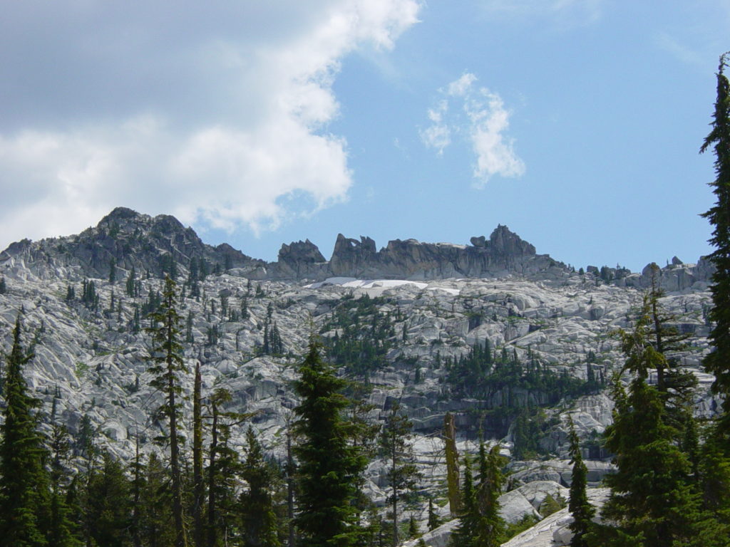
Despite our relocation, the weather hadn’t budged. The majority of the Fitz Roy massif was still hiding deep in the clouds above. There is a certain feeling that comes from camping below such a massive mountain. It is a humble feeling. A feeling that you are truly in the shadow of a giant. We decided to stay put for a couple of days, hoping that we might catch a glimpse of Fitz Roy if the weather broke. That break came at 7 AM the next morning and lasted only an hour. We slept right through it and only heard about our misfortune from our neighbors that had been up early to do the hike to Laguna de los Tres. We decided to spend the day kicking around camp and waiting for another break in the weather. By 3 PM, the sky was still dark gray and we decided that it was now or never. We threw together our day packs and headed out across the Rio Blanco to Laguna de los Tres. At least the difficultly of the trail didn’t come as a surprise. We could see it from our camp, carving a scar straight up the hillside below Fitz Roy. The hike was tough and snow was beginning to fall, but our packs were light and we made pretty good time. Laguna de los Tres was more like Ice Cube de los Tres. It was totally frozen over and we still had no view of Fitz Roy. We decided to descend the moraine to the edge of the lake and hike around the side. What we found was quite a treat. We had an amazing view of Glaciar Sucia and Lago Sucia directly below us. These two had been hidden to us until now. The color of Lago Sucia was hard to believe. We took several pictures before deciding it was time to descend. During the hike back down, the snow started to fall even harder and we got back to camp just in time.

One More Sunrise

We planned to hike out to El Chalten the next day, so our last chance for a view and pictures of Fitz Roy was the next morning. Up at 4:30, I left Jody in the tent and made my way in the bitter cold to a clearing where I was able to frame the morning light against the clouds lifting from Fitz Roy. Finally – it’s about damn time! Four days of waiting to take these pictures and after shooting my first roll, what do I do? I have the mother of all brain-farts and open the back of my camera before rewinding the film. Doh! Through some act of Divine intervention, I only ruined three frames.

The hike back to El Chalten was pleasant, with a nice side trip to Laguna Capri. This area would make a great campsite for a future trip. We descended into town and setup camp at the free Madsen campground. After ditching our packs, we made the walk into town for some food and some beers. At one point, we were looking to burn some time and the weather turned on us. We found ourselves in a little bakery where we were able to buy a bag full of delicious pastries and a couple of Cokes for about $2. The gastronomical safari continues! After a big pizza dinner, we crawled into our tent and got some much needed rest.

Our Last Night in the Tent

At some point during the night, it began to rainhard. Sheets of rain, driving wind, all of that good stuff. Our bus was rolling out of town at 6:30 AM, so when our alarm went off at 5:30, we knew we had our work cut out for us. I have to say that I was pretty damn impressed with our skills. We were able to get dressed, pack our packs and then take down the tent from the inside out, all in about 30 minutes. Taking down the tent from the inside out allowed us to keep the fly up while we packed the rest of the tent. At the last minute, we took down the fly and hit the road. It worked like a charm and we stayed relatively dry considering the torrent outside. Another dusty ride back to El Calafate passed and we checked back into Hospedaje Sir Thomas. All of the Christmas gifts we had bought for family and friends on the first swing through town were waiting for us. We were able to enjoy another day of shopping and the incredible dinner at Sancho that I mentioned above. Of course we also had a few more ice cream cones and some random chocolate treats to get our fill before heading back to Chile the next day.

The day we left San Francisco, we had a general idea of where we wanted to go, but no set itinerary. As the trip went on, our plan became more well defined and we had laid out the rest of our days in a very clear order. From El Calafate, we did a marathon bus trip back to Punta Arenas, with a 1 hour stop in Puerto Natales. It was a boring day, with few highlights, but it got us back into Punta Arenas with enough time to schedule a trip to the penguin colony the next day. Arriving in town without a hotel reservation made our first hour kind of interesting. The first place we tried had only a mediocre room with two beds and the price changed depending on who we talked to – it seemed a bit shifty to us. We kept looking and before long found ourselves at the Hotel Mercurio – the same place we had spent our first night. They only had a room for one night and we would need two, so we kept looking and soon realized that we might be camping with the dogs in the town square if we didn’t find something soon. Eventually we realized that we would have to move hotels after the first night.

Penguins, Penguins, Everywhere

Our trip to Isla Magdalena didn’t leave until 4 PM the next day, so we had most of the day to wander about in Punta Arenas and continue our Christmas shopping spree. That afternoon, we made our way over to the dock where our boat picked us up for the trip. It was exciting to be taking a trip on the Straights of Magellan – as far as famous waterways goes, this one is up there. To one side, we could see the South American mainland and to the other was Tierra del Fuego, the island that represents the terminus of the continent, with Cape Horn at its end. The massive ship we were on eased its way toward Isla Magdalena at glacial speed. With giant sea birds circling overhead in the overcast sky, the midnight black water had an ominous look to it.

Before we got to the island, I wasn’t really sure what we were in for. When you have a chance to see penguins in their natural environment, you go see penguins. It beats the hell out of the zoo. Several options for touring penguin colonies existed and the boat trip to Isla Magdellena seemed like the best option, not to mention quite a bit more interesting than another bus ride. Isla Magdellena is actually a national preserve and is managed by park rangers. All of that being said, I didn’t know if we were going to spend our hour on the island searching high and low for the 3 or 4 penguins that decided to show up this year. Our first view of the beach put any such concerns to an end. There were hundreds of penguins on the beach alone. As we began to hike along the trail, we soon realized that there were probably tens of thousands of penguins on this one island. These Magellenic Penguins are on the smaller side, at 16 – 18″ tall. Their visit to Isla Magdellena is part of their natural migration pattern. It is primarily a breeding ground for them. The entire island was covered with thousands of “nests” that were essentially holes burrowed into the hillside. Every nest had a curious penguin or two that would poke its head out to see what all the fuss was about. It was an interesting time to be there because we really saw the entire spectrum of their mating process. From the loud, honking mating calls, to mating pairs that already had one or two chicks in their nest, we really saw a bit of everything.

Goodbye Patagona, Hello Santiago

The next day, we sadly brought the Patagonian portion of our trip to a close and boarded a plane bound for Santiago. We had one night and all of the following day to explore Santiago, before our red-eye flight back to Miami. The friendly, but drunk, gentleman on the plane from Punta Arenas gave us some tips on where to eat and what to do while we were in Santiago. We stayed at a nice hotel (Hotel Eurotel) in the Providencia area of town. It wasn’t long before we found ourselves in the thoroughly “gringofied” section of town where the dining and partying options looked like something you might find in Orlando. Much too hungry to care, we settled on a place for dinner and washed down our food with about 5 Pisco Sours each. We stumbled back to the hotel that night and found that 10 AM came way too fast. After checking out and leaving our bags with the bell hop, we set out to do more shopping of course. When we finally decided that we really couldn’t haul any more loot home, we stopped by the tourist information office and asked what we should do for our last 4 hours in Santiago. We were directed to the large municipal park in the city center (think Central Park or Golden Gate Park). The park was a great way to spend a warm, sunny day. We bought a ticket for the Funicular and took a ride up the mountain where we gained a great view of the entire city. From the Funicular, we continued our tour of odd transportation systems and jumped aboard the sky tram that whizzed us across the park, 80 feet above the ground. We got off halfway to have some ice cream before proceeding to the end of the line. By now, we were only a few blocks from our hotel and we grabbed dinner on our walk back.

Going Back to Cali

The flights back home were pretty uneventful, but they sure were comfortable. We had empty flights the whole way and scored an exit row for the Santiago to Miami leg of the trip. Back on US soil – almost. There was a bit of a hangup coming through customs when they tried to figure out why a shoe box covered in duct tape with a rope handle strapped to it weighed about 15 pounds. Because we had 13 jars of El Calafate berry jam inside, of course. That box full of jam had traveled halfway around the world to serve as stocking stuffers for our family and we weren’t going to leave it behind. The agricultural inspector eventually gave it a thumbs up and taped the box closed with some “USDA INSPECTED” tape. We thought it was a nice touch.

One last flight and we were back in San Francisco. It brought to a close an incredible trip – one that was far beyond any expectations we had. We both had an amazing time and think that a return trip is inevitable. Few places in the world have such a raw, but beautiful setting. The trip was also full of firsts and personal records for us. Among other things, it was the longest backpacking trip we’ve done, the first international backpacking trip we’ve done, the first South American trip we’ve done, the first ice bergs we’ve seen, the first Condors we’ve seen, the longest distance we’ve ever hiked at once, the best steak we’ve ever had, the first wild penguins we’ve ever seen, and far and away the craziest weather we have ever experienced. Patagonia is a place that burns its image in your memory, and we know our trip will not soon be forgotten.

This post is part of the SierraSoul Archive. The trip took place in November, 2003 (or thereabouts).

Filed Under: sierrasoul Tagged With: adventure log, trip report

Trip Report: White Mountain, 14,246′

October 31, 2003 by matt Leave a Comment

It was a long weekend. Tough, awesome, and long. I was determined to get one of the mountains on my California 14er challenge out of the way this year. Other trips and conflicting schedules pushed our window of opportunity out to mid-October. By any measure, White Mountain is the easiest 14,000′ mountain in the state to climb. Using the word climb is a misnomer. Gaining the summit of White Mountain requires no more technical skills than one would need during a day hike at the local state park. In its defense, it is 14 miles round trip and tops out well above 14,000′. So it may be a day hike, but it is certainly not your average day hike.

White Mountain is not only of interest to hikers and climbers, but to scientists as well. The University of California manages several facilities on White Mountain for use in high altitude research, including a small lab on the summit. Because of this lab, there is a rocky, dirt road that winds its was all the way up the mountain. This makes route finding idiot-proof. The hike generally takes a direct route to the summit, with the most noticeable elevation gain occurring during the final 2 miles, in series of seemingly endless switchbacks. Considering the height of its trailhead, White Mountain sees more than its fair share of climbers with AMS (Acute Mountain Sickness, aka Altitude Sickness). In less than 35 miles, visitors are whisked up from the Owens Valley (elevation 4,000′) to the Barcroft Gate trailhead at nearly 12,000′. Since we were going to try this in one whirlwind weekend, we wanted to make good use of our time.

Jody and I left San Francisco on Friday evening with a stockpile of gear and food and headed out to Eileen’s house in the Valley. We got to bed relatively early and were out the door before 7:00 on Saturday morning. From Eileen’s, we headed to Tuolumne Meadows in Yosemite for a day of playing up high. We didn’t do much – just hiked around a bit and generally enjoyed a relaxing day in a nearly empty park. More importantly, we were trying to squeeze as much acclimatization in as possible. Early in the afternoon, we got back in the car and went over Tioga Pass and then headed south to Big Pine. From there we picked up 168 and started going up. The last 17 miles of road to the trailhead are all dirt and all very rough. We heeded the numerous warnings about this road and took it very slow, not wanting to repeat the flat tire episode from our Trinity Alps trip.

We arrived at the trailhead relatively unscathed and setup camp while we still had available light. We saw a couple of orphaned climbers who were left behind to suffer in their AMS-induced stupor as the rest of their party did the climb. Moaning, vomiting, and staring off into space didn’t look like much fun to us, so we agreed to keep ourselves on close watch the next day as we made our own attempt. We had friendly neighbors at the trailhead camp and traded chocolate for tacos as the light grew dim and the wind picked up. It was a pretty cold night and a bit restless as well.

We rolled out of bed and broke down camp at 5:00 AM. On the trail by 5:30, we hiked the first few miles in the dark, with just a bit of moonlight to illuminate the road. After two miles, we reached the Barcroft Lab and both felt good enough to keep going. A few steep switchbacks led us up to the observatory just as the sun was rising; offering up some of the most surreal light I’ve ever seen. We took a few pictures and kept moving. We trudged along at a slow, but steady pace, forcing ourselves to eat and drink as often as we could. Despite the thin air, we both felt pretty good.

From the observatory, the road descended and cut a long, but direct, route across the arid landscape; up to a plateau near the 13,000′ mark. At this point, the wind was blowing hard, but the summit was in plain view. Another unfortunate descent took us to the base of the switchbacks where we began the long, arduous task of trudging up the rocky road. As we climbed up, everything seemed to slow down. Not only did our pace slow down, but everything around us had a slightly dull quality. I’m sure it was just a bit of hypoxia, but it was kind of a cool feeling.

About a half mile from the top, with the summit hut in plain view, I looked up to see a pack of Bighorn Sheep cruising down a rocky ridgeline a few hundred feet away. Just a few minutes later, we came across a lone ram, intently checking us out and walking within 50 feet of us. We were totally amazed. That was by far the coolest wildlife sighting we’ve ever had. A bit stupefied by what we just saw, we kept moving and reached the summit a few minutes later. It was 10 AM and we had been hiking for four and a half hours. To our surprise, we were the first to sign the summit log that day. A few minutes after we arrived, one of our neighbors from the trailhead camp cruised to the top – he had done the hike in only 3 hours. After taking some pictures and eating a bit of food, we took one last look at the amazing view of the Sierra crest and began our hike down.

The descent was pretty uneventful – just a long slog back to the car. It never did warm up much – I kept my jacket and hat on all day. I would not want to do this hike on a warm day. There isn’t an ounce of shade on the entire route. It was a windy, chilly day for us, and that was just perfect. During the hike down we got a better look at the landscape. The high desert environment of White Mountain is beautiful in a harsh, caustic sort of way. There is very little plant life to speak of and only a few animals here and there. The scenery has a lunar quality to it.

We arrived at the car in the early afternoon and got going as soon as we could. The nasty dirt road was just as nasty on the way out. We took our time again and suffered no casualties. From Bishop, we had another 6 – 7 hours of driving ahead of us, the only highlight of which was a great dinner at the Whoa Nelly Deli in Lee Vining. Back to San Francisco just after midnight, we brought to a close a very exciting and very tiring weekend.

This post is part of the SierraSoul Archive. The trip took place in October, 2003 (or thereabouts).

Filed Under: sierrasoul Tagged With: adventure log, trip report

Ride Report: Tahoe Sierra Century 2003

September 30, 2003 by matt Leave a Comment

In February of 2002, I suffered an unfortunate accident while skiing at Alta, Utah. Actually, “skiing” might not be the right word – walking on the deck of the lodge would be more accurate. I slipped on ice, I fell hard, I dislocated my kneecap (sublexed my patella). What it lacked in glory, it made up for in monumental pain. It brought my ski season to a screeching halt. While no surgery was required, my sofa-bound approach to rehab left me with a seriously weakened right leg and head start on a sedentary lifestyle. After four months of doing nothing, I decided that if I didn’t start building my legs back up soon, next year’s ski season was in peril too.

In June, I pulled out my dusty steed and began by doing a short, 8-mile ride through Golden Gate Park three times a week. It felt great to be active again, but after a couple of months, I decided that my training needed some direction. I signed up for a three month stint with Carmichael Training Systems. While I wasn’t always impressed with the attention given by my coach, I did like the program she setup for me. For the rest of the fall, I was riding longer distances and getting out 4 times per week. By the time the ski season rolled around, my knee was still not 100%, but it was good enough to enjoy 12 days on the mountain.

My goal to start riding again in April came and went and it was June by the time I started a new program with CTS. This time I decided that I needed a more concrete goal. Getting in shape and strengthening my leg is a fine goal, but it’s a bit nebulous and not easily defined. I decided that I would try to complete a century ride by the end of the season. It was a big goal for me – much farther than I had ever ridden before. But I knew plenty of people that had done them and I like the non-competitive nature of these rides. I worked with a new coach at CTS this year and was very happy with the attention and dedication they had to my program. All of my questions were answered and they really tried to fit a program around my goal. Choosing a ride was difficult. It needed to be late in the season to allow for ample training time and I really wanted something in Northern California. After talking my friend Shannon into joining me, we decided on the Tahoe Sierra Century.

The Ride

To be honest, the ride intimidated us a little bit. After putting in 1,300 training miles over the summer, the distance wasn’t really the problem. It was the amount of climbing that had both Shannon and I worried. 5,500 feet of climbing was spread out over 4 major climbs. And the entire route was above 6,000 feet. We both tried to include as much climbing as possible into our training regimen, which helped enormously.

Shannon, Jody, and I drove up to Truckee the night before the race. Work schedules and last minute details en route had us checking into the Holiday Inn Express at about midnight. This wasn’t an ideal bedtime the night before a big ride. 5:30 A.M. came very soon and we stumbled through the motions of getting ready. The start time for the ride was listed as 7:00 to 8:00 A.M. Knowing that we had a big day ahead of us, Shannon and I wanted to get on the course as early as possible. We were among the first to arrive at the start area at Squaw Valley. It was still dark outside. After checking in and receiving our shwag bags, we grabbed our bikes and started to get ready. The guy next to us in the parking lot, a Chicago transplant named Don, was a first timer as well.

At 7:15, Shannon, Don, and I set off into the bitter cold to get this thing underway. The first section of the ride took us out to Highway 89 and south through the Truckee River Canyon toward Lake Tahoe. The sun was still hiding behind the steep walls of the canyon and the bitter morning air brought with it numb fingers and lethargic legs. The sight of Lake Tahoe was welcome, as it meant that we were out of the dark and could finally start warming up. The route veered east around the north shore of the lake and within a few miles, we were already at the Carnelian Bay rest stop. We were all very impressed with the spread of fruit, baked good, and assorted drinks that were available to us. After quickly fueling up, we got back on our bikes and headed off towards the first big climb of the day.

According to local lore, Greg Lemond holds the record for this climb at 14.5 minutes. Our time was somewhere north of that.

When we reached Kings Beach, the route headed north on Highway 267, towards Brockway Summit. The first climb of the day came and went without much fanfare. It was tough, but totally doable. Sometime during the climb, our new friend Don decided we were slowpokes and he sped off in the distance. Despite Don’s desertion, finishing this ride was beginning to look like a more of a reality. A long, fast descent down the backside of Brockway took us past Northstar and into Truckee. We skirted around the perimeter of the city and headed into the hills north of town. We took our time at the second rest stop, knowing that the toughest climb of the day was on the horizon. Again, we were greeted with smiling faces and a well stocked rest area. This was a great ride

The second climb of the day was absolutely punishing. From the second rest stop, we headed back towards Tahoe Donner and began a step ascent up Alder Creek Road. The suffering took a turn for the worse as we merged onto Ski Slope Way and got our asses thoroughly kicked by an obnoxiously steep residential street that just kept going. After some heaving and whimpering, we topped out at 7,350′. We were toast and were only forty-something miles into the ride. A mercifully long descent led us through Truckee and around Donner Lake to the third rest stop of the day.

About this time, Shannon and I realized that we were definitely bringing up the rear of the pack. That was OK by us, but we decided to get a move on to the lunch stop before too long. The 3-mile climb up Donner Pass road was tough. The sun was high in the sky and the grade didn’t relent. Switchback after switchback led us up what was arguably the most scenic, but also one of the toughest sections of the ride. According to local lore, Greg Lemond holds the record for this climb at 14.5 minutes. Our time was somewhere north of that. After cresting Donner Pass, we began the 12 mile descent past Sugar Bowl and Soda Springs. Roughly following Interstate 80, we made our way down Donner Pass road to the turnaround at Cisco Grove and the nearby lunch stop. The 14 year old girl fixing sandwiches at the lunch stop looked a me sideways when I asked for a peanut butter and cheese sandwich, but she made it for me nonetheless.

Shannon and I muscled down our lunch and reluctantly headed back onto the course. We had an easy, but long 12 mile climb ahead of us before we were in the home stretch. My body was beginning to feel the effects of the ride and soon my back started cramping really bad. I couldn’t take deep breaths without the muscles in my upper-mid back spasming, squeezing the breath out of me in a cruel cycle of suffering. I thank Shannon for her patience on this portion of the ride as we inched our way back up Donner Pass, leapfrogging another pair of riders that were also having a tough go of it. By the time we reached the top of the pass, we were among the last 25 riders still on the course. Thankfully, we only had 20 miles to go and it was all pretty easy.

A fast descent back to the Donner Lake rest area and a quick refueling got us back on the course without much delay. The final 15 miles of the course was like a race to get it over with. Riding through Truckee and back down Highway 89, we kept an average speed somewhere around 17 MPH, despite the slight incline. We just wanted to be done. Soon enough, we found ourselves turning right onto the Squaw Valley access road for the final 2 miles of the day. We rolled in nice and easy and smiled from ear to ear as we finished our first century. But wait! We were done with the ride, but my bike computer was only registering 99.8 miles! There is no chance I’m going to do a century and not see that third digit on my bike computer turn over. A quick lap around the parking lot solved that problem and we headed to the van for some well deserved rest. Total ride time – 7 hours, 45 minutes. Total time on the course – a skoach over 10 hours. Umm, we took a lot of breaks.

A pile of pasta, a few slices of pizza, and good beer brought some life back into my body. Both Shannon and I were very impressed with the overall quality of the ride. It was well organized, well supported, and the route was absolutely beautiful. It probably wasn’t the best choice for our first century, given the challenges of the route, but that made finishing it that much sweeter. Time to start training for next year.

This post is part of the SierraSoul Archive. The ride took place in September, 2003 (or thereabouts).

Filed Under: sierrasoul Tagged With: adventure log, trip report

Trip Report: Trinity Alps, Caribou Lakes

August 31, 2003 by matt Leave a Comment

Labor Day weekend. The symbolic end of summer. The last three day weekend to get outside and enjoy the summertime sun. For us, it was an opportunity to explore new terrain and tune up in preparation for our Patagonia trip. The Trinity Alps was our destination and we were excited to see something new. Located in between Interstate 5 and Highway 101, northwest of Redding, the Trinity Alps Wilderness is a rugged, beautiful, and less crowded alternative to the Sierra. Our plan was a 3 day, 2 night romp through the Caribou Basin area.

Looking to avoid holiday traffic and trailhead crowds, we opted for an alpine start to our weekend, leaving San Francisco at 2 AM on Saturday morning. With minimal traffic, we reached Redding in a little over 3 hours. After filling up on $2/gal ARCO gas (love it), we headed west on 299 and made it through Weaverville just as the sun was rising. Another 40 miles north on Highway 4, put us at the Coffee Creek ranger station where we picked up a Wilderness Permit. The trailhead is only about 20 miles from the ranger station on Coffee Creek road, but 15 of those 20 miles are unpaved and a bit rowdy in a little Subaru.

There were a lot of cars at the trailhead and we encountered several groups along the trail to Caribou Lake. The route to Caribou Lake has two versions – the shorter, steeper Old Caribou Trail, or the longer, flatter New Caribou Trail. After driving all night we opted for the New Caribou Trail, which still had plenty of climbing to keep it interesting. The trail was long and a bit rugged in spots, but after 5 hours of hiking we saw the dark, blue waters of Caribou Lake below us. Of the three lakes in the area (Caribou, Lower Caribou, and Snowslide), Snowslide Lake is the first one you reach. Tired and thirsty, we dropped our packs at the first site we came to and decided it would be just fine for the evening. After pumping some water and setting up camp, we actually realized that we had scored a great site. It was large, shady, near the water (but not too close), and had a great big granite slab that we could use to cook and spread out our gear.

The rest of the day was spent taking naps, taking pictures, and tending to blistered feet. A delicious chicken fajita dinner and excellent lakeside views made the decision to stay put a simple one. Originally, we had entertained the idea of hiking over Caribou Mountain and off-trail to Little Caribou Lake. But we were quite happy right where we were and neither of us fancied the idea of doing a hard hike the next day. Instead we got some rest and spent Sunday exploring the area. We hiked up to Caribou Lake and spent the day swimming and relaxing in the sun. The area around Caribou Lake proper is beautiful, with small waterfalls and “gardens” and incredible views of Sawtooth Ridge.

Another relaxing night gave way to an early morning departure back to the trailhead. Our goal to put the worst of the climbing behind us before the sun beat down paid off, and we made good time back to the car. We reached the car a little bit before noon and headed back towards Redding. About two or three miles down the dirt road from the trailhead, the left rear tire on the Subaru decided to go flat. We still had about 10-12 miles of dirt road and 80+ miles to Redding. After swapping out the tire for a donut-sized spare, we gingerly eased down the road and made it to Redding at 4:30. It was 107 degrees. Finding a place to buy tires in Redding at 4:30 on Labor Day can be quite a challenge. Les Scwabb was closed. Costco was closed. The good people at Kragen’s offered us a bit of advice – Wal*Mart. Now, I basically hate Wal*Mart and everything that they stand for, but I was pretty damn excited to see the greasy faces at the Express Lube and Tire center that day. The abhorrent business and labor practices of Wal*Mart came through in a pinch. While the tires were being installed, we found a Red Robin and asked the hostess to seat us as far from everyone else as possible, lest we offend them with our surly odor. After 2 hours (about an hour longer than you ever want to spend in Redding on an August afternoon), we had full stomachs and a pair of the finest Goodyears that Sam Walton had in stock. A friend later told me, “Anytime you get to hike 20 miles, sleep outside, and deal with Redding locals all in one weekend, I think adventure goes without saying.” I would have to agree.

This post is part of the SierraSoul Archive. The trip took place in August, 2003 (or thereabouts).

Filed Under: sierrasoul Tagged With: adventure log, trip report

Trip Report: Sabrina Basin, Blue Lake

July 31, 2003 by matt Leave a Comment

I love DEET. It took a weekend trip to the Sabrina Basin for me to realize this point. After receiving an undisputed ass whoopin’ at the hand of 5 billion hungry mosquitoes, I began to embrace the miracle that is N,N-diethyl-m toluamide, in all of its stinky, nasty, plastic-melting, carcinogenic splendor and glory. During our trip over the July 4th weekend, we also learned a critical lesson in the use of DEET-based insect repellants. For the repellent to work effectively, you must bring enough to last the entire weekend. It is a simple, but important bit o’ wisdom that eluded us during our preparation for the trip. Half of a bottle seemed like it would be fine. We were wrong. A point made abundantly clear to us by the swarms that awaited our arrival.

So far, I’m making this trip sound much worse than it actually was. Itching and scratching aside, we actually had a great time. Our original plan was to arrive at the Sabrina Lake trailhead early, after driving through the night and picking up our permit in Bishop. Once on the trail, we were going to hike up to Blue Lake and spend the first night there. The next day, we would proceed to Hungry Packer Lake and set up camp before exploring the area and possibly hiking up to Echo Lake. On Sunday, we would hike out to the car and head home.

We left San Francisco at midnight on Thursday night. In an odd twist on the norm, Matt did most of the driving, and we made it over Tioga Pass and through Lee Vining just as the sun was painting the sky brilliant shades of deep blue and orange. Expecting high temps and a lot of people, we wasted no time getting to the trailhead and heading out. The elevation of the Sabrina Lake trailhead is 9,000 feet, so you find out very fast if you are in shape or not. We took it slow and found the hike to Blue Lake to be a bit shorter than we had originally thought. The distance indicated on the map was 4.6 miles, but I have a tough time believing that it was much more than 3.5.

After arriving at the lake, we promptly lost the trail and made a sketchy downclimb and stream crossing to get us headed back in the right direction. We were thankful to find a nice campsite amongst the granite boulders that surrounded the western shore of the lake. It was barely 11AM when we arrived, so after setting up camp and scouting out our surroundings, we settled down for a well-deserved nap. Two hours and twenty degrees later, we woke up sweaty and groggy. I was determined to cool off and Blue Lake was looking very inviting. Taking a look at the snow capped peaks that surrounded us, Jody concluded that I was nuts and she decided to watch from shore as I made my bid for membership to the High Sierra Chapter of the Polar Bear Club. It probably took me 10 minutes to get myself all the way into the water. I don’t know what the temperature of the lake was, but I’ve been in Tahoe quite a bit and it felt about 10 degrees colder than that. There’s something a bit surreal about dancing on the fringes of hypothermia when it’s 80 degrees outside. I made a quick lap out to the island in the middle of the lake and headed back to shore before I froze solid.

Fisticuffs nearly ensued during a pre-dinner nap when a curious squirrel tagged Jody on the head to see if she wanted to play. Jody was less than amused. As it was the 4th of July, we had a special dinner of Hotdogs and Potato Salad. We ate a couple of candy bars for desert and spent the rest of the evening taking pictures of the lake and mountains around us. As the light faded, we came under heavy attack from the mosquitoes and were eaten alive by the little bastards. We were using the bug spray sparingly because we realized that our 6 oz bottle of Cutter Backwoods wasn’t going to last the entire weekend. We would be lucky if it made it through the next morning. That night we made the decision to head out a day early and spend our extra day exploring Mono Lake or the Ancient Bristlecone Pine Forest.

There’s something a bit surreal about dancing on the fringes of hypothermia when it’s 80 degrees outside.

The next morning we packed up camp and made our way down to the car. The heat was getting to us and we took our time hiking down. Once in Bishop, we stopped for lunch at a BBQ place and decided to check out Galen Rowell’s Mountain Light Gallery, which was right across the street. I knew his gallery was in Bishop and I had always wanted to check it out. It looked like our decision to bail was going to have some upside after all. The gallery was incredible and we probably spent an hour and a half taking it all in. As someone who is just beginning to get into nature photography, it was a special treat to view so much of his work up close. I have been reading a few of his books and some of his archived columns on the Outdoor Photographer website. I really appreciate his approach to photography which combines a strong scientific understanding of light and the natural world with the vision of an artist.

After the gallery, we paid a visit to the White Mountain Ranger Station and came to the conclusion that it was going to be too hot and crowded to enjoy the Ancient Bristlecone Pine Forest. Before leaving Bishop we made one last stop at Vons to buy the biggest can of DEET we could find. Muskol 40 % DEET bug spray – it’s a beautiful (and totally disgusting) thing. We got back in the car and headed north to Lee Vining and the Tioga Gas Mart. This is one of the weirdest places I’ve ever been. Aside from being a very large gas station with a sizeable store inside, it has to be the only gas station in the High Sierra with a trapeze on the front lawn. And while all of that is well and good, the truly magnificent part of the Tioga Gas Mart is Tioga Toomey’s Whoa Nellie Deli. For the uninitiated, this is the single greatest gas station restaurant in the U.S. Having toured this great land by converted school bus just a few years ago, I can make this statement with the confidence of a person that has eaten more than his fair share of gas station meals. This was our second time visiting and we were totally impressed once again. How many gas stations serve Grilled Salmon Salad and Herb Crusted Pork Tenderloin? Not many! If you are ever driving through Lee Vining and are hungry for a great meal, do not pass this place up. If you are driving through Lee Vining and aren’t hungry, stop anyway and sit there until the faintest notion of hunger crosses your mind. It is located on highway 120 West, at the intersection with Highway 395.

With full stomachs and a few hours to kill before picture taking time at Mono Lake, we headed over to June Lake for a little R&R. After we cooled down and knocked the dust off with a good swim, we got back in the car and began looking for an alternate approach to the South Tufa area of Mono Lake. A ranger at the Mono Basin Ranger Station had suggested a different route that would give us a good view of the largest tufa formations without the crowds that can be found at the designated South Tufa viewing area. We found the dirt road the ranger was talking about and promptly put Jody’s off road driving skills to the test as we turned off down one of the side roads that leads directly to the lake’s edge. Ignoring the warning signs that clearly indicated loose sand, we continued down the road until we realized that dodging sage brush and fish-tailing through sand berms was a bit more than the Subaru was built for. On the way back we came very close to being stuck several times as we spun our way through some very deep sand. I kept telling Jody she was doing great with the driving and she kept pretending to believe me. I was absolutely convinced that we were going to have to be pulled out by a truck. But as a testament to her driving skills and my bullshit skills, we made our way back out to the main road without serious incident.

A few miles down the road, we found a good spot to stop and spent the better part of an hour taking pictures of the tufa formations as the sun set behind us. It was dark by the time we left the lake and we had no idea if our “secret” campsite near Crooked Meadow would be available. We found this campsite a year earlier when our spur of the moment Labor Day plans landed us at Mono Lake without campground reservations. It has a long and dusty approach, but the upside is huge. The Subaru redeemed itself along the bumpy, dirt roads leading to the campsite and we were happy to find that we had the place to ourselves. A good night’s sleep refreshed us and breakfast at Tioga Toomey’s put a smile on our face before a long drive home. It was not the trip we planned, but it was definitely one worth remembering.

This post is part of the SierraSoul Archive. The trip took place in July, 2003 (or thereabouts).

Filed Under: sierrasoul Tagged With: adventure log, trip report

Trip Report: Channel Islands Proposal – Matt’s Version

May 31, 2003 by matt 1 Comment

As our boat pulled away from the dock in Ventura Harbor, I ran through a mental checklist of big-ticket items for this trip.

Backpack – check.

Camera bag – check.

Diamond engagement ring – check.

Stove fuel…wait, what ever happened to the stove fuel?

And so it came to pass, that on the weekend of our engagement, in the picturesque Channel Islands, I would absent-mindedly subject us to three days and two nights of cold meals. I could hardly be blamed. I had more important things on my mind. Like how I was going to pull off a romantic marriage proposal in the company of 60 spastic Boy Scouts and their various handlers. I crossed my fingers and called upon the powers of all that is good and fair in the universe, hoping they would be let off at the first stop – fifteen miles and one big ridgeline away from where we planned to start our trip.

Despite the overcast skies, Someone was smiling down on me. When we arrived at Scorpion Bay, 110 of the 120 passengers on board, including every last one of the Scouts, got off the boat, carrying with them enough gear to mount a three-month Himalayan expedition. Jody and I watched with amusement as the crew begrudgingly unloaded the stockpile of crap the Scouts had toted aboard. Before long, we pulled away from the dock and headed around the eastern flank of Santa Cruz Island, passing Chinese Harbor and Coche Point; landmarks that would, for several reasons, be burned into our collective memories for years to come. En route from Ventura we had already passed various seals and sea lions, a friendly humpback whale, and a group of dolphins so large they gave life to the rather placid morning waters of the Santa Barbara Channel. The trip had all the markings of an epic, by our standards at least.

Backpacking on the Channel Islands presents a unique challenge. In a cruel twist of irony, there is no water in the backcountry. Despite the lush hillsides, most of the creeks and seasonal springs are dry by late May. We knew this in advance and had planned accordingly. For the first two days of our trip, until we reached Scorpion Bay, we would need to haul every drop of water we might need. This translated into about 5 gallons, to be on the safe side. After loading two 6-liter water tanks into my pack, I effectively added about 25 pounds to the load I normally carry. Throw in a bottle of Champagne and a full camera bag plus tripod and I was looking at the heaviest pack I had ever hauled.

We arrived at Prisoner’s Harbor and were surprised to learn that only one other couple was heading to the same campsite we were. During our “orientation” by an NPS ranger, he encouraged us to hike the dirt road all the way to the campsite, avoiding the overgrown but more direct Del Norte trail. After a mile of slogging up a steep and none-too-interesting dirt road, we arrived at the intersection where the Del Norte trail veered off. We dropped our packs, caught our breath, and settled down for lunch.

While we munched away on our sandwiches, I pulled out the map and decided to review our route options myself. Ranger Dave had been pretty clear about his recommendation. I also noticed that, when discussing ticks on the island, he indicated a counterclockwise turn was the best method for removing the little buggers. Since any backpacker worth their salt knows that pulling a tick straight out is the approved method of the hour, I took this as a clear indication that he didn’t know shit and couldn’t be trusted. In hindsight, this might have been an ill-advised leap in logic. One thing lacking from my arsenal of map reading skills is an attention to the little things – the small details. For instance, when I saw that the Del Norte trail was shorter and more direct than taking the dirt road, what I should have noticed is that it crossed through two substantial drainages en route, forcing us down and back up very steep and rocky sections of trail. During the next 2.5 miles, I was very aware that getting us stuck deep in the brush of some overgrown canyon wouldn’t bode well for my impending proposal. Channeling Sacagawea, I led us through the overgrown muck and we arrived at the Del Norte campsite in one piece.

Channeling Sacagawea, I led us through the overgrown muck and we arrived at the Del Norte campsite in one piece.

The other couple had taken the recommended route and beat us to the campground, staking claim to the only decent site; a grassy little number under a shady oak. We trampled about in search of the other “sites” and settled on the only other level spot we could find, deep in a thicket of fennel and thistles. Neither of us had been blessed with any more than two hours of sleep in the past day and a half. After six hours of driving, two hours of boating, and three hours of hiking, we were a bit punchy and the only thing on our minds was taking a hard-earned nap. My master plan was to wake up before sunset and suggest a hike to a spot where we might take pictures while the light was good.

We rose from our long nap feeling refreshed. Before departing for our photo safari, I checked for the forty-seventh time that day to be sure the ring was, in fact, stashed safely in the bottom of my camera bag. Hiking down the trail I began to wonder just how many guys had lured their girlfriends to a scenic spot under the guise of “taking some cool pictures.” It might not have been the most original idea, but Jody seemed pretty clueless about what was really happening. Several times, we stopped and Jody asked if the spot was good. I knew that our destination had to be more than just photogenic. It had to be proposal-worthy. It had to stand the test of time. It had to endure what I hoped would be countless retellings of “our story.” We pressed on. A mile down the road we came to a bend where the hillside dropped off and we were treated to an unobstructed view of Coche Point, the spot where Montanon Ridge finally yields to gravity and tumbles down to the Pacific.

As the sun inched toward the horizon behind us, the light grew warmer and we both started taking pictures. Waiting for the perfect moment, I pretended to be interested in what I was doing, bouncing from one spot to another, burning through an entire roll of thoroughly uninspired pictures. Just before the sun dipped below the horizon, as it set ablaze the clouds spilling down Coche Point, I set up my tripod and asked Jody to come over and take a look at my composition. As she peered through my camera, I took a knee and pulled out the ring. When Jody turned around, it took her a second to figure out what was going on. I’m not exactly sure what I said, but I took my sister’s advice and kept it short. I’m pretty sure the words “Will you marry me?” came out at some point, because Jody said “Yes” and we enjoyed a long hug and kiss on the top our mountain on our little island in the Pacific.

We snapped a couple of quick self-portraits and headed back to the campsite, drunk on love and tripping over our smiles. I was finally able to tell Jody about the past few weeks of shopping and planning and the reason why I couldn’t be blamed for leaving the stove fuel on the dock. With no hot meal in our future, we settled down at the picnic table near our site and enjoyed an engagement dinner that couldn’t have defined the moment any better – two Powerbars, half a salami sandwich, and a bottle of Champagne that I had snuck along for the trip.

The next morning, we took our time getting ready. Our excitement about the engagement was tempered by the day that lay ahead of us – eleven miles of hiking, some of it off-trail, to reach the Scorpion Bay campground. Mercifully, the weather was cool and the overcast skies gave us some reprieve from the Southern California sun. Despite the heavy loads and our sore hips, we settled into a nice pace. Our route took us past the previous night’s spot and pushed us up and down steep dirt roads as we headed east toward Montanon Ridge. The scale of the landscape took shape as we approached the ridgeline. Although they weren’t necessarily very tall (1500′), the proximity to the ocean below gave the mountains in front of us an impressive stature. I felt very small as the trail faded away and we were left to pick our route up the craggy flank of High Mount. A wrong turn a mile back had worn us down a bit and by the time we finally reached the ridgeline, we were ready for a break.

Jody took some pictures and I assessed our water situation. After topping off our Camelbacks and smaller water bottles, I realized that in less than two days, we were going to finish all 5 gallons we had brought along. Unfortunately, I never really noticed the weight missing from my pack. As my load had become lighter, my legs had also grown more tired, resulting in a disappointing net-zero effect.

We snapped a couple of quick self-portraits and headed back to the campsite, drunk on love and tripping over our smiles.

With only four miles to go, we began the slow descent to Scorpion Bay. Day hikers began to pass us going the opposite direction. The route was littered with golf-ball-sized rocks that caused us to stumble downhill in an awkward display of footwork. What we lacked in grace, we made up for in determination. The last four miles of the hike dragged on and on. By the time we reached Scorpion Bay, we were ready to crash. We found a great campsite in a eucalyptus grove and were happy to hear that the Boy Scouts had been isolated in the upper campground, secluded and contained at a safe distance. During my nap, Jody took a stroll and charmed her way into the good graces of a church group that was camping nearby. She informed them of our stove predicament and they graciously offered us some time on one of their stoves later that evening. During a yummy dinner of freeze-dried lasagna, we resumed our talks about wedding plans and how we were going to tell our family and friends.

A peaceful night under the stars gave way to a mellow morning. We explored the boundaries of laziness in earnest as the day passed by. Our 4 P.M. departure from the island gave us a chance to cruise the beach of Scorpion Bay and talk about our marriage and our wedding and all sorts of other mushy stuff. The time alone was relaxing and stood in stark contrast to the whirlwind that was sure to await us when we got home and told everyone about our weekend

The passage back to Ventura took a long time as our boat was half as big and the seas were twice as rough as two days prior. After powering down a couple of foot long sandwiches in record time, we got back on the road and made good use of the six-hour drive to San Francisco. Roaming charges be damned, we called all of our family and friends and spilled the beans about our weekend. Our calls were met with smiles and laughter and resounding approval. The fun of telling everyone our news made the drive home speed by. We pulled the car onto Lake Street a few minutes past midnight, bringing to a close the most memorable backpacking trip of our lives. WOO HOO! WE’RE GETTING MARRIED!

Read Jody’s version of this story.

This post is part of the SierraSoul Archive. The trip took place in May, 2003 (or thereabouts).

Filed Under: sierrasoul Tagged With: adventure log, trip report

Trip Report: Snow Camping at Carson Pass

March 31, 2003 by matt Leave a Comment

The winter of 2003 will go down in our history as the season of chilly nights. With season passes to Kirkwood and an itch to spend some nights outside, we convinced ourselves that snow camping near Carson Pass was the perfect way to get plenty of time at the ‘Wood and still get some backcountry nights under our belts early in the year. While I had some experience with snow camping, having spent 3 or 4 nights in snow caves on Mt. Hood, this was an entirely new experience for Jody.

Over the course of the winter, we spent 5 nights camped at two different spots near Carson Pass. Both areas are pretty popular destinations for cross-country skiers and snowshoers. Despite the popularity among day-trippers and the proximity to Highway 88, we never saw a soul out there past sunset. Since we were usually skiing on Saturdays, we wouldn’t leave Kirkwood until about 2:30 or 3:00. It was always fun to see the looks on people’s faces as we shouldered packs at 3:30 and headed away from the trailhead. Both of our regular camping spots were no more than ¾ of a mile from the trailhead, which made the hike in (and out the next morning) pretty fast. If we had more time, it would have been great to explore both areas more extensively and camp a bit further from the trailhead. But given the fact that we were usually skiing Saturday and Sunday, long hikes in and out weren’t really in the cards.

Each of our five nights was a very distinct experience and can be summed up with some easy titles. Below are some quick notes from my journal for each of our trips.

1/4/03 – The First Night

This was an eagerly anticipated night. We used the Megamid for the first time and tried to dig out a pit beneath it. The snowpack was not deep enough and we wound up with a funky floor plan that wasn’t very comfortable for either of us. We carried in minimal water with a plan of melting snow for cooking and drinking water. We soon realized just how long it takes to melt snow and bring it to a boil. For future trips we decided to haul in more water since our approach was so short. We realized this wouldn’t really be an option on longer trips. Overall, the trip was pretty successful. The temperature at night was on the warmer side and our sleeping bags did a fine job keeping us warm, despite the discomfort of our sleeping arrangement.

1/11/03 – The Windy Night

We returned to the same area, but found a new spot and decided to pitch the tent directly onto the snow after stomping out a platform. I experimented with burying the tent stakes, deadman style, in a bid to make the tent pitch a bit more secure. The inside of the tent has a ton of room when pitched directly on the ground. We decided that the pit wasn’t really necessary unless you were staying put for a few days and really needed a larger basecamp-style shelter. The extra time spent with the tent stakes was rather fortuitous, as the wind picked up and howled through our campsite all night long. Unlike a regular tent with a floor, the only thing keeping a Megamid from blowing away in high wind is the stakes. While the stakes may have kept the tent from blowing away, they did nothing to help with the spindrift that blew under the tent walls and covered us by morning. Overall, this was not the most comfortable night ever spent outside.

1/18/03 – The Full Moon Night

We returned to the same spot as before and proceeded to build a bombproof shelter, complete with securely anchored stakes and a windbreak around the perimeter of the tent, should the weather turn sour on us. We were applying learnings from our first two trips. This being our third trip, we had by now perfected the menu for a simple snow camping dinner: a big pot of Velveeta Shells & Cheese and some instant mashed potatoes with bacon bits. Snickers bars for desert. We had a beautiful full moon that night and enjoyed a long snowshoe walk around the meadow near our campsite before turning in for the night. The clear sky brought chilly temperatures and the mercury dropped to somewhere around 10 degrees overnight. Despite the cold, we both enjoyed the night and slept comfortably. However, the next morning, I was surprised to find that my contacts were frozen solid in their solution!

2/8/03 – The Really Cold Night

With three nights under our belts, we strutted out to the same spot as the previous two trips and promptly got our butts kicked. By the time we went to bed at 8 PM, it was 7 degrees outside. When we woke up the next morning at 7 AM, it was 0 degrees. Our best guess is that the overnight low was somewhere around -5 to -10 degrees. Most of the night was spent shivering away in our 20-degree bags, which, up to this point, had proven quite comfortable in most conditions. It was another uncomfortable night.

3/15/03 – The Best Night

We were pretty certain this would be the last snow camping trip of the year and I wanted some good pictures for our Fundamentals of Snow Camping guide. About 24 inches of fresh snow had fallen and we were disappointed to find that our regular trailhead had not yet been plowed. As such, there was nowhere to park our car. We turned around and headed back up the hill to a large Sno Park that had already been plowed. Although breaking trail in the fresh snow was tough, we were able to find a beautiful campsite within a short hike from the car. After setting up camp, we enjoyed the late daylight and spent some time taking pictures of the area. By our fifth night we had dialed in the best way to set up the Megamid and were feeling pretty well seasoned as snow campers. Our reward was a very comfortable and restful night before our last day at Kirkwood for the season.

An introductory guide to snow camping can be found here.

A guide for using the BD Megamid for snow camping can be found here.

Filed Under: sierrasoul Tagged With: adventure log, trip report

Trip Report: The Lost Coast, 2001

July 31, 2001 by matt Leave a Comment

Waaaay back in July of 2001, we decided to take a long weekend up to the Lost Coast. It sounds like some place out of a Hemingway novel, doesn’t it. It was our third backpacking trip together and we were getting incrementally bolder with our choices of venue each time. The Lost Coast is one of the most remote pieces of coastline in the US, certainly in California. I first heard of the Lost Coast from an article in the first issue of NG Adventure. Extensive information on the area is difficult to come by. I suppose the lack of information fits quite well with the moniker. Despite the mysterious name and elusive details, we were pleased to find out that the area is relatively tame. Most guides to the Lost Coast will describe the Lost Coast Trail which travels north from Shelter Cove (Black Sands Beach) to the mouth of the Mattole River. The trail is 24 miles in length and 3 to 4 days are recommended.

We didn’t really have a solid plan for our trip when we left. We knew we didn’t have the time to do the whole trail. Nor did we have a way to get back to our car after completing the trail (a bit more research might have solved this problem – see Destinations). So we decided to start at the mouth of the Mattole River and just hike around for a few days. We had two nights and three days to kill, but the drive to and from SF would take some time on either end. And take some time it did. I think we ballparked it at three to four hours prior to leaving. It took a solid six. I believe there are only three roads into the Lost Coast area and two of them are dirt roads. Jody’s Honda braved the roads like a champ and soon we realized that such a drive was well worth the effort.

After parking the car, we came across an information board at the trailhead that revealed a couple of key details. First, were surprised to find out that we were in bear country and canisters were strongly recommended. Somehow, we rationalized that if we stayed close to the beach our ursine friends would keep their distance. The logic we employed totally sucks, but we didn’t have any bear encounters just the same. We also found out that portions of the route are impassable at high tide. Thankfully, there were tide tables posted on the board and a quick study assured us that if we got moving soon, we could get past the key points before we got into any trouble.

I don’t remember if it was the bumpy roads or the Burger King breakfast, but for one reason or another, Jody wasn’t feeling very well once we got going. Never one to turn down an opportunity to loaf it, I agreed that taking it easy was just what the doctor ordered. We hit the trail, or beach as it were, and started chugging south. You’re not going to break any land speed records hiking in sand – a point we quickly realized. During the entire hike in, we were amazed at the number of seals and sea lions swimming near the breakers and lounging on the beach. The weather was pretty cooperative througout the trip. There were clouds about, but the temperature was comfortable enough for shorts and a shirt. The Lost Coast is notorious for the rain that pounds the area year round, but the worst we saw was some heavy fog and a stiff wind.

After a few miles, we came across the Punta Gorda lighthouse. We set up camp on a bluff about a quarter mile north of the lighthouse. For the next few days, we spent our time hiking about, checking out tidepools further south, and taking pictures of the area. With the exception of getting stung by a yellow jacket on my pinkie toe, the trip was quite pleasant. We would both recommend it highly to anyone with an adventurous soul and a tolerance for inclement weather.

This post is part of the SierraSoul Archive. The trip took place in July, 2001 (or thereabouts).

Filed Under: sierrasoul Tagged With: adventure log, trip report

  • « Previous Page
  • 1
  • …
  • 8
  • 9
  • 10

Even More Stuff

  • SF Recommendations
  • SierraSoul Archive
  • Lands End Aerospace
  • Yummy Lovin'
  • PritchardPeck Lighting

Social

  • Matt on Instagram
  • Jody on Instagram
  • PritchardPeck on Instagram
  • Cali on Instagram

History

  • December 2024
  • November 2024
  • December 2023
  • December 2022
  • December 2021
  • June 2020
  • December 2019
  • December 2018
  • December 2016
  • July 2016
  • April 2016
  • December 2015
  • August 2015
  • January 2015
  • November 2014
  • August 2014
  • January 2014
  • December 2013
  • January 2013
  • November 2012
  • October 2012
  • August 2012
  • April 2012
  • March 2012
  • February 2012
  • December 2011
  • November 2011
  • October 2011
  • April 2011
  • March 2011
  • December 2010
  • November 2010
  • August 2010
  • July 2010
  • June 2010
  • April 2010
  • January 2010
  • November 2009
  • October 2009
  • September 2009
  • August 2009
  • June 2009
  • May 2009
  • April 2009
  • March 2009
  • February 2009
  • January 2009
  • December 2008
  • November 2008
  • October 2008
  • September 2008
  • October 2007
  • September 2007
  • August 2007
  • May 2007
  • March 2007
  • December 2006
  • October 2006
  • September 2006
  • June 2006
  • May 2006
  • April 2006
  • December 2005
  • September 2005
  • July 2005
  • May 2005
  • April 2005
  • October 2004
  • September 2004
  • July 2004
  • May 2004
  • November 2003
  • October 2003
  • September 2003
  • August 2003
  • July 2003
  • May 2003
  • March 2003
  • July 2001
  • April 2001

Copyright © 2025 · WordPress · Log in